 The photo at right shows the massed bloom of white-headed wyethia (Wyethia helianthoides) and slender-fruited desert parsley (Lomatium leptocarpum) along Forest Road 4215 about a mile or so south of Big Summit Prairie, Ochoco National Forest.........May 22, 2017.
Access:
From Prineville, OR, drive east along US Highway 26 for about 17 miles and then turn right at a fork in the road that is signed "Ochoco Creek" and Ochoco Ranger Station. Proceed along this paved road (County Rd 23) for about 8.2 miles, watching for deer and pronghorn before reaching the ranger station. At 0.2 miles past the old ranger station, turn right onto paved Forest Road #42. Drive upwards through open ponderosa pine forests for about 7 miles until a pass is reached. Nice penstemons (Penstemon humilus) can sometimes be found along the road here. Proceed downhill on FS Rd #42 past the Amity Mine to reach the western edge of Big Summit Prairie. An intersection with FS Rd 4210 (gravel) is soon reached. Turn left on this road if you wish to explore the northern fringes of the prairie, or continue on paved FS Rd #42 to explore the southern edge of the prairie. FS Rd #4215 affords explorations of the balds and wetlands along the North Fork Crooked River, although there are sections of private land along this route, so a forest map is handy to use to avoid trespass.
From John Day, OR, drive west along US Highway 26 for about an hour or so, proceeding uphill west along Highway 26 past the John Day River and eventually reaching a signed road to the south (left) which is Forest Service Rd #12. Proceed uphill through rangeland several miles before passing Barnhouse Campground (camping, picnic tables & vault toilets) at the forest boundary. Upon reaching Forest Road #30, turn right (west) and proceed on this road for about one-half hour before descending to the eastern edge of Big Summit Prairie. At the east edge of the prairie, you will reach a "T" in the road. Turn left on what is still FS Rd #30 if you wish to explore the southern part of the prairie. Turn right onto FS Rd #3010 if you wish to explore the northern portion of the prairie. If you turn south, you will shortly reach Forest Rd #42. Turning left (east) on this road takes you through a beautiful open forest along the North Fork Crooked River. Turning right will lead you along the southern edge of the prairie and eventually to Ochoco Ranger Station and from there, west to Prineville. FS Road #22 follows the north side of the prairie but mostly travels through open ponderosa pine forest with a mix of open scablands to explore. FS Road 22-300 heads west to Indian Creek from Road 22 at the west end of Big Summit Prairie. Pull over at the meadows around Indian Creek to explore that area more fully. The fence to the south is the boundary with private rangelands.
Wildflowers to expect from early to late May:
arrowleaf balsamroot (Balsamorhiza sagittata), upland larkspur (Delphinium inflatum), desert shooting star (Dodecatheon conjugens), dwarf hesperochiron (Hesperochiron pumilus), ballhead waterleaf (Hydrophyllum capitatum var. alpinum), slender-fruited desert parsley (Lomatium leptocarpum), barestem desert parsley (Lomatium nudicaule), false agoseris (Nothocalais troximoides), inflated grass widow (Olsynium douglasii var. inflatum), Sandberg's bluegrass (Poa secunda var. secunda), red bessya (Synthyris rubra), bighead clover (Trifolium macrocephalum), edible valerian (Valeriana edulis), wavyleaf violet (Viola praemorsa ssp. linguifolia), valley yellow violet (Viola vallicola), northern mule's ears (Wyethia amplexicaulis), white-headed wyethia (Wyethia helianthoides).
Wildflowers to expect from Memorial Day to mid-June:
Wetland Meadows: american bistort (Bistorta bistortoides), small camas (Camassia quamash ssp. breviflora), Nebraska sedge (Carex nebrascensis), Cusick's paintbrushes (Castilleja cusickii), common paintbrush (Castilleja miniata), dark-throat shooting star (Dodecatheon pulchellum), slender-fruited desert parsley (Lomatium leptocarpum), Oregon saxifrage (Micranthes oregana), Rydberg's penstemon (Penstemon rydbergii var. oreocharis), Elmer's cinquefoil (Potentilla gracilis var. elmeri), fan-leaved cinquefoil (Potetnilla gracilis var. flabeliliformis), large-flowered swamp buttercup (Ranunculus orthorhynchus var. platyphyllus), Hansen's clover (Trifolium longipes ssp. hansenii), hyacinth clusterlily (Triteleia hyacinthina, mid-June), hooked spur violet (Viola adunca), northern bog violet (Viola nephrophylla).
Scablands: tapertip onion (Allium accuminatum), tolmie's onion (Allium tolmiei), twin arnica (Arnica sororia), pale Wallowa paintbrush (Castilleja oresbia), elkhorns clarkia (Clarkia pulchella - about mid June), baker's hawksbeard (Crepis bakeri), parsnipflower buckwheat (Eriogonum heracleoides), Goose Lake wild buckwheat (Eriogonum strictum var. anserinum), Modoc sulphurflower (Eriogonum umbellatum var. modocense), Cusick's elkweed (Frasera albicaulis var. cusickii -mid June), prairie smoke (Geum triflorum), scarlet gilia (Ipomopsis aggregata), western blue flag (Iris missouriensis), Gray's desert parsley (Lomatium papilioniferum), velvet lupine (Lupinus leucophyllus), Gairdner's penstemon (Penstemon gairdneri), purple phacelia (Phacelia hastata var. alpina), antelope bitterbrush (Purshia tridentata), western groundsel (Senecio integerrimus var. exaltatus), oregon checkermallow (Sidalcea oregana), woolly goldenweed (Stenotus languinosus), blue dicks (Triteleia grandiflora).
Most of Big Summit Prairie is in private ownership, with only parts of the fringe of the prairie in public ownership. Consult the Ochoco National Forest map or watch for private signs. It's best to err on the side of caution by not crossing through fences on the prairie side of the road right of way if you are exploring the circumference of the prairie!
Forest Road 42:
a) open forest, scablands and riparian area along Road 42 from Road 4210 east along Johnson Creek to spur Road #206 and fenceline to the east (private land). The fence to the south along the creek signifies the start of private land. Look for elk and feral horses in the meadows to the south of Johnson Creek in late April and early May.
b) broad scablands along FS Road 42 between spur road 300 to FS Road 4215. Be careful to park off to side of road as best as possible. Very good sites for early to mid-May botanizing.
c) Junction of FS Roads 42 & FS 4215: BLM land. Good scablands and riparian area (SW side of junction) along the road here where I stop several times through the season. Look for profuse gairdner's penstemons (Penstemon gairdneri) and elkhorn clarkias (Clarkia pulchella) from mid-to late June.
d) Between FS Roads 4215 & 4240: Private lands the first mile. BLM lands much of the rest of the way. Use a forest map to determine ownership, or watch for signage of private lands. The south side of the road has good mule's ears meadows in early to mid-May as well as upland forest. FS Road 4230 can be explored too (open by early May).
e) Junction of FS Roads 42 & 30. Parking available north of the junction or on the north side of the North Fork Crooked River. Stay east or south of all fences. Walk back to the bridge to look for riparian plants downstream or around the bridge abuttment (especially good into mid-May). The scablands at the NE side of the junction are worth an hour of searching for plants of that habitat.
Forest Service Road 30:
Most meadows along the North Fork Crooked River can be explored if you aren't able to find the site I've listed above, although the southern portion of Antler Praire to the east of Biggs Spring Campground is private.
At the western edge of Big Summit Prairie, FS Rd 42 parallels Johnson Creek. There should be large samples of Oregon saxifrage (Saxifraga oregana) and large paintbrushes (Castilleja cusickii and C. miniata) to be seen. The forest and riparian habitats can be explored for wildflowers and birds in this location. Land behind the fences here is private, so stay out.
Scan Big Summit Prairie at every stop for sitings of the numerous pronghorn, elk, mule deer and sandhill cranes that can be found here.
As of 2016, most Forest Service campgrounds are primitive, consisting of a single outhouse, and a fire ring and picnic table at each campsite. Deep Creek Campground is a fee site but has vault toilets and potable water along the scenic North Fork Crooked River a few miles east of Big Summit Prairie. There are numerous dispersed camps, but these are largely filled on weekends with ATV campers.
Partial Plant Lists For BLM and USFS Lands Around the Periphery of Big Summit Prairie:
Partial Flora for Big Summit Prairie (to be updated Fall 2018)
May 21, 2018: Vernally moist wetlands adjacent to Indian Creek, off FS Rd 22-308 (Ochoco National Forest)
June 21, 2017: Balds and riparian areas adjacent to Road 30 and south of the junction with FS Road 3000-100, near the old Cold Springs Guard Station (Ochoco National Forest)
May 19, 2017: Balds and riparian areas adjacent to Road 30 and south of the junction with FS Road 3000-100, near the old Cold Springs Guard Station (Ochoco National Forest)
May 10, 2017: Balds and riparian areas adjacent to Road 30 and south of the junction with FS Road 3000-100, near the old Cold Springs Guard Station (Ochoco National Forest)
May 10, 2017: Bald along FS Road 22 east of FS Road 22-300 and opposite the junction with FS Road 4215 (Ochoco National Forest)
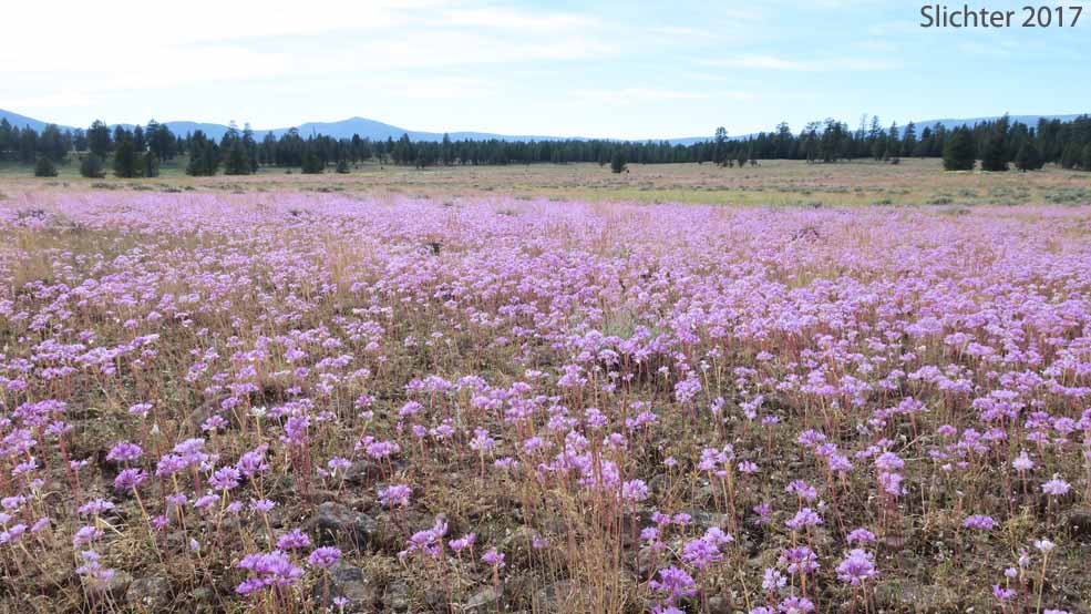
May 9, 2017: Bald and riparian area at southwest corner of the junction of FS Roads 42 and 4215 (Ochoco National Forest)
May 9, 2017: Wildflowers west of a butte at the north end of Antler Prairie and west of Road 4215 and north of the junction with FS Road 4215-100 (Ochoco National Forest)
May 27, 2016: Meadow along Road 4215 and north of the junction with FS Road 4215-100 (Ochoco National Forest)
April 30, 2016: Viewpoint at Rocky Bald North of Junctions of FS Roads #4230 and #920. (Ochoco National Forest)
April 30, 2016: Rocky Balds from FS Road 050 to the Top of a Ridge Southeast of Long Prairie (Ochoco National Forest)
April 30, 2016: Balds and Meadows into Coniferous Forest Along FS Road #42 at the Junction with FS Road #42-300 (Ochoco National Forest)
April 29, 2016: Riparian Meadows & Rocky Balds at the Junction of FS Road #42 & FS Rd #3010 (Ochoco National Forest)
April 29, 2016: Meadows and Uplands on North Side of Johnson Creek Along FS Road #42 ( (Ochoco National Forest)????????
June 12, 2015: Meadows and forest along the North Fork Crooked River west of Road 4215 (Ochoco National Forest)
May 24 & 25, 2002