 Catherine Creek is one of the best known wildflower destinations in the eastern Columbia River Gorge from March through late May. There is a paved wheelchair access trail on the south side of Old Highway 8 though one has to look out for potholes in that trail (largely fixed in fall 2023). A little harder to navigate is getting the wheelchair from the gravel trailhead lot to the paved trail. There are several trails that spread out uphill from the northside of the trailhead. There may or may not be signage, so keep that in mind for those that get lost easily. Go with friends who know the trails there at least once and one should be experienced enough not to get lost.
There has been talk to add a new trailhead off Old Highway 8 which would possibly include better restroom possibilities and better handicapped access, but if that comes to fruitition, that is still a number of years away. In spring, it's a popular place, so if you can, visit Catherine Creek on weekdays, or come early or perhaps mid-afternoon to find parking. Old Highway 8 is a country highway, so please be careful crossing the road since locals drive fast through here.
Neither a Northwest Forest Pass nor a Washington Discover Pass are required for parking at the trailhead.
From mid-March into early May, the parking lot is full by 9:30am on weekends, and often during midweek.
The nearest modern restroom facilities are along State Road 14 at the Chamberlain Lake Safety Rest Area. This is about 3.2 miles east of the County Road 1230 entrance to Catherine Creek. There is one or two port-a-pottys at the trailhead, although it can get pretty disgusting by mid-afternoon on Sundays due to heavy use.
Trails below the parking area are paved and have interpretive signs. Trails above the parking area diverge either west towards a trail heading up Rowland Rim (bikes can be on it as of 2016) or towards the lower part of the basalt arch. There is a 'new' hiker bridge across Catherine Creek with easier access to the user trail along the rim above the arch and a longer loop up to the powerline road east of Catherine Creek.
Dogs should be on leash to protect ground-nesting birds and mammals. Please pick up and haul out bagged dog poop. There's a garbage can at the trailhead.
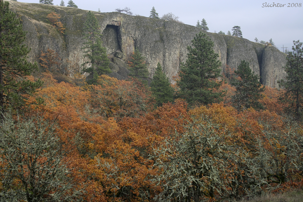
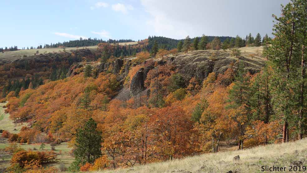
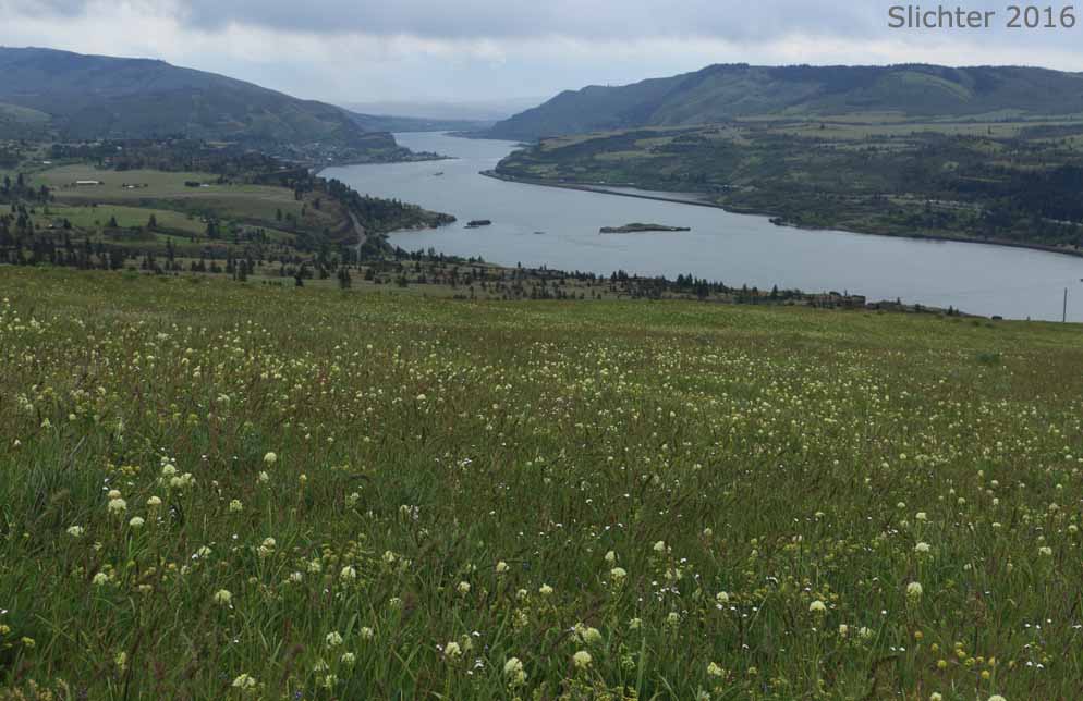
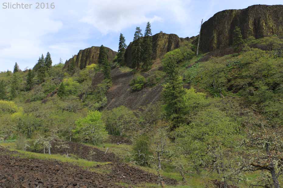
Catherine Creek is a unique natural area which gets quite a bit of use. There are numerous wildflowers to see from early March to mid summer. In addition, a natural basalt arch may be viewed about 1/4 mile up the canyon above the old homestead. The habitats include riparian, grassy basalt scablands, and mixed oak and Ponderosa Pine forests. Beware of the dense thickets of poison oak, be alert for the possibility of rattlesnakes, and check yourself for ticks during the moister spring months.
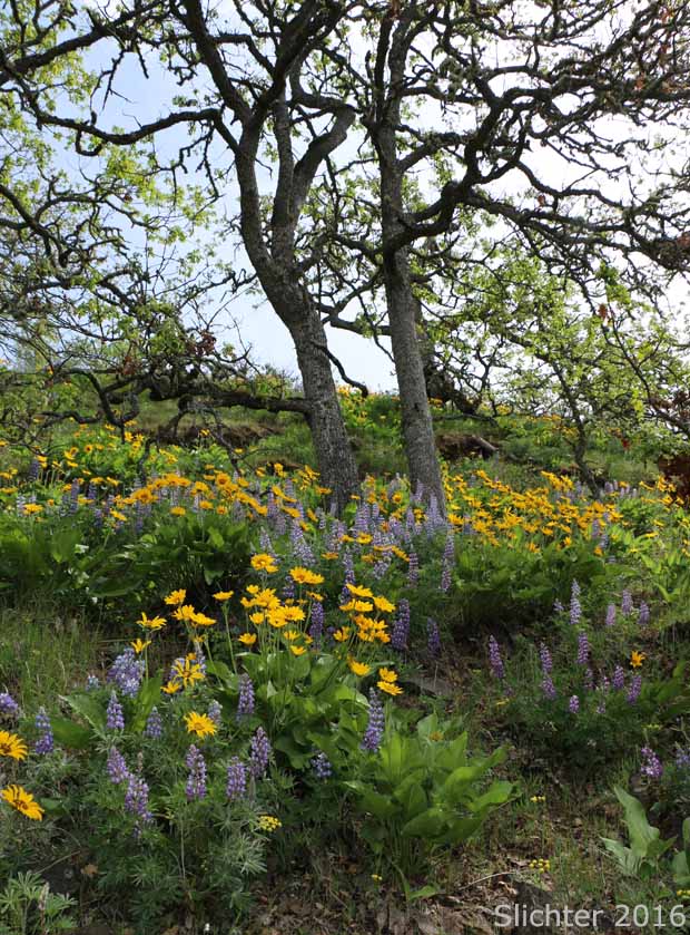
On average, the first grasswidows (Olsynium douglasii) and salt and peppers (Lomatium gormanii/piperi) can be found along the paved trails at Catherine Creek by January 1st. Yellowbells (Fritillaria pudica), Columbia desert parsleys (Lomatium columbianum) and several of the saxifrages begin bloom by late February or early March. Dutchman breeches (Dicentra cucullaria) and glacier lilies (Erythronium grandiflorum) bloom amongst the poison oak in late March to early April. The lupines and poet's shootingstars (Dodecatheon poeticum) bloom by early April with the balsamroots and harsh paintbrush (Castilleja hispida) blooming by the middle of that month. Count on finding bitterroots (Lewisia rediviva) and Barrett's penstemons (Penstemon barrettiae) blooming by early May. The bulk of the wildflower season winds down by early June, but at that time, look for meadow larkspur (Delphinium distichum), harvest brodiaea (Brodiaea coronaria) and ball-head cluster lilies (Dichelostemma congestum) in bloom in the moister swales and drainages. It is dry at Catherine Creek during mid-summer but one can still find something in bloom, including hyacinth cluster lily (Triteliea hyacinthina) narrow-leaf milkweed (Asclepias fascicularis)
Take Washington State Road 14 east of Bingen, WA to about milepost 71. Turn left on County Road 1230 (the Old Highway), which runs between basalt cliffs on the west and a lake on the right. Proceed about 1.4 miles to a rough gravel parking lot on the north (left) side. This is a popular place, and parking may be tight. Car pool if possible. I believe this is a site which requires a parking pass from the National Scenic Area.
Westbound:Proceed west through Lyle, WA and cross the Klickitat River. Turn right on the first road after the bridge. Travel upward on a twisting road for about 1.2 miles. Near the top of the hill are two rights. Don't take these! At the top of the hill, the road straightens out and parallels the Columbia River along a relatively flat plateau. Proceed for about 4 more miles, crossing Major Creek (another nice wildflower walk) and then Catherine Creek. The parking lot will be on the right (north side).
 -
- 
 -
- 
 -
- 
 -
- 
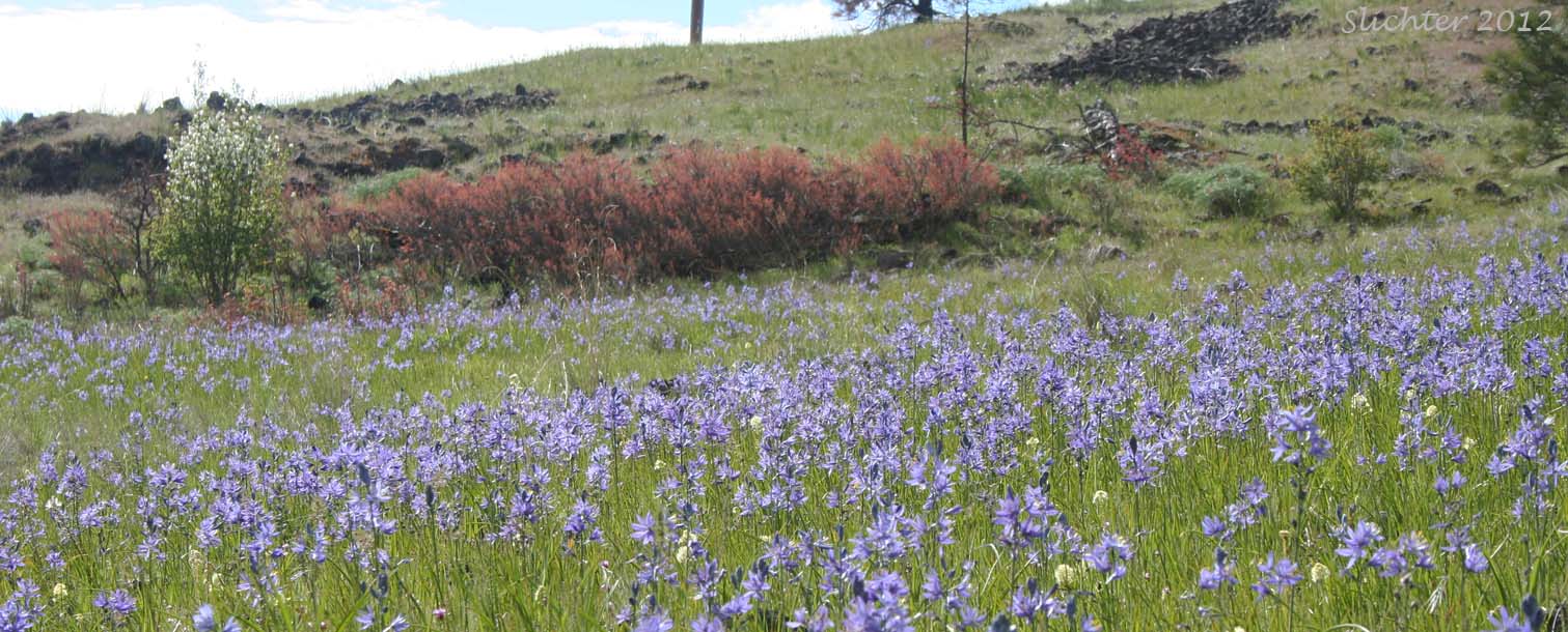
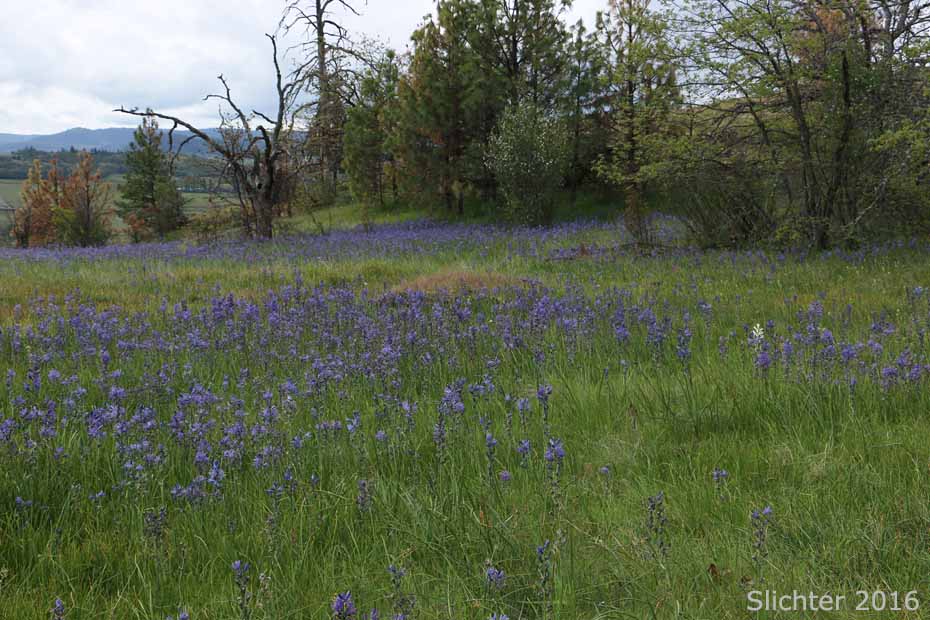
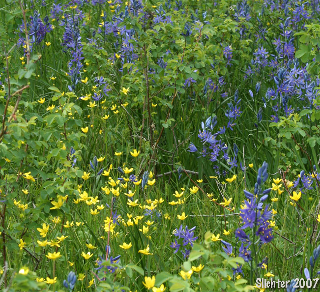
The photo at left shows a vernally moist drainage filled with western buttercups (Ranunculus occidentalis) and common camas (Camassia quamash) at Catherine Creek.....April 14, 2007. The image at right shows a meadow filled with meadow deathcamas (Toxicoscordion venenosum) on west Tracy Hill, Catherine Creek.....May 20, 2011.
Plant Lists For Catherine Creek:
Comprehensive Plant List for Catherine Creek
April 25, 2025: Paved Trail
February 28, 2025: East Catherine Creek Loop
April 3 & 7, 2012: Slopes between Catherine Creek and Minor Creek
January 22, 2011: Catherine Creek to Coyote Wall. Near 60 degree day.
May 14, 2006: Small vernal creek (Minor Creek) on the east side of Catherine Creek
March 11, 2006: Botany in the snow!
Catherine Creek Trailhead - OregonHikers.org
Catherine Creek Universal Access Hike - OregonHikers.org
Catherine Creek Arch Loop Hike - OregonHikers.org
Catherine Creek West Hike - OregonHikers.org (to Rowland Rim)
Catherine Creek-Rowland Basin Loop Hike - OregonHikers.org (includes the area above the Labyrinth)
Catherine Loop Hike - Washington Trails Association (includes a loop up the east side of Tracy Hill)
Catherine Crek Arch Loop - Friends of the Columbia Gorge
Catherine Creek Recreation Area - USFS
