 -
- 
Accessed via the North Trailhead
-
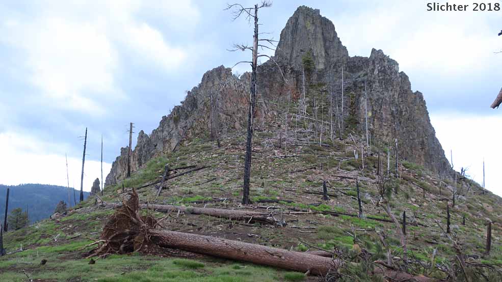
 The Twin Pillars North Trail is best known for the extensive wet wildlfower meadows in Bingham Prairie (adjacent to the trailhead) and the scenic views of the Twin Pillars which are 200' rhyolite intrusions into a 40 million year old vocanic caldera. The view downstream across the Mill Creek Wilderness and western Ochocos is quite spectacular. Steins Pillar can also be seen in the distance.
Bingham Prairie at the trailhead displays a broad swathe of american bistort (Bistorta bistortoides), white-headed wyethia (Wyethia helianthoides) and early season wildflowers by Memorial Day most years. Expect many of the same wet meadow and upland scaland wildflowers there that you'd find blooming in early to mid-May at Big Summit Meadows. Flower lovers could probably spend several hours around the prairie, although waterproof boots might be handy if venturing out towards their center.
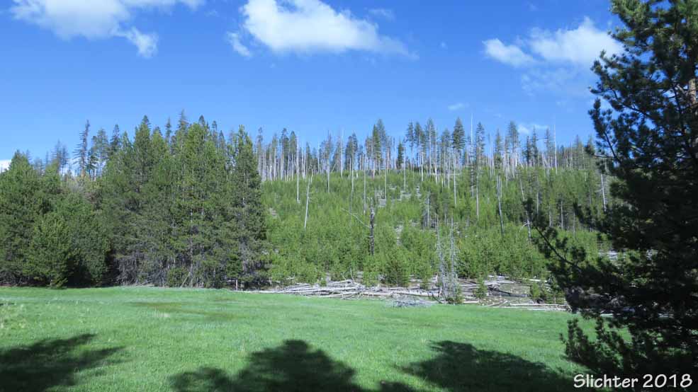
The Twin Pillars Trail #832 passes through an area of ponderosa pine snags resulting from a 2000 wildfire which burnt through much of the Mill Creek Wilderness. There are numerous snags but also remnant ponderosa pines along the trail. Because of the snags, there may be downed logs to climb over the couple weeks of the season, but the trail was clear by early June in 2017. At the half mile mark, you will ford a small creek filled with riparian plants. At first, the mostly flat trail follows the west rim of scenic Desolation Canyon. At about the two-thirds mile mark, the trail turns away from Desolation Canyon and begins a gentle ascent, reaching the hike high point at the mile point. The trail then descends gradually towards the Twin Pillars. At the 2.8 mile point, hikers can hike a short but steep 0.2 mile trail to the base of the Twin Pillars. By mid-June there are numerous shrubby penstemons (Penstemon fruticosus var. fruticosus) and snowbrush (Ceanothus velutinus) in bloom along much of the trail.
Rating: Great for views and variety of plant habitats and plant species. The hike is fairly easy the first 2 miles out and back but could be more difficult for some when returning uphill that last mile. The full hike from Bingham Prairie to the base of the Twin Pillars is 6 miles (RT) with 600' elevation gain.
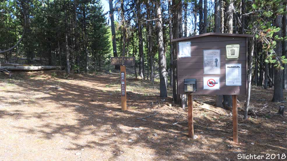
This is a free facility (parking and camping). Northwest Forest Passes are not required at this location. Please fill out a Wilderness Permit at the trailhead. Groups are limited to 12 when entering the wilderness.
The trailhead and campground have an outhouse (bring TP, just in case!) and two campsites with picnic tables and fire pits.
During the week before and after Memorial Day, expect to find:
Bingham Prairie: american bistort (Bistorta bistortoides), meadow larkspur (Delphinium burkei), desert shooting star (Dodecatheon conjugens), Rydberg's penstemon (Penstemon rydbergii), northern bog violet (Viola nephrophylla), Oregon checkermallow (Sidalcea oregana), white-headed wyethia (Wyethia helianthoides)
Twin Pillars Trail: nettleleaf horsemint (Agastache urticifolia), pale agoseris (Agoseris glauca var. glauca), sagebrush agoseris (Agoseris parviflora), heartleaf arnica (Arnica cordifolia), snowbrush (Ceanothus velutinus var. velutinus), mountain mahogany (Cercocarpus ledifolius var. ledifolius), upland larkspur (Delphinium nuttallianum), cutleaf fleabane (Erigeron compositus var. glabratus), Modoc buckwheat (Eriogonum umbellatum var. modocense), alpine alumroot (Heuchera cylindrica var. alpina), bush oceanspray (Holodiscus microphyllus var. glabrescens), whiskerbrush (Leptosiphon ciliatus), longspur lupine (Lupinus arbustus), false solomon seal (Maianthemum racemosum ssp. amplexicaule), nodding microseris (Microseris nutans), a few early-blooming shrubby penstemon (Penstemon fruticosus var. fruticosus), sticky currant (Ribes viscosissimum), black elderberry (Sambucus racemosa var. melanocarpa), western groundsel (Senecio integerrimus var. exaltatus), claspleaf twisted-stalk (Streptopus amplexifolius)
Plant Lists for Twin Pillars & the Meadows Around Bingham Springs:
Comprehensive Plant List for Twin Pillars Trail #832, Bingham Prairie, Trail Station Meadows and upper Desolation Canyon (Updated May 20, 2018)
May 25, 2018: Bingham Prairie & the first half mile of the Twin Pillars Trail #832 from the north trailhead downhill to the Twin Pillars.
May 18, 2018: Bingham Prairie & the first half mile of the Twin Pillars Trail #832 from the north trailhead (to the second stream crossing).
See Also:
The hike description for Mill Creak and Twin Pillars in "100 Hikes/Travel Guide: Eastern Oregon" by William L. Sullivan. Note: The approach from the north is described briefly in "Other Options" at the end of Sullivan's description of the hike.
The hike description for Twin Pillars in "Day Hiking Bend and Central Oregon" by Brittany Manwill.
There's a brief description with good photos (including flowers) of a hike to Twin Pillars from the North Trailhead on the Oregon Hikers website.
From Prineville, travel north on Main Street (which then becomes N McKay Rd or NE McKay Creek Rd) for about 11 miles to the Ochoco National Forest Boundary. Here the road changes to FS Road 27 and remains paved but can be windy as it follows Little McKay Creek. After 12 miles, the pavement ends at the junction of FS Road 27 and FS Road 2745. Stay right on FS Road 27 (now a primitive road - low slung vehicles can have problems, especially when the road is wet). Proceed east along FS Road 27 for half a mile. The Twin Pillars North Trailhead will be on your right at the Bingham Springs Campground.
Access to the Twin Pillars North Trailhead and the Twin Pillars Trail was largely snow-free by mid-May in 2018. AWD vehicles should have no problems accessing the trailhead in all but the wettest weather. The last half mile of primitive road may be difficult for low slung vehicles to drive, especially when the ground is soft and when the vehicle is loaded. Recent timber thinning along the primitive road should help dry the primitive road earlier in the season, and large-diameter rock-gravel was dumped in the wettest spots, but those still a season to settle in.
Driving distance each way is about 24-25 miles with a driving time of an hour from Prineville. Early in season, look for rockfall onto FS Road 22 on road cuts, especially on corners.
 -
- 
 -
- 
 -
- 