 -
- 
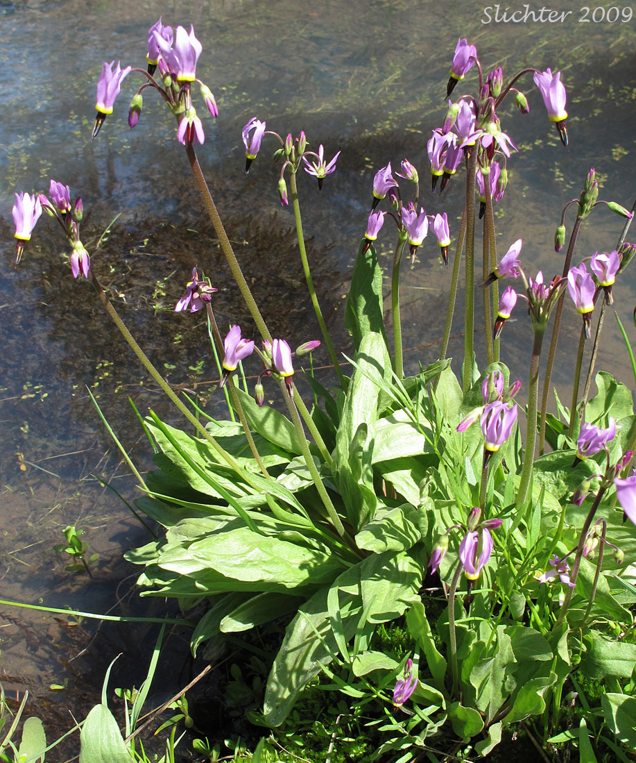
 The photo at right shows poet's shooting star (Dodecatheon poeticum) observed along a stream in the Klickitat Wildlife Area.
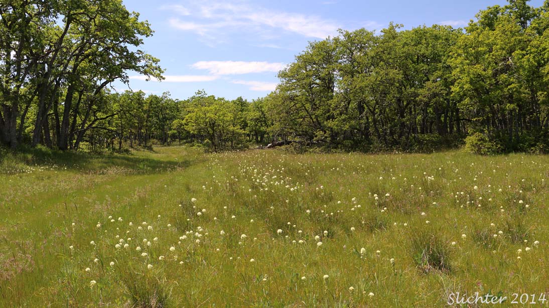
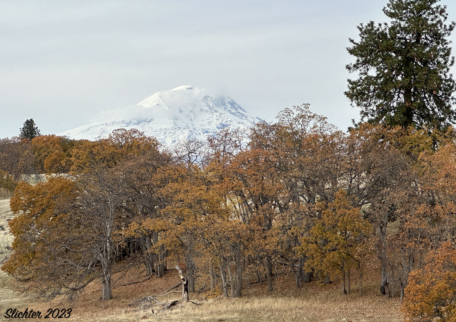
The Soda Springs Unit of the Klickitat Wildlife Area is located on the eastern slopes of the southern Washington Cascades roughly half way between the Columbia River and Mount Adams. From higher locations in this area one can see south to the Columbia Hills and Mount Hood, west to Indian Heaven and north to Mount Adams. The country is relatively wild and the landscape reflects that with numerous, steeply eroded canyons, a mix of coniferous and oak forests, and numerous rocky balds. Portions of the wildlife area were formerly farmed or grazed but many portions retain a fairly natural plant community. To some extent, the habitats here give a glimpse at what much of the Columbia River Gorge and east slope of the Cascades looked like prior to the introduction of farming and ranching in the area during the late 1800s.
There are no established hiking trails here. One either hikes crosscountry or follows old jeep roads. Several routes are suggested in the online resources below. There are several private property parcels in the center of the wildlife area, and adjacent private property that is grazed is fenced to prevent cattle intrusion into the wildlife area. Other property boundaries may not be fenced, so it really pays to look at the Klickitat County Interactive Mapping Program prior to any visit to determine where the wildlife area boundaries are. Some of the neighboring property owners do not look kindly to trespass.
Wildflower bloom begins here in late March to early April most years. Peak bloom is typically in May with summer species persisting in bloom through July. Because the landscape has seen minimal disturbance, many rare plants and habitats can be found here.
Note that there is a spring turkey hunting season that usually begins April 1st and lasts until the end of May. The first 3 weeks are generally the most active hunting times before the turkeys get wary. Where orange or other bright colors and stick to open routes. Deer season is very active in the fall and I'd advise not visiting the area at that time. Check the WDFW website for hunting seasons.
Currently (2024), I've not listed directions to the various trailheads. Check the online resources below for information about several hiking routes and how to access them. Occasionally, an NPSO or WNPS wildflower hike is offered along one of the routes at the Soda Springs Unit of the Klickitat Wildlife Area and that is a good way to begin getting familiar with the area.
Plant Lists:
Comprehensive Plant List for the Klickitat Wildlife Area: Soda Springs Unit
Comprehensive Plant List for the Klickitat Wildlife Area: Mineral Springs Unit
May 3, 2025: North Breaks from the Old Headquarters Road
May 1, 2025: South Breaks from the Old Headquarters Road
April 21, 2025: North Breaks from the Glenwood-Goldendale Road
April 10, 2025: South Breaks from the Old Headquarters Road
April 3, 2025: East Canyon Creek Loop
May 26, 2020: Meadows and woods west of Soda Springs Road to the Klickitat Breaks
March 31, 2018: Klickitat Breaks and Soda Springs Road to Soda Springs
April 2, 2017: Klickitat Breaks Road to bluffs above Soda Springs
April 26, 2016: Grayback Mountain Road to Upper Sheep Canyon
April 2, 2016: Canyon Creek Loop
March 26, 2016: Canyon Creek Loop
March 6, 2016: Canyon Creek Loop
May 30, 2015: Little Bowman Creek (Canyon Creek Trailhead - An NPSO Hike)
May 22, 2015: Canyon Creek accessed from the Canyon Creek trailhead off the Glenwood-Goldendale Highway
May 4, 2015: Western Canyon Creek accessed from Anderson Road
February 26, 2015: Klickitat Breaks and the upper half of Soda Springs Road
May 16, 2014: Klickitat Breaks Road
May 1, 2014: Klickitat Breaks (bluffs along the eastern Klickitat River rim uphill from Soda Springs
March 21, 2014: Canyon Creek (east rim loop)
May 15, 2013: Champion Lumber Company Haul Road from the Glenwood-Goldendale Highway south to where the road is washed out (west bank of the Klickitat River).
April 18, 2013: Champion Lumber Company Haul Road from the Wahkiacus Trailhead to Beeks Canyon
April 6, 2013: Canyon Creek Loop
May 20, 2012: Champion Lumber Company Haul Road from the Glenwood-Goldendale Highway south to where the road is washed out (west bank of the Klickitat River).
May 16, 2012: Champion Lumber Company Haul Road from Wahkiacus Trailhead to Beeks Canyon
October 23, 2011: Klickitat Trail from the Wahkiacus Trailhead to Suburbia
July 21, 2011: Company Road along the west bank of the Klickitat River upstream from the Wahkiacus Trailhead to where the road was washed out.
June 17, 2011: Canyon Creek east rim loop
May 8, 2011: Klickitat Trail from the Wahkiacus Trailhead to Klickitat Mineral Springs and south nearly to Suburbia
April 26, 2011: Company Road between the Wahkiacus Traihead and Leidl Park along the west bank of the Klickitat River - Note: most of this route has seen the removal of the paved road surface and naturalization of the landscape to promote fish habitat. Floods have broken the link between these two trailheads.April 12, 2011: Klickitat Trail from the Wahkiacus Trailhead to Klickitat Mineral Springs and south nearly to Suburbia
March 18, 2011: Klickitat Trail from the Wahkiacus Trailhead to Klickitat Mineral Springs and south nearly to Suburbia
February 20, 2011: Company Road between Wahkiacus and Leidl Park along the west bank of the Klickitat River. Floods have washed out the road preventing hiking the entire route between the two trailheads. Most of the pavement has been removed and the roadbed naturalized.
June 1, 2010: Slopes east of the Klickitat River near the Glenwood-Goldendale Highway (1 mile south of Sheep Canyon)
April 30, 2010: Soda Springs from the Old Headquarters Road to Soda Springs Road (west-facing slopes above the Klickitat River)
April 7, 2010: Klickitat Breaks
February 25, 2010: Klickitat Trail: Wahkiacus Trailhead to Klickitat Mineral Springs
June 26, 2009: Klickitat Breaks
June 26, 2009: Canyon Creek Loop
June 12, 2009: Klickitat Breaks
June 12, 2009: Canyon Creek Loop
May 31, 2009: Klickitat Breaks west of the Old Headquarters Road
May 27, 2009: Canyon Creek Loop
May 24, 2009: Klickitat Breaks west of the Old Headquarters Road
May 8, 2009: Canyon Creek Loop
April 23, 2009: Canyon Creek Loop
April 1, 2009: Canyon Creek Loop
Klickitat Wildlife Area - Washington Department of Fish & Wildlife
Soda Springs Wildflowers - Northwest Wildflowers
Klickitat Trail: Klickitat Mineral Springs Hike - OregonHikers.org
Soda Springs Loop Hike - OregonHikers.org
Klickitat Canyon Hike - OregonHikers.org
The photo at left shows a view down into the Klickitat River towards the Stinson Flats Campground from along the Glenwood-Goldendale Highway, Klickitat Wildlife Area.....May 1, 2010. The image at right shows a stock pond providing moisture to a drainage downstream while providing habitat for both plants and wildlife, Klickitat Wildlife Area......May 21, 2021.