Access: From Washington State Highway #14, proceed north on State Route #141 from White Salmon, WA. Drive through the small town of Husum, WA and at BZ Corners, WA, turn right onto the BZ Corner-Glenwood Road. Proceed uphill, eventually passing a large ranch with hay fields to the south of the road before ascending again into forest. About 15-20 minutes northeast of BZ Corners, you will come to the first main, signed road on the left. This is Laurel Road. Turn left (north) onto Laurel Road which soon passes through the western edge of Conboy Lake NWR. Proceed past Kreps Lane (stop sign) still heading north another two miles to the paved Trout Lake-Glenwood Road. Turn right onto the highway and proceed about one mile to the signed entrance to the headquarters of Conboy Lake National Wildlife Refuge. This is a gravelled, sometimes washboarded road. Proceed south on this road to the trailhead or another quarter mile to the headquarters where there is a parking area with picnic table (very rickety), pit toilets, old pioneer homestead 100 meters to the southwest and views overlooking the fields of the refuge. Scan the fields for the numerous birds (more easily seen early in season when the grass is shorter) including breeding pairs of sandhill cranes.
Water: Carry plenty of bottled water. Water is found all along the south loop trail and again at Willard Springs. Treat all open waters with chemical purification or by filtering.
Permits: No permits are needed at this time. Be aware that hikers should stay on trails or on roads at all times. All other lands are off limits to foot traffic in the Conboy Lake NWR, partly to protect sensitive plants and herps (turtles and frogs) as well as to protect the endangered sandhill cranes which nest in the open marshlands.
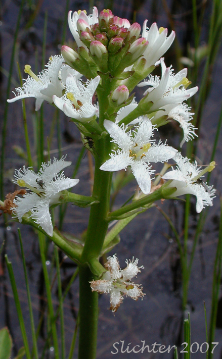 The photo at right shows a close-up of the aquatic buckbean (Menyanthes trifoliata) as seen along the Willard Springs Foot Path.....May 7, 2007.
This is one of my favorite wildflower trails, partly for the wildflowers, partly for the birding, butterflies and dragonflies, but also because it is little used by other hikers and also because its a good hike through most of the year, from early April through October (or until the snow flies). The trail offers at least a few wildflowers to see throughout the dates listed above!
At the trailhead, park on the west side of the road (room for about 5-6 vehicles). The Willard Springs Trail is usually done as a loop. I will present the route here proceeding counter clockwise, beginning from the right branch which follows the wetlands for over one mile.
The trail first passes a salt lick, where the numerous elk (I've seen as many as 40 in here before!) and mule deer have dug a good sized hole in the ground to access the salty soil. The trail passes through coniferous forest at first, with a riparian area a short distance off to the right (south). Look here for Oregon anemone (Anemone oregana) and later on, the attractive phantom orchid (Eburophyton austiniae) seen in June. After 200 meters, the trail veers briefly left, then turns right and runs east along a tall fence which protects a large aspen grove from the marauding elk (Elk and deer like to browse on young aspen shoots!). The field to the north of this aspen grove is pretty weedy and was once perhaps used for agricultural purposes. Around this field, look for small birds including swallows and Lazuli buntings. This is also a good area for viewing butterflies, dragonflies and damselflies.
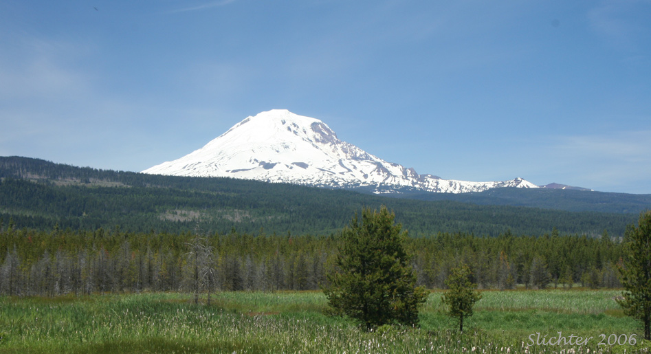
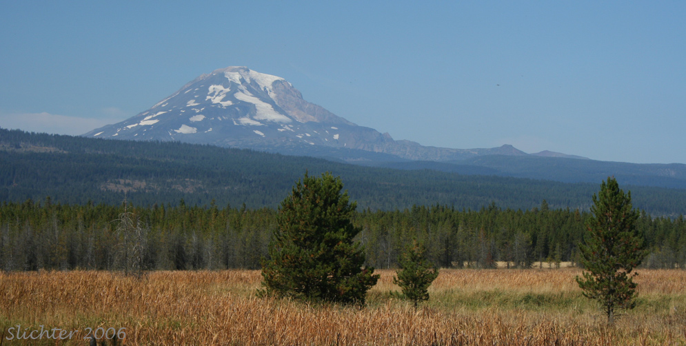
After about 300 meters the trail again enters coniferous forest but descends towards the riparian area to the south (and right) of the trail Look for several small trails which descend to the riparian area from the main foot path over the next half mile or so. The water level reaches right to the foot of the forest in spring, but receeds gradually over the course of the summer, making visible a shallow irrigation ditch that parallels the foot path through this area. Highlights include buckbean (Menyanthes trifoliata) which bloom in the shallow water in May. The trail stays largely in the coniferous forest and curves gently to the northeast. Watch for a small path that heads briefly right (east) to a viewing platform with a good viewacross marshlands towards Mt. Adams with the forest surrounding Willard Springs seen immediately below the mountain.
Continue through the forest to a branch in the trail. The branch to the right proceeds to Willard Springs. Going straight is the path of the "cutoff" trail. If this path is followed, you will pass through open forest with some subalpine mariposa lilies (Calochortus subalpinus) and later on, many scarlet gilia (Ipomopsis aggregata) and some green-banded mariposa lilies (Calochortus macrocarpus). You will come to another junction. Turning left takes you back to the trailhead (via a different route) while right takes you to Willard Springs.
Turn right to Willard Springs. You will pass through a low spot with aspen within about 5-10 minutes. Continue on this route for another couple minutes to reach Willard Springs, the end of the trail. Willard Springs was the site of an old homestead, the rocky foundation of which can be seen next to the springs. There is also a cluster or two of domestic iris here too. The springs outlet into a marsh which is very soggy until August or so. Later in the summer, hike into the marsh to search for primrose monkeyflower (Mimulus primuloides) and several asters. Copper butterflies also like to nectar on the asters here.
Hike back the way you came, passing through the aster grove several minutes west of Willard Springs. You will arrive at several junctions. Either proceed straight or take right branches of the path and you should be able to return to the trailhead by a different route in about 30 minutes.