[Wildflower Hikes and Trips in Central and Eastern Oregon]
2007
July 10, 2007: Road to Hat Point, Hells Canyon National Recreation Area
July 9, 2007: Road across Zumwalt Prairie to Buckhorn Lookout
July 8, 2007: Lostine River Road & Irondyke Campground
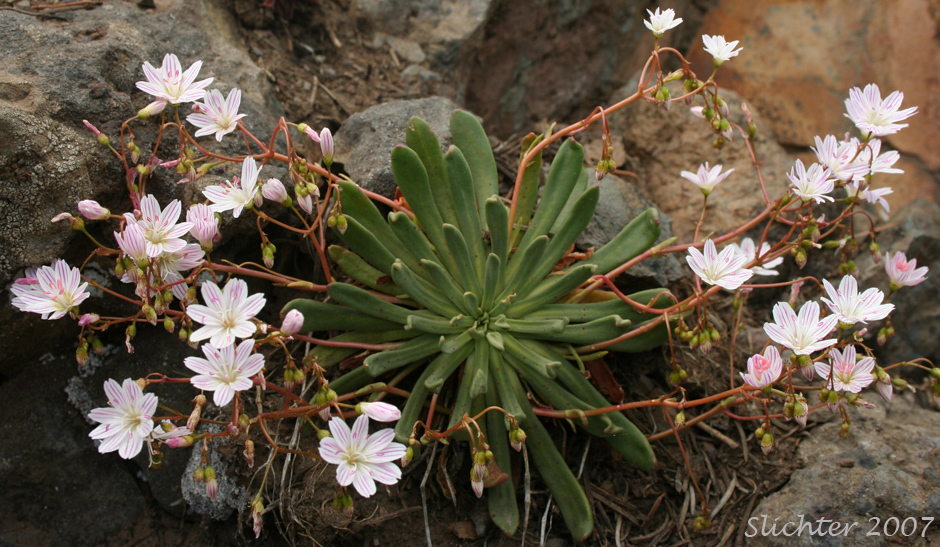
June 26, 2007: Road to Hat Point, Hells Canyon National Recreation Area
June 24, 2007: Umatilla Rim Trail 33080, Umatilla National Forest - A WNPS Field Trip
June 22, 2007: Blue Mt. Scenic Byway, Umatilla National Forest
May 28, 2007: John Day Fossil Beds National Monument, Sheep Rock Unit (Picnic Area and Blue Basin)
May 28, 2007: Oregon Highway #19 MP 80 (near Service Creek, OR)
May 28, 2007: Locations around Condon, OR
April 19, 2007: A number of plants are beginning to bloom along the central John Day River, including Chaenactis nevii. With fairly abundant rainfall this spring, I believe bloom in the Painted Hills should pretty good, perhaps by the first or second weekend of May (NOTE: Sadly the rest of April and May were dry, so wildflower bloom in the lowlands really dropped off!). Patches of snow still can be found above 4000' in the western blue Mts and and mountains to the north of Mitchell, OR. Good open forest plants should be visible and beginning bloom to about 3000'. Prairie and sagebrush wildflowers should also begin bloom up to 3000' soon if they haven't already. Good May flower drives include Oregon Highways 19, 206, 207 and 217. Traffic is minimal on these roads, so stop when you see flowers to investigate what they are! Just be careful to pull fully off the road as people drive fast out here and obey private property signs.
April 19, 2007: Oregon Highway 216 (Grade rising east out of the Deschutes River canyon)
April 19 , 2007: Tygh Ridge (US Highway 192 north of Tygh Valley, OR)
April 8, 2007: Painted Hills, John Day Fossil Beds National Monument
April 8, 2007: South Twickenham Road (west of Twickenham, OR)
April 8, 2007: Oregon Highway #207 and Gerd's Creek Road (Between Service Creek, OR and Mitchell, OR)
April 8, 2007: Oregon Highway #19 MP 80 (near Service Creek, OR)
April 8, 2007: Locations around Condon, OR
April 8, 2007: Oregon Highway 207 descending into the John Day River canyon
April 8, 2007: Oregon Highway 206 (west grade) to the east of Wasco, OR
March 24, 2007: Deschutes River Access Road (Downstream from Sherar's Bridge
March 24, 2007: Tygh Ridge (US Highway 192 north of Tygh Valley, OR)