Malheur National Forest
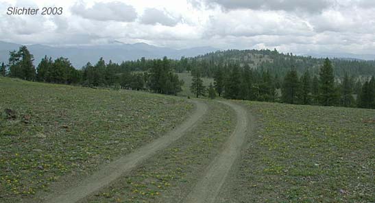
Blue Ridge is a beautiful serpentine gravel ridge with scattered juniper and Ponderosa pine, mostly meadow. It gets its name from the color of the serpentine. There are massive seeps in wetter springs. The elevation is about 5500-6000'. Easy walking, as little or much as you want. Walk the old jeep road winds east along the crest of Blue Ridge or walk cross country across the rocky, serpentine slopes or through open forest.
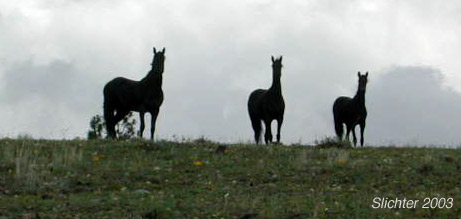
Watch for herds of wild horses (which can be a source of over-grazing and fouling of the springs here). Some interesting plants observed June 21, 2002 include: blepharipappus Blepharipappus scaber, Balloon-pod milkvetch (Astragalus whitneyi), Onespike Oatgrass (Danthonia unispicata), prairie lupine (Lupinus lepidus var. aridus), western twin bladderpod (Physaria occidentalis), bushy birdbeak (Cordylanthus ramosus), meadow deathcamas (Toxicoscordion venenosum) and panicle deathcamas (Toxicoscordion paniculatum), narrowleaf skullcap (Scutellaria angustifolia), dwarf purple monkeyflower (Mimulus nanus), scabland fleabane (Erigeron bloomeri), bitterroot (Lewisia rediviva), humble penstemon (Pensetmon humilus?), elkhorns clarkia (Clarkia pulchella), washington monkeyflower (Mimulus washingtonensis), Milkweed (Asclepias spp.), hairy owl clover (Castilleja tenuis), serrate balsamroot (Balsamorhiza serrata), and broom buckwheat (Eriogonum vimineum).
Because of the serpentine, many of the plants here are similar to those found on Baldy Mt. The elevation is probably in the 5500-6000 foot range, and it is south-facing, making it a better choice if Baldy Mt. is still snow-covered, and Baldy Mt. a better choice if the spring is very early.
To reach Blue Ridge, you drive south from John Day 18 miles on US 395, then west on the Izee-Paulina Highway about 10 miles (passing through the Flagtail Fire area). Then northwest on Forest Road 24 (a decent one lane paved road, then good gravel road) about 14 miles. Then turn north on Forest Road 2490 (still pretty good, some big potholes and possibly mudholes the last .1 mile) about 1.5 miles. Then turn to the right (east) on Forest Road 228 for about .2 miles before getting out and rambling. The only rough part is about the last .3 miles total. For this part, it would help to be in at least a Subaru or higher vehicle (I drove over it fairly easily in my Honda Civic but had to watch closely to avoid scraping bottom on higher rocks.). Four-wheel drive is not necessary. It should take about 1 hour and 10 minutes from John Day.
I should point out that low slung passenger cars and SUVs should not be tempted to drive west from Blue Ridge to the South Fork John Day River Road via FS Rd 24 along Deer Creek as it gets very rough and windy west of Blue Ridge. I nearly high centered my Honda Civic on a loose rock that had rolled onto the road in 2003. The road is rarely travelled, so help would be along ways away. I'd suspect that the road west from FS Rd 2170 along lower Murderers Creek is likewise treacherous for passenger cars!
July 14, 2003: Blue Ridge, Malheur N.F.
June 23, 2003: Blue Ridge, Malheur N.F.
May 25, 2003: Blue Ridge, Malheur N.F.
 -
-  -
-