 Memaloose Viewpoint is a good destination for viewing early
season wildflowers, with good bloom extending from the grass widows and desert
parsleys of February and March to the lupines and paintbrush of May, with decent
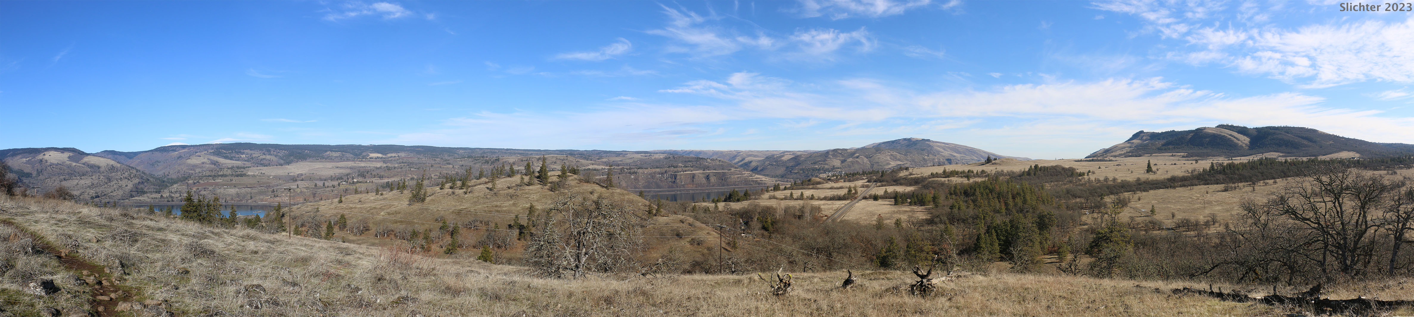
bloom extending into late June most years. As shown above, the view looks to
the north towards Catherine Creek and Major Creek.
Memaloose Viewpoint is a good destination for viewing early
season wildflowers, with good bloom extending from the grass widows and desert
parsleys of February and March to the lupines and paintbrush of May, with decent
bloom extending into late June most years. As shown above, the view looks to
the north towards Catherine Creek and Major Creek.
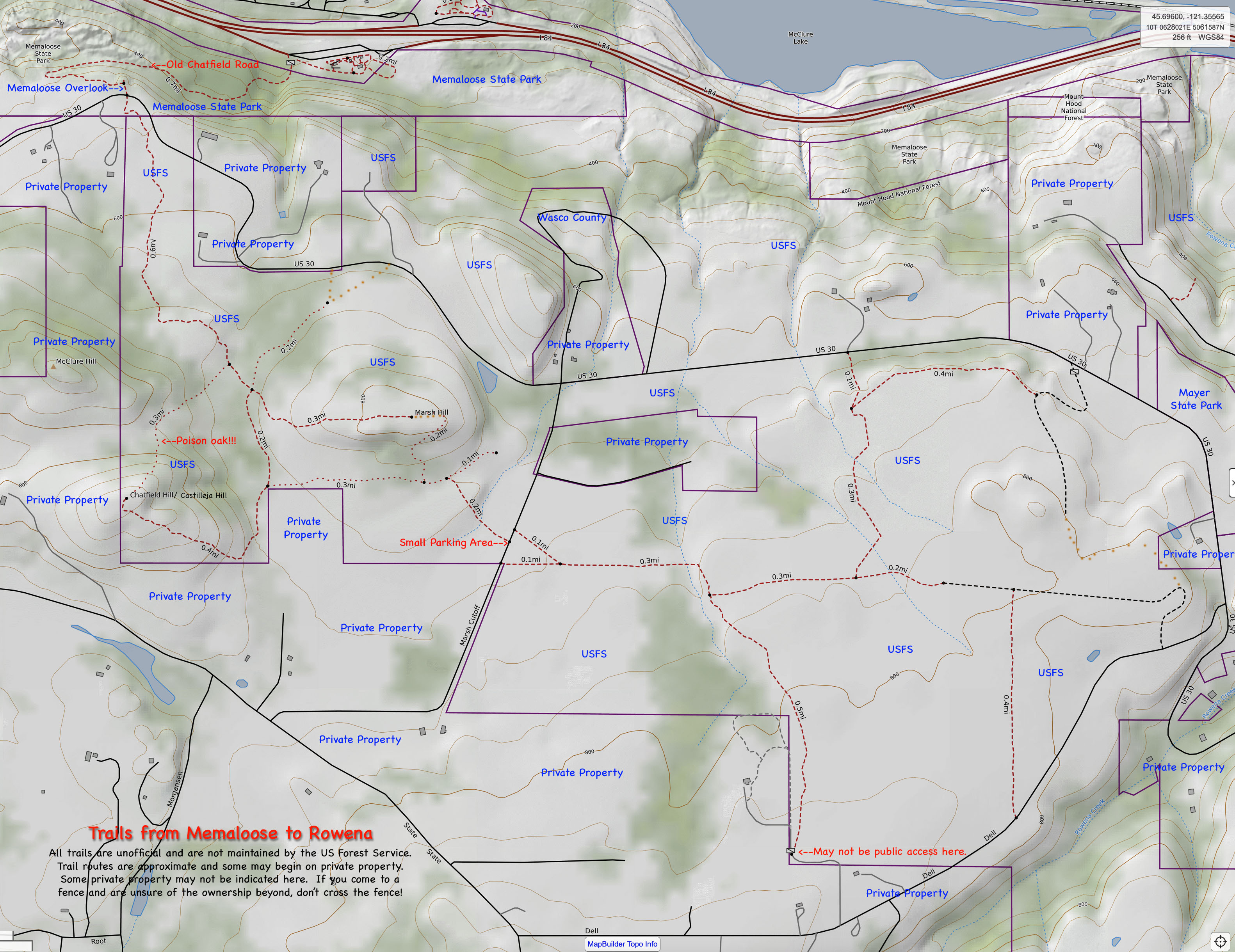
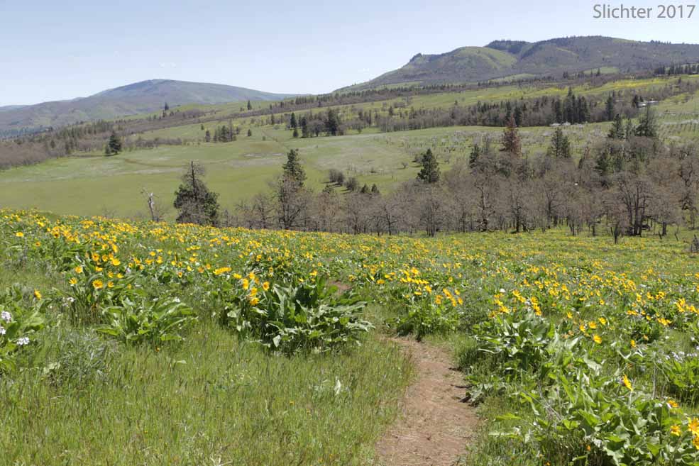
Several trails criss-cross the area, but one must beware of the cliffs along the viewpoint. A trail which heads downhill towards the north may be found approximately 40 yards west of the viewpoint. This takes you eventually to the eastbound rest area off Interstate 84. A nice trail extends south of the viewpoint parking area, wandering through the oak forests to eventually climb several hills with good views west, east and south. Depending on the season, the trails may range from well marked to confusing. A good cross-section of wildflowers may however be found here though, and the balsamroots, lupines and paintbrush on Castilleja Hill at the southern tip of the loop can be photogenic in March and April.
Take care in venturing off the paths as poison oak is abundant here, and rattlesnakes may be found here too.!
Westbound from The Dalles on Interstate 84, take exit 76 at Mayer State Park. Cross under the freeway and then turn right (west) onto US 30. Proceed uphill several miles past Tom McCall Nature Preserve, then dip downhill into a small canyon. Climb again and then slowly descend through open oak forests and meadows. Memaloose Viewpoint is on the right (north) side of the road about 4 miles west of Tom McCall Nature Preserve.
Eastbound Directions:
Eastbound on Interstate 84, exit onto US 30 at exit #69. Exit the freeway southbound (to the right). Proceed uphill, winding through beautiful oak forests and meadows for about 3.25 miles. Memaloose Viewpoint is on the left side of the road, with a striking view north across the Columbia River towards Catherine Creek and Major Creek on the Washington side of the river.
Note: I've not included the trailhead at the Eastbound Memaloose Rest Area for Interstate 84. During the initial years of COVID-19, the parking lot was inundated with hiker vehicles parking there all day long, so State Parks and the Rest Area posted signs stating "No Hiking Parking" to keep the lot clear for day travelers on the freeway. The hiker parking closure has persisted into spring 2023.
Castilleja Hill/Memaloose Loop Trail
This loop trail is accessed only from eastbound Interstate 84. If you are coming westbound from The Dalles, you will either need to exit the freeway at Rowena and then reenter the freeway eastbound at Mosier, or drive the freeway west to Mosier where you would exit and again reenter the freeway eastbound.
Note: Due to the high number of hiking vehicles parking at the Memaloose Eastbound Rest Area from the second week in April to mid-May, Oregon Department of Transportation began posting "No Hiking Parking" signs around the parking area because there was not room for travelers to park. Please respect this request to not park at the rest area during April and May. Note that hikers sometimes tear down the signs, so that's not an excuse. In addition, if you plan to park at the Memaloose Viewpoint off Highway 30, arrive early, or in mid- to late-afternoon as parking is limited there, and unsafe to park on the edge of the road with fast vehicles travelling by.
Exit the freeway at the Memaloose Rest Area and park at either the east or west ends (leaving room for those who urgently need to stop and use the restroom facilities). Walk east on the sidewalk past the westernmost restrooms for about 50 meters where you will come upon a gravel road that climbs south into the woods at a gate. Proceed through the gate entering the forest, where you will immediately see a number of wildflowers you'd expect further west. As you climb uphill, proceeding west at this point, the meadow openings increasingly appear, with numerous balsamroot, lupines and paintbrush to be seen by mid to late April. After about one-half mile or so, the trail crests the ridge. Follow the path to the left which winds through open oak forest of desert parsleys, grass widows and shooting stars before reaching old Highway 30 near the Memaloose Viewpoint.
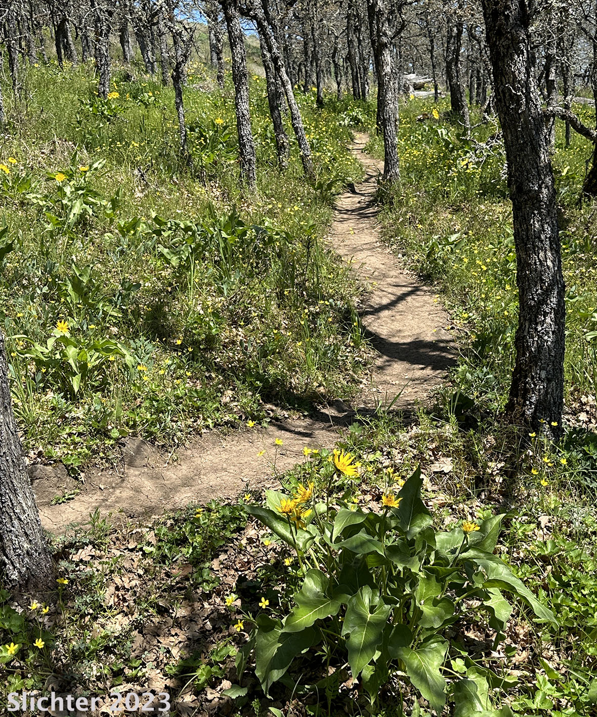
A path should be seen across the old highway from the viewpoint parking area which proceeds south through the oak forest. In mid April through May, one may find chocolate lilies and large, colorful drifts of large-flowered blue-eyed Mary beneath the trees. After about one-half mile, the trail turns and climbs a ridge to the east. There should be a path here that proceeds straight south, following on the east side of a small creek and wetland that skirts the east side of the looming, conifer and oak covered hill. Continue along the east side of the wetland until you see a path that climbs the open southern slopes of this hill (locals refer to it as Castilleja Hill due to the numerous paintbrush here) for views west down the Columbia, south, and east towards Tom McCall Point.
Descend the hill the way you came, then hike across the fallow field to the east to Marsh Cutoff Road. Hike north along Marsh Cutoff Road, looking for the raucous Lewis' woodpecker in the oaks, and also being aware of approaching traffic. Upon reaching Old Highway 30, turn right (east) and carefully walk the north side of the roadside for about 150-200 meters where you will pass a fenceline at a small ravine. There should be a path that proceeds along the west side of the ravine downhill (north), and eventually turns northwest back to the Memaloose Rest Area. Note: The path can be difficult to find in this area, so you might want to hike this with NPSO or Friends of the Gorge with leaders who know the route (and can teach it to you). There is an eastern loop that adds another two miles, but again, do this with a group that knows the route!
Watch for poison oak and ticks throughout this entire route!
Comprehensive Plant List for Memaloose (east to Rowena Creek)
March 29, 2025: Memaloose Area (USFS lands south of US 30)
March 8, 2025: Memaloose Area (USFS lands south of US 30)
April 14, 2018: Memaloose Trail Loop
March 20, 2018: Memaloose Trail Loop from Interstate 84 Memaloose Eastbound Rest Area to the summits of Castilleja (Chatfield) Hill and Marsh Hills and return.
April 21, 2017: Memaloose Loop Trail (From Eastbound I-84 rest area south to Castilleja (Chatfield Hill) and east to near Dell Rad, returning to the rest area via user trails to the east of Marsh Hill. If you don't know the eastern part of the loop, You Will Get Lost!)
March 22 & 24, 2013 - An NPSO hike.
April 26, 2009: Memaloose State Park and Surrounding Federal Lands - (A Native Plant Society of Oregon Hike.)
Memaloose Hills: Northwest Wildflowers
Memaloose Overlook Trailhead: OregonHikers.org - This is the most popular trailhead for the unofficial trails around the Memaloose Hills.
Memaloose Hills Hike: OregonHikers.org
Memaloose Hills: Washington Trails Association
 -
-  -
- 
 -
-  -
- 
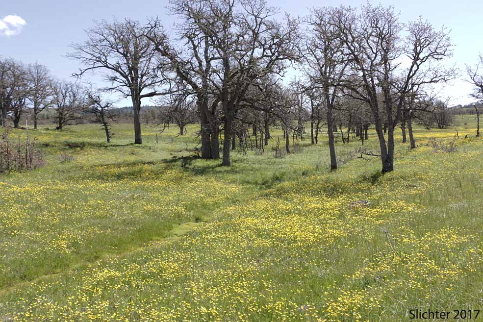
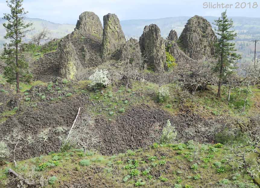
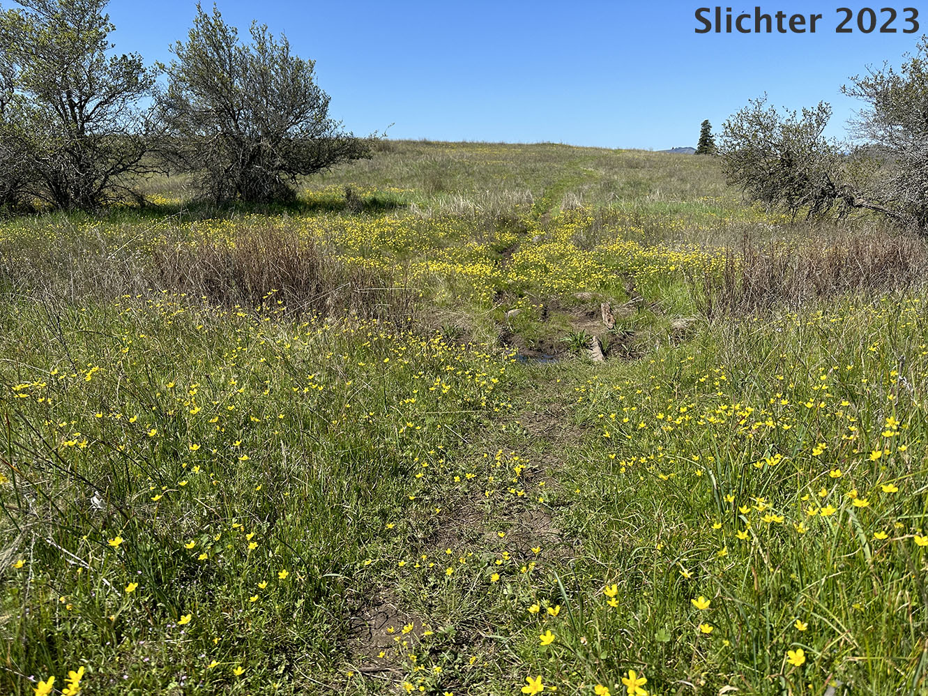
The photo at upper left shows a mass of western buttercups blooming adjacent to the Marsh Cutoff Road at Memaloose......April 21, 2017. The photo at upper center shows basalt pinnacles with balsamroots beginning to bloom around them along the old Chatfield Road, below the Memaloose Overlook......April 14, 2018. The photo at upper right shows the Carey's balsamroot bloom nearing its peak atop Castilleja Hill, Memaloose area.....April 21, 2017.
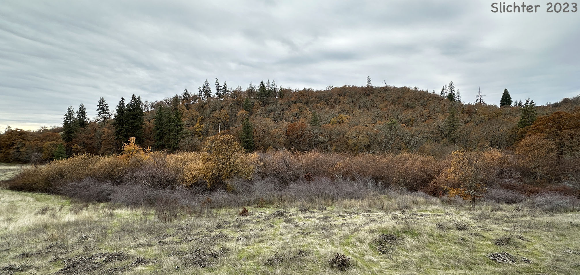
The photo at lower left shows masses of plantain-leaved buttercups blooming in moist, grassland swales to the south of Marsh Hill......April 28, 2023. The photo at lower center shows Carey's balsamroots in bloom along an oak forest trail on the south side of Marsh HIll......April 28, 2023. The photo at lower right shows masses of Oregon white oaks showing their fall color along the east sides of Chatfield (Castilleja) Hill at left and McClure Hill at right as seen from atop Marsh Hill, Memaloose area......November 16, 2023. Memaloose is a very nice fall hike, too!