Eastbound on Interstate 84, exit onto US 30 at exit #69. Exit the freeway southbound (to the right). Proceed uphill, winding through beautiful oak forests and meadows for about 7 miles. Either park on the west side next to the Nature Conservancy sign, or at the traffic circle at Rowena Overlook.
Westbound:
Westbound from The Dalles on Interstate 84, take exit 76 at Mayer State Park. Cross under the freeway and then turn right (west) onto US 30. Wind several miles uphill to the crest of Rowena, where one may park either on the west side of the road next to the Nature Conservancy sign, or at the traffic circle at Rowena Overlook.
Note: For those planning to hike to the summit of Tom McCall Point, it is best to park at the traffic circle at Rowena Overlook. There are no restroom facillities at the Rowena Overlook. It is best to stop for a restroom break at the city park in Mosier (across from the grocery store) or at Mayer State Park.
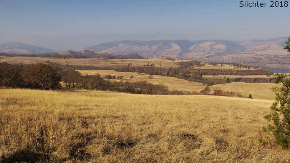
The views from the overlook are outstanding. One may look east towards the Dallesport, WA, or north across the river towards Lyle, WA and the mouth of the Klickitat River. A planting of native wildflowers, complete with signage may be seen within the traffic circle at the overlook.
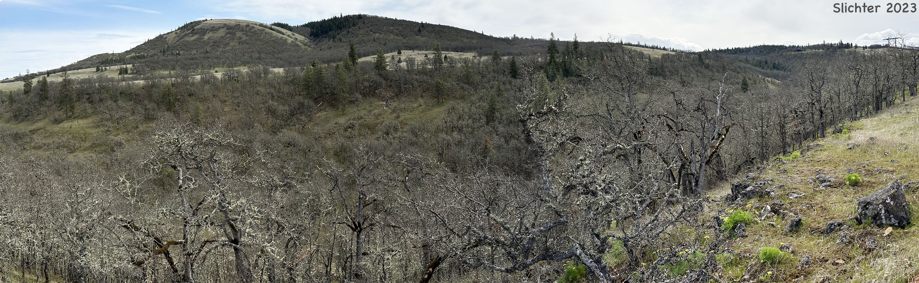
One may also hike a trail that runs from the south side of the traffic circle to the crest of the hillside overlooking Rowena and Tom McCall Preserve. This is the Tom McCall Point Trail. Just walk around the east side of the fence and follow the trail along the west edge of the cliff. Be aware that there is lots of poison oak, ticks, and rattlesnakes along the trail! Wear pants for your protection. The first hundred yards of trail are on state park lands. After that, you are on private property owned by the Nature Conservancy. From that point on dogs are not allowed on the trail to the summit of Tom McCall Point! Please respect the no dogs policy and any trail closures that are posted.
Note: The trail to Tom McCall Point was rebuilt (winter of 2016-17) to USFS standards for wear and tear as well as easier accessibility. Despite that, the trail sees heavy wear and tear, especially after rain or melting snow events where the trail gets muddy. Consider hiking this trail at least 3-4 days after rain events to help prevent erosion.
Rowena Plateau, the lower section of the preserve, is easier to walk around on and view wildflowers. Walk back to the old Gorge Highway (US 30), where you will see a fence with steps over them, and a large sign.
View the common wildflowers on the Nature Conservancy sign along US 30. Cross the fence and proceed along a trail which leads through lush meadows which often show wildflowers from February through August. Many vernal pools display their own unique microhabitats, and a permanent pond and small stream provide a different source of wildflowers than those seen in the meadows. Beware of dense stands of poison oak anywhere you see brush or trees. Also be aware for the presence of rattlesnakes.
 -
- 
Tom McCall Preserve - Plant Species List (August 2016) - Provided by the Nature Conservancy (Click "Open Site in New Window" to view plant species list.)
August 29, 2004: Tom McCall Nature Preserve
August 29, 2004: Dry vernal pond between Mosier, OR and Tom McCall Nature Preserve
February 18, 2002: Includes reports for multiple locations in the eastern Gorge.
February 2, 2002: Includes reports for multiple locations in the eastern Gorge.
Tom McCall Preserve at Rowena - The Nature Conservancy
Tom McCall Point - Friends of the Columbia Gorge
McCall Point Hike - OregonHikers.org
Rowena Plateau Hike - OregonHikers.org
Rowena Plateau and Tom McCall Point - Washington Trails Association
 -
-  -
- 