Cottonwood Canyon State Park is a recently new state park straddling the John Day River the extends both upriver and downriver from where Oregon Highway 206 crosses the river. Park staff, interpretive information, picnic area, both flush toilet and vault toilet and camping facilities can be found on the Sherman County Side of the river, just north of the highway. Trail access is located on both sides of the highway on the Sherman County adjacent to the highway bridge, and on the Gilliam County side on the north side of the river (from the JS Burress State Park river access. Currently, there is no developed trail heading upstream on the Gilliam County side of the river. One can bushwack upstream on the east side of the river, but the route is covered with thick brush, and during high water, access is restricted due to the flood waters coming up to the sheer rock walls about a half mile upstream.
For wildflower seekers, the further upstream or downstream along the trails, the better the flowers (this was formerly an active ranch), or the higher on the canyon walls (where one can safely go) one ventures, the more natural the vegetation. Wildflowers begin appearing in mid-February (most years) with good grassland and shaded cliff flowers by mid-APril to early May.
Look for bighorn sheep on the steeper slopes, and for now, it is best to not hike up the steep slopes directly north of the Pinnacle Trail to avoid disturbing the bighorns. Once flooding on the river subsides, there are abundant waterfowl which set up nests, and numerous smaller bird species become abundant by mid-April.
Note: In warm weather, keep a constant watch for rattlesnakes and beware of poison ivy/and or poison oak in shrubbery along riparian areas, including in the drier side canyons. Ticks can also be numerous in the tall grasses and shrubbery. The wind can be pretty strong here at times, so I check the weather forecast before deciding to go. Take plenty of water in your pack as temperatures can be much warmer due to the baking action of the narrow canyon walls than in the nearby Columbia River Gorge.
March 5, 2020: Pinnacles Trail downstream to about MP 3.0 across from the Lost Corral at the mouth of Essau Canyon, Cottonwood Canyon State Park and adjacent BLM lands.
October 25, 2017: South River Trail, Cottonwood Canyon State Park and adjacent BLM lands to about 1 mile west of Essau Corral (Gilliam County) - Plants in bloom: big sagebrush (Artemisia tridentata ssp. tridentata), torrent sedge (Carex nudata), hoary-aster (Dieteria canescens var. incana), rubber rabbitbrush (Ericameria nauseosa var. oreophilus), low gumweed (Grindelia nana var. nana), hairy goldaster (Heterotheca villosa var. minor), toothed cutleaf penstemon (Penstemon richardsonii var. dentatus), narrowleaf wire lettuce (Stephanomeria tenuifolia). One western rattlesnake was observed on the trail.
April 22, 2023: Hard Stone Trail, Cottonwood Canyon State Park upstream to about one-third of a mile east of the big whorlpool on the John Day River.
May 3, 2017: Hard Stone Trail, Cottonwood Canyon State Park and adjacent BLM lands (Sherman County)
March 19, 2017: Hard Stone Trail south (and upstream) from OR Highway 206 for 2.4 miles along the west bank of the John Day River. (Sherman County)
March 10, 2017: Hard Stone Trail, Cottonwood Canyon State Park and adjacent BLM lands (Sherman County)
April 9, 2016: South River Trail, East Bank of the John Day River from JS Buress State Park to the Esau Corral (Gilliam County)
March 18, 2016: Slope west of the Day Use Area, from the Sage Knob Trail uphill to the top of the rim. (Sherman County)
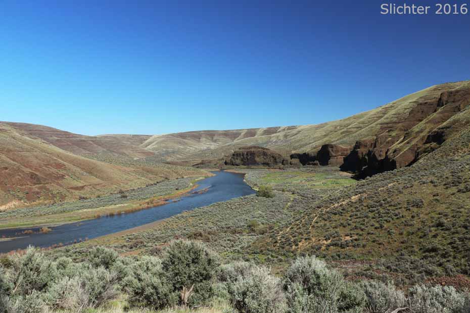
February 20, 2016: South River Trail, East Bank of the John Day River from JS Buress State Park to the Esau Corral (Gilliam County)
April 6, 2015: Pinnacles Trail downstream about 4-5 miles. (Sherman County)
February 22, 2015: Slope west of the Day Use Area, from the Sage Knob Trail uphill to the top of the rim. (Sherman County)
Additional Online Resources for those planning to hike Cottonwood Canyon State Park:
Cottonwood Canyon Info: includes map showing BLM vs. Oregon State Park land. Even better maps are available from the BLM. http://oregonstateparks.org/index.cfm?do=main.loadFile&load=_siteFiles/publications/Cottonwood101301.pdf
Cottonwood Planned Trail Development: (scroll down for planned trails) http://www.oregon.gov/oprd/PLANS/docs/masterplans/cottonwood/cottonwood-plan-maps-ch10.pdf