 -
- 
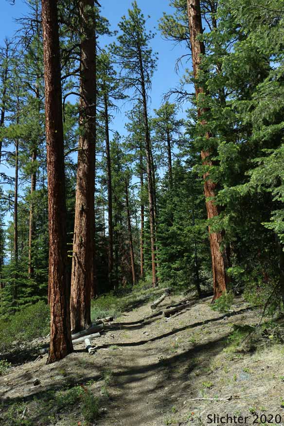
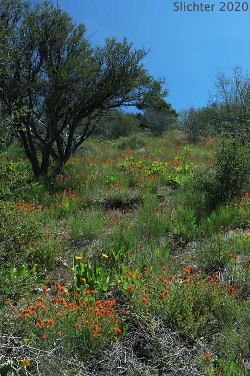
The photo at upper left shows the The Fremont National Recreation Trail climbing up through open ponderosa pine forest on the northwestern slopes of Hager Mountain, Fremont-Winema National Forest.....June 18, 2020. The photo at upper right shows the Fremont National Recreation Trail climbing up past wildflower-filled slopes on the northwestern slopes of Hager Mountain, Fremont-Winema National Forest.....June 18, 2020
The photo at middle left shows numerous wildflowers along the Hager Mountain Trail on the northwestern slopes of Hager Mountain, Fremont-Winema National Forest....June 18, 2020. The photo at middle right shows he Fremont National Recreation Trail climbing up past wildflower-filled slopes with a view up towards the summit on the northwestern slopes of Hager Mountain, Fremont-Winema National Forest.....June 18, 2020
The photo at lower left shows a view northeast across Paulina Marsh towards the Devil's Garden and Lava Butte with the peaks along the south side of US20 from near the summit of Hager Mountain, Fremont-Winema National Forest......June 18, 2020. The photo at lower right shows the Hager Mt. lookout with the vault toilet and various out buildings, Fremont-Winema National Forest......June 18, 2020. The lookout is staffed during the summer and early fall months by USFS fire staff. The lookout is available for recreational rent much of the rest of the year, though it should be noted that access during the winter would have to be by snowshoe, cross country skiing, or perhaps snow mobile due to snow on the access roads.
Hager Mountain (7195') is a volcanic peak that dominates the skyline south of Silver Lake, OR. It lies at the northwest corner of the Basin and Range province of the western US. It is several miles west of Winter Rim, a dominant fault block ridge that makes up that part of the Basin and Range province. Much of the mountain is covered in conifers, but bunchgrass meadows dominate the ridge that extends north from the summit while the summit is an open rock garden. An old one room lookout situated at the summit is in the rental system (Recreation.gov) and is available after the end of fire season from November 15 to May 15. Views from the top are impressive with good views west to the Cascade Mountain range from Mt. Hood in the north to Mt. Shasta in the south. Extensive views north include all of northern Lake County from Newberry Crater east across Christmas Valley. The forested western slopes of Winter Rim are to the east and the views to the south include Thompson Reservoir and out towards Sycan Marsh.
Wildflower season begins in mid-May most years and extends into early July or so. The summit meadows are dominated by balsamroots, wavyleaf paintbrush, several hawksbeards, creamy light blue flowered upland larkspurs and Washington lilies. Numerous shrubs bloom in late May as do the balsamroots.
Just east of the Silver Lake Ranger Station in Silver Lake, Oregon, head south on paved Forest Road #28, reaching the signed Hager Mountain Trailhead on the left after about 9.3 miles. This offers the longest roundtrip hike and greatest elevation gain. If you choose this hike, park here and walk back north about 100 meters to find the trail. Expect an 8 mile roundtrip hike with 1990 foot elevation gain from this spot.
If you'd like a shorter hike, continue south on FS Road #28 an additional 0.2 miles to FS Road #012 on the left, a dirt road leading uphill through the conifers. Continue uphill about 1.2 miles, passing masses of balsamroot and paintbrush under the trees to where the Fremont National Recreation Trail #160 crosses the road. The trail is faint, but a blue diamond on a tree at the right alerts you to the prescence of a trail. Park where you can (a wide spot in the road is about 50 meters uphill). Expect a 6.6 mile hike with approximate 1700 foot elevation gain from this trailhead.
If you'd like an even shorter hike, continue driving uphill on Road #012 to the end of the road (a fainter road heads downhill at a sharp angle to the left). This trailhead has room for about 3-5 vehicles, depending on how everyone parks. This is the Hager Springs Trailhead. A trail sign directs foot traffic to the rightfor about 75 meters before reaching the Fremont Trail. Veer left up the hill, quickly passing fenced Hager Springs (not flowing in May 2016). The trail climbs steadily through conifer forest along the south edge of a clearcut, the path marked by numerous blue diamonds on the trees (put there to aid navigation for winter x-country skiers). After several switchbacks, the trail veers north passing above the old clearcut and soon begins to break out into flower-filled, bunchgrass slopes. At about 1.1 miles from the car, you will reach a signed junction. Veer left to stay on the Fremont Trail and pass along the north-side of Hager Mt., or continue straight on the trail to the summit of Hager Mt, first passing gently through more flower-filled meadows before climbing more steeply through coniferous woods to a shoulder on the south side of the summit. Proceed several hundred meters east, then switchback uphill to the left with the first glimpses of the summit. The trail wraps around the west side of the summit before switchbacking south and climbing directly to a picnic table and outhouse at the summit after a 1.4 mile climb from the previous junction. A fire lookout dominates the summit (7195'). This is manned during the summer. The lookout is available for rent from fall through mid-May, and sees heavy use during that time. Views east show Abert Rim in the distance and Winter Rim about 10 miles east. Views south include Gearhart Mt., Sycan Marsh, Thompson Reservoir and Mount Shasta horizon behind the reservoir. The tree-lined ridge of Yamsay Mountain (8196') dominates the western skyline, although several of the Cascade Peaks can be seen on a nice day. To the north, one can see the pyramidal peak of Bald Mt. (7393') with Newberry Crater behind, and Fort Rock and the Christmas Valley further east in the distance. Expect a 4.4 mile roundtrip hike with 1450 total elevation gain from this trailhead.
More comprehensive plant list for Hager Butte
June 18, 2020: Hager Mountain via the Fremont National Recreation Trail #160 from Hager Springs Trailhead (Silver Lake Ranger District, Fremont-Winema National Forest)
May 19, 2016: Fremont National Recreation Trail #160 (from the Hager Springs Trailhead up to the Hager Mt. summit)
Resources:
Hager Mountain Lookout (USFS)
100 Hikes/Travel Guide: Eastern Oregon by William L. Sullivan - This book has a description of hikes on Hager Mt. It should be available at many book stores that cater to hikers and nature enthusiasts. Obtain the latest edition for the most current information.