Malheur National Forest
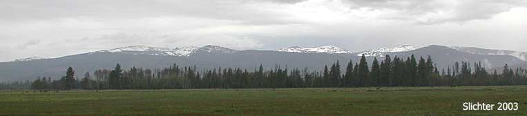
The Logan Valley (5000') is a large, relatively flat valley of mostly wetland habitat located on the south side of the Strawberry Mountain Range in central Oregon. Much of it is part of the Malheur National Forest although there is a mix of private lands and lands administered by the Burns Paiute Tribe.
The valley is a graben, a geologic formation formed when the land stretches, causing cracks or faults in the earth, allowing the land which became Logan Valley to drop relative to the surrounding landscape.
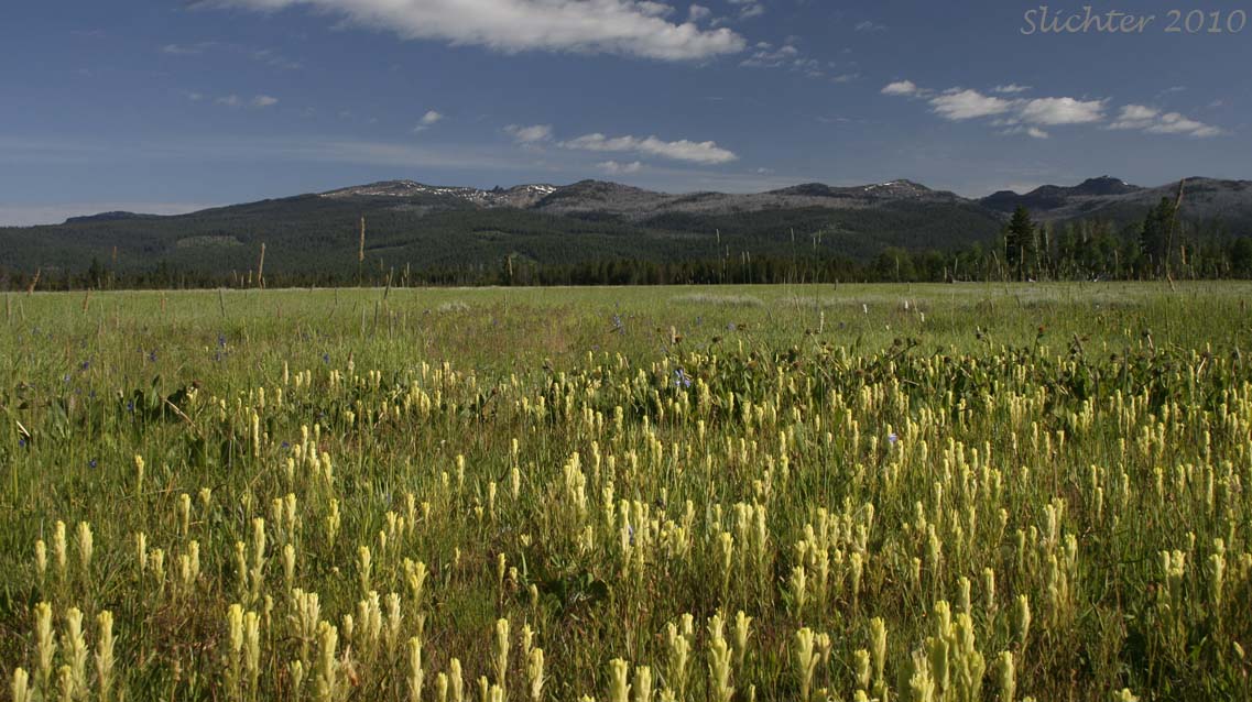
Three major creeks (Big, Bosenberg, and McCoy Creeks) run through Logan Valley wind through the valley to converge and form the Malheur River at the south end of the valley. Since the valley is largely flat, this creates extensive wetlands that are separated by several low, narrow ridges of shallow soil which support arid scabland habitats. Slightly higher ridges towards the periphery of the valley support open conferous forests of ponderosa pine and douglas fir.
Care should be taken to not venture out onto private or tribal lands in Logan Valley. There is a turnoff and parking area to view nature on the north side of FS Rd 16 about midway between FS Rd 16.924 (the access road to Lake Creek Camp) and the access road to Big Creek Campground. Use spotting scopes or binoculars to search the surrounding wetlands for birds and larger mammals. The site is a safe place to park off the main road and can be a base for short hikes into the wetlands or along the main road in search of many of the more than 200 plant species to be found there.
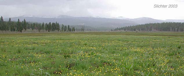
Logan Valley is largely a moist wetland meadow in spring but begins to dry out by late June. The wetland portions are covered at most with several inches to perhaps as much as one and one-half feet of water. Look for vast patches of magenta elephant heads (Pedicularis groenlandica), Cusick's paintbrush (Castilleja cusickii), common camas (Camassia quamash) with taper-tip penstemon (Penstemon attenuatus), Oregon saxifrage (Saxifraga oregana), american bistort (Bistorta bistortoides) and several species of bright orange arnicas mixed in. Numerous species of sedges and rushes can be observed between the more showy flowers with an occasional cottongrass (Eleocharis gracile) to be seen. Along the main roads, look for showy bigpod Mariposa lily (Calochortus eurycarpus) Cusick's elkweed (Frasera columbiana var. cusickii), neglected balsamroot (Balsamorhiza hookeri var. neglecta, northern mule's ears (Wyethia amplexicaulis), scarlet gilia (Ipomopsis aggregata), showy penstemon (Penstemon speciosus), sugar bowls (Clematis hirsutissima) and white-headed Wyethia (Wyethia helianthoides).
Watch for several herds of pronghorn antelope in the valley. Rocky Mt. elk and mule deer are also numerous, especially near the forest edges. Listen for the raucous cries of nesting greater sandhill cranes. Numerous birds of coniferous forest, riparian shrubland and wetland meadows should also be seen. Unfortunately, one of the stream courses was altered through an area favored by upland sandpipers and this rare bird has not been recently seen.
Much of the flora and wildlife can be observed from the car by driving FS Rd 16 as well as the gravel roads around the northern edge of the valley. FS Rd 1647 offers access to the eastern valley edge to the south side of FS Rd 16. Be aware that lands west of this road are largely private, while most (but not all) lands east of FS Rd 1647 are public. If worried about getting wet while hiking, my recommendation is to park at Big Creek Campground and walk north from the west edge of the campground (the gate in the fence is immediately west of the pit toilets) on the trail (ATV, mountain biking, hiking). One can roam off trail westwards about 50-100 meters before the ground begins to get too wet. At a fenced aspen grove, one reaches an east-west trending trail. Hike west to FS Rd 924 just north of Lake Creek Camp. Hike eastward to explore the riparian area at Big and Bosenberg Creeks before reaching the east edge of Logan Valley. Evidently the trail then climbs uphill and wanders through the forest just north of FS Rd 16 for about 4 miles before reaching Summit Prairie.
From John Day, drive south on US Highway 395 for about 10 miles and turn left onto Grant County Rd 65. Follow paved County Rd 65 (which becomes FS Rd 15 at the forest boundary) for about 15 miles before turning left onto FS Rd 16. County Rd 65 can be a bit windy so slow down and drive at an appropriate speed. Drive east on FS Rd 16 for another 4.5 miles to the west edge of Logan Valley. Logan Valley is about a 45-50 minute drive from John Day, OR. It is about a 25 minute drive east of Seneca, OR. Generally the road here have light traffic (except for free range cattle and the occasional deer, feral horse, or elk), although traffic is heavier on summer holiday weekends and during hunting season.
There are accomodations for larger groups at Lake Creek Camp on FS Rd 924 in central Logan Valley.
Just north of Lake Creek Camp at the junction of FS Rd 924 and FS Rd 1648 is Murray Campground which has 6 campsites and vault toilets.
Big Creek Campground is located along Big Creek about one-third of a mile north of FS Rd 16 in Logan Valley. There are 14 campsites, a pair of centrally located vault toilets and a manual water pump. The camp is fairly heavily used by ATV campers during the week before and after Memorial Day, the Fourth of July and Labor Day. Generally there are at least a few campsites open during the week. It also provides easy access to fly fishing in Big Creek. This is a fee site.
I should point out that I use Big Creek Campground (along with the North Fork Malheur CG) when I visit the area. The other campers have always been friendly, it offers easy access to the wildflower meadows to the west, and is an excellent place for morning and evening birding!
Partial Flora for Logan Valley
August 18-20: Logan Valley (Malheur National Forest)
August 2-4, 2011: Logan Valley (Malheur National Forest)
June 26, 2011: Southern Logan Valley (along FS Rd 1647) - A Native Plant Society of Oregon Field Trip
June 23 & 24, 2011: Logan Valley - A Native Plant Society of Oregon Field Trip
June 3-5, 2011: Logan Valley, Malheur National Forest - Logan Valley is now entirely clear of snow although it is partially flooded at this point. The road shoulders may also be soft. Although there's not a lot of traffic here, find a spot to park off the flow of traffic if possible! Mosquitoes are currently pesky in the open part of the valley, although they are less of a problem (but still present) at Lake Creek Camp and the two formal campgrounds. Bring water if you plan to use Big Creek Campground as they are currently improving the water system there.
July 16-18, 2010: Logan Valley, Malheur National Forest
June 30-July 3, 2010: Logan Valley, Malheur National Forest
May 25, 2003: Logan Valley, Malheur National Forest