Wildflower Hiking the Mosier Twin Tunnels
Mark O. Hatfield Trail
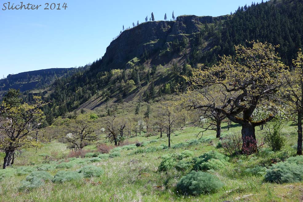
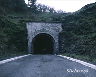 Photo at right of the eastern
portal to the Mosier Twin Tunnels.
Photo at right of the eastern
portal to the Mosier Twin Tunnels.
Take I-84 to Hood River, exiting at Exit #64. If westbound on the freeway off ramp, turn left and cross under the freeway bridge. If proceeding eastbound on the freeway off ramp, turn right and again right onto OR 35. Proceed uphill, winding left to the 4-way stop at Old Columbia River Dr.. Turn left onto Old Columbia River Dr.. Proceed uphill on the winding road. Park in the parking area and buy a parking ticket to display on your dash board. Note the variety of native plants on display at the parking area. Proceed on foot uphill on the old gorge highway. At this point there still may be some private property along the trail, so please don't trespass!
The walking surface is pavement, and is in fairly good condition. Notice the rock and mortar crash barriers which have recently been restored. The tunnels are about 2.5 miles from this point, so you would be looking at a good 2-3 hour hike from this point, depending on your conditioning. Beware of trucks on the road this spring and summer as work begins on the protective lid to the west entrance to the tunnels!
Many nice views abound from this route. Mid April into late May are good times to observe wildflowers along the route. Beware of poison oak which abounds along much of the road! The route passes through Douglas Fir forest into oak forest, and through some grasslands.
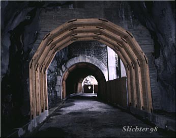 Photo at right of the Mosier
Twin Tunnels, viewed from within the tunnels, looking downhill towards the western
entrance, which was gated at the time of this photo (during its construction).
Photo at right of the Mosier
Twin Tunnels, viewed from within the tunnels, looking downhill towards the western
entrance, which was gated at the time of this photo (during its construction).
Take I 84 to Mosier, exiting at exit #69. Cross the freeway and railroad tracks heading south. As the road (Old Gorge Highway) curves to the left, you will see Mosier School ahead to the right. At this point you will take the first left onto Rock Creek Rd. Go under the bridge, cross the creek, and wind uphill on a nicely paved road for about 0.65 mile (from the intersection with the Old Gorge Higway). Turn right (its easy to miss if you're going fast) and you will see a gate ahead with a small gravel parking area along the road on the right. This is the trailhead for the eastern approach to the Mosier Twin Tunnels. If parking is tight here, you can proceed up Rock Creek Road for about another 0.2 miles and turn left into the Mark Hatfield Trailhead Parking area. There is a pit toilet at this latter parking area and one may need to buy and display a state parking ticket here.
The road to the Mosier Twin Tunnels is walked on the old road bed. It begins in an old lava flow area, and proceeds slightly uphill for about a 15 minute walk to the eastern entrance to the tunnels itself.
Comprehensive Plant List for the Mark Hatfield Trail
April 3, 2015: Scabland Benches Around the Rock Quarry Between US 30 and I-84 Between Hood River and Mosier
April 13, 2014: Mark Hatfield Trail (Twin Tunnel Trail) from the Mosier Trailhead west to the large rock quarry.
May 27, 2012: Twin Tunnels/ Mark Hatfield Trail Trail (between the west and east trailheads)
October 12, 2010: Twin Tunnels (from the west trailhead near Hood River, OR)
April 29, 2010: Twin Tunnels (from the east trailhead near Mosier, OR)

Online Resources:
Mosier Twin Tunnels Hike: OregonHikers.org
Mosier Twin Tunnels: Friends of the Columbia Gorge
Historic Columbia River Highway State Trail - Mosier Twin Tunnels: Washington Trails Association
 -
- 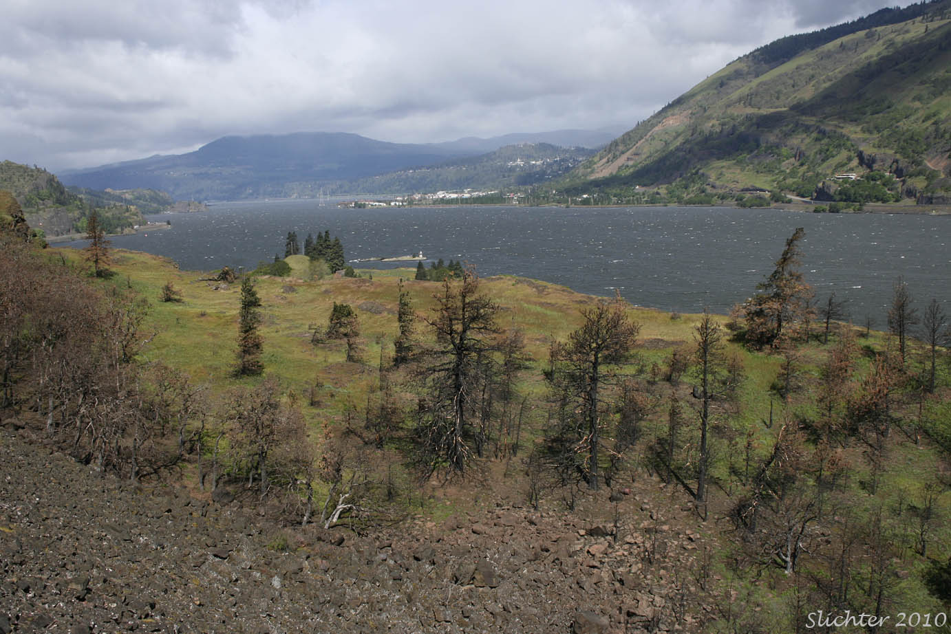
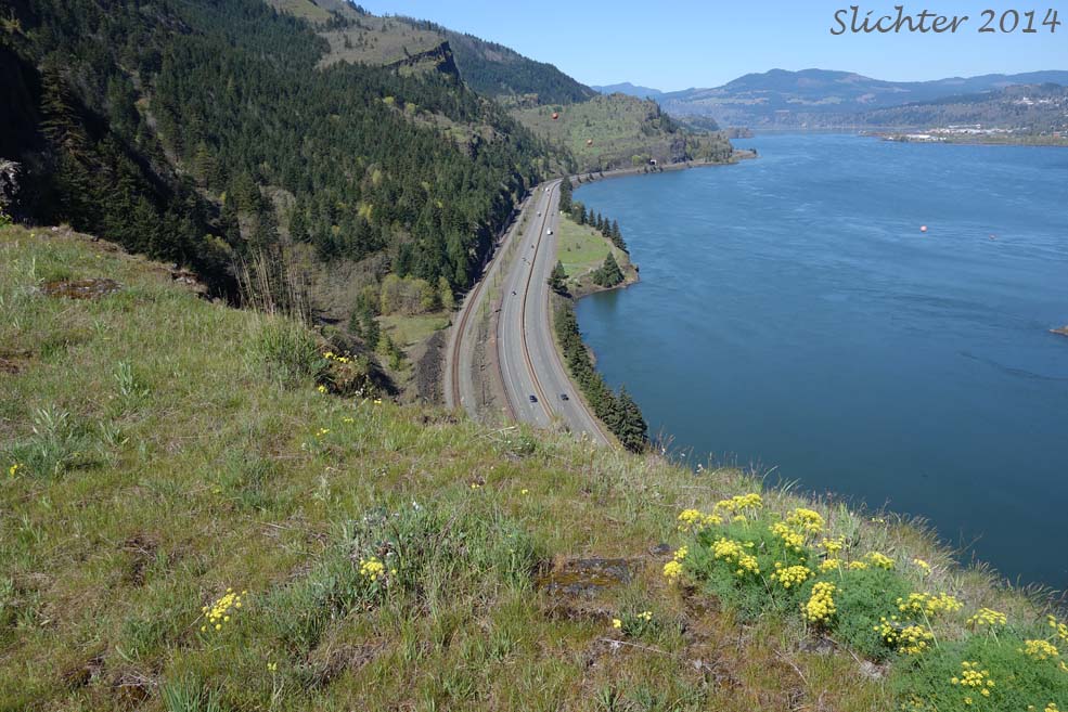
The photo at lef shows a view west along both Interstate 84 and the south bank of the Columbia River from the east embankment for the Mosier Twin Tunnels.....April 13, 2014. The photo at right shows a view west downriver from the Mark Hatfield Trail to Bingen on the Washington side of the Columbia River....April 28, 2010.
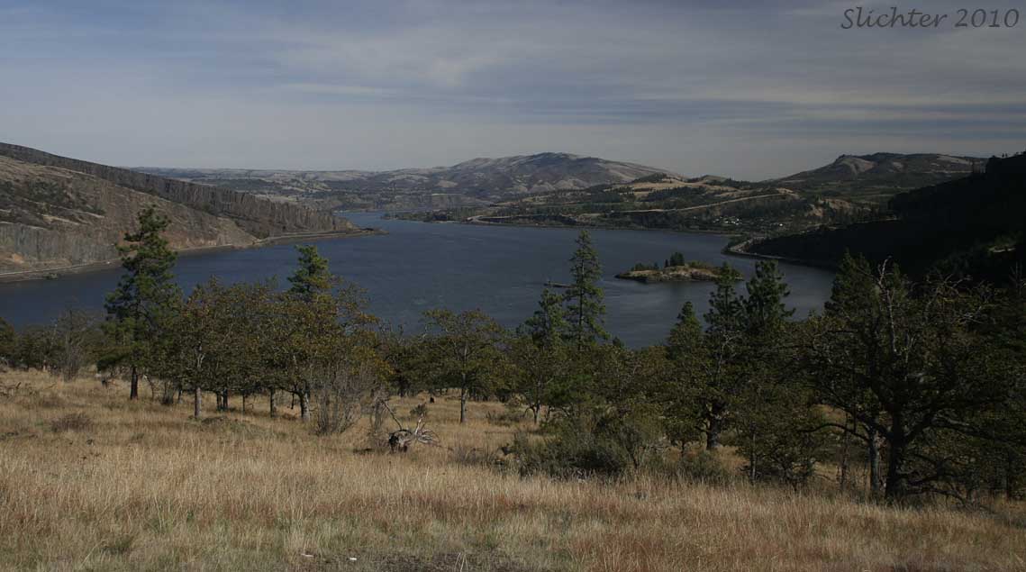
The lower photo shows a view east upriver towards Coyote Wall at left and the Columbia Hills at center.....October 13, 2010.