Sevenmile Hill is a prominent ridgeline that is oriented west to east directly above the south side of Interstate 84 . It stretches from Rowena Creek on the west eastward to the west slope above Interstate 84 adjacent to The Dalles Discovery Center. Currently, there are no trails east along the ridgetop from near the top of McCall Point heading towards The Dalles Discovery Center. The ridge actually travels east past US Highway 97 many miles to the east, but one has to cross the Columbia River to the Columbia Hills to continue that exploration.
Friends of the Columbia River Gorge used to lead hikes every year by staying to public lands near the ridgetop, but those leaders have all aged out and the hikes have ceased. There are plans (2024) to develop a trail from west to east along the ridgeline, but any resulting trail(s) won't be developed for a couple of years. People can explore east from Rowena Creek or Rowena Overlook up onto the northwestern slopes of Sevenmile Hill, being sure to keep to public lands. Just realize that no one has maintained the unofficial trails constructed there for over a dozen years, and there are many dense patches of poison oak (and numerous ticks) there.
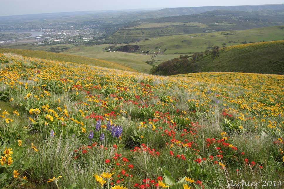
Instead, continue east on Interstate 84 and instead hike the USFS parcel on the southeastern corner of Sevenmile Hill (See directions below.). The open slopes on this side of the ridge are hikeable from February on in the spring and sport a beautiful mix of native bunchgrasses, balsamroots, lupines and paintbrushes from mid-April into early May most years. Views from the crest of the crest of Sevenmile Hill afford views north towards Mt. Adams and the Goat Rocks to the northwest as well as down onto the Columbia and Klickitat Rivers, the town of Lyle, WA, and across to the Lyle Cherry Orchard trail system across the river.
Note cautions about property boundaries and potential conflicts below in the middle paragraph of the directions section.
No access permits are required for this site. There is no restroom nor any water available at this site, so make a quick stop at the Memaloose Rest Area or in The Dalles to take care of bathroom needs prior to your hike. It's open countryside, so people are visible for miles around!
From the Interstate 84 Exit 82 for the Port of The Dalles and Columbia Gorge Discovery Center, turn right (for eastbound traffic)at the end of the off ramp. For westbound traffic having passed The Dalles, take Exit 82 and at the stop sign at the end of the off ramp, turn left (west) and cross the bridge. At the frontage road (Highway 30W), turn left and drive about 0.3 miles. Turn right onto Chenoweth Loop Road (Home Depot will be at the SW corner of this junction). Drive approximately 0.6 miles west to a T-junction. Turn right onto W 10th Street. Follow W 10th Street about 0.6 mikles to a junction with Sevenmile Hill Road. Check your odometer and turn right onto Sevenmile Hill Road, driving uphill 1.1 miles where you will turn right onto a dirt road heading up the slope to the north. My hiking group drives up this dirt road and parks about 0.1 miles uphill at a wide spot in the road where there is room for 4-6 vehicles if carefully parked. This is at the top of a small rise where the road levels out.
Other hiking guides advise driving further uphill to park at the first pullout to the left. If possible, avoid doing so as that site is on Wasco County land. We've not had any issues with the county in this area, but a number of other hikers had issues with the Wasco County Sherrif's Department (possibly other law enforcement agencies, too) pre-Covid when they parked there or tried driving further up the road to park at the circular gravel area at the head of the road. Currently (2022), there are 2 metal 55 gallon drums along the road before getting to the circular gravel area that are posted "No Tresspassing". The circular gravel area has been used at times by Wasco County law enforcement agencies for target practice, so they don't want to find cars parked in their target practice area. Evidently, some hikers were also confronted about parking on county land below the metal drums. Currently, I haven't heard whether the US Forest Service and Wasco County have settled the issue about access to this area, so this is just a warning to park on USFS land as directed in the first paragraph above and then proceed crosscountry to the second drainage above the old Sevenmile Hill Road to avoid problems. See the two maps below which hopefully clarify access.
Most hikers skirt the east side of the circular gravel target area and about 100 yards uphill beyond that, the USFS land gets much broader. Follow the old jeep track up the slope. It should be fairly easy to spot. Nothing is signed in this area to direct hikers. Hiking west or east, if you come to an intact barb wire fence, do not cross it as you'd be entering private lands. There is an old fence that crosses east to west across forest service lands about one-half of the way up. There is no problem crossing it. Currently, there is no legal route west towards McCall Point without dropping down the north-facing slope. Likewise, there is no legal access east towards the Discovery Center. Efforts have been launched (winter 2023-24) by Friends of the Columbia River Gorge to work with the USFS and adjacent property owners to gain legal access and then eventually develop a trail from McCall Point east to the Discovery Center. At this point, I've not heard that there is any intent to develop a trailhead at the narrow strip of USFS property that can be accessed via Sevenmile Hill Road.
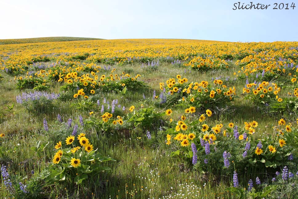
 The photo at right shows extensive slopes of Carey's balsamroot and Columbia Gorge lupine in bloom on the south-facing slopes of Sevenmile Hill, Columbia River Gorge.........April 20, 2014. I believe this photo was taken prior to a wildfire that burned perhaps as much as 50% of the balsamroot and lupines.
Plant Lists:
Comprehensive plant list for Sevenmile Hill
March 2, 2017: East Sevenmile Hill
April 23, 2016: East Sevenmile Hill
February 15, 2016: East Sevenmile Hill
April 12, 2015: East Sevenmile Hill
March 30, 2015: East Sevenmile Hill
March 8, 2015: East Sevenmile Hill
February 13, 2015: East Sevenmile Hill
April 20, 2014: East Sevenmile Hill
Seven-mile Hill: Northwest Wildflowers
Sevenmile Hill Trailhead: OregonHikers.org - See my maps above about access to USFS lands on Sevenmile Hill to avoid potential hassles with parking and where to hike up to the USFS jeep trail.
Sevenmile Hill Loop Hike: OregonHikers.org