Note: If you don't like trails with long drop offs to one side, this probably isn't the trail for you to hike. This may also not be the best hike for young children and dogs.
I have to admit that the Eagle Creek Trail #440 was one of my favorite wildflower hiking trails. There are numerous trailside wildflowers to view on the open cliffs as well as in the forested sections of the trail. However, about 1 dozen years ago, this trail was discovered by the masses and it was difficult to stop on the narrow cliffside sections of trail as dozens of people tried to squeeze past, sometimes with off leash dogs racing back and forth. Another issue for me was the loud music some hikers were hiking too. Parking also became a problem. What was once a wilderness experience for me became similar to an urban hike with far too many fellow hikers and the problems some of the bring with them. So I haven't hiked this trail since 2013. Thus, ttake what I say here with a grain of salt.
More problematic was the Eagle Creek Fire which began on September 2, 2017 and burned the Eagle Creek Gorge and much of the surrounding forest. Consider culting OregonHikers.org for current trail conditions (many people hike this and report current conditions). There are still land slides and tree fall that occur after heavy rain or snow melt events which often close the trail. It took a lot of work to fully reopen the trail, and volunteers still constantly work on it to keep it open.
For wildflower hikers, one can hike upstream along the trail as far as you want. There are patches of good flowers upstream as far as the High Bridge. Stronger hikers can do in and out hikes that go far beyond that point, or perhaps hike all the way up to Wahtum Lake. See the online resources below as they will have excellent trail descriptions for the various destinations along the trail.
Wildflowers one might expect to see along the Eagle Creek Trail #440: tapertip onion (Allium accuminatum), Martindale's desert parsley (Lomatium martindalei), streambank arnica (Arnica lanceolata ssp. prima), goldstars (Crocidium multicaule), long-bearded hawkweed (Hieracium longiberbe), great hound's tongue (Adelinia grandis), Sitka mist maidens (Romanzoffia sitchensis), Oregon flag (Iris tenax), glacier lily (Erythronium grandiflorum), wood lily (Trillium ovatum), fairy slipper orchid (Calypso bulbosa), dutchman's breeches (Dicentra cucullaria), bleeding heart (Dicentra formosa), rock penstemon (Penstemon rupicola), Cascade penstemon (Penstemon serrulatus), white shooting star (Dodecatheon dentatum), dark-throat shooting star (Dodecatheon pulchellum), Columbia windflower (Anemone deltoidea), rockslide larkspur (Delphinium glareosum), Oregon bolandra (Bolandra oregana), rosy plectritis (Plectritis congesta), Scouler's valerian (Valeriana sitchensis ssp. scouleri) and evergreen violet (Viola sempervirens). Of course many other plant species can be found along the whole length of the trail so please look at the link for the comprehensive plant list below.
Note: The Eagle Creek Trailheads are only accessible from eastbound Interstate 84.
Eastbound Traffic on Interstate 84: Drive on Interstate 84 east from Troutdale, OR. As you arrive at Bonneville Dam, be sure to move into the right lane on the freeway. Immediately after passing through the freeway tunnel at Tooth Rock, take Exit 41. At the end of the offramp, turn right and follow the signs to the Eagle Creek Trailhead and Picnic Area. There are two parking areas. The one furthest upstream is frequently full, but one can drive to it to check and see if there is an available space to park. Otherwise, park at the lot just south of the Eagle Creek Fish Hatchery and carefully walk upstream along the road before arriving at the actual trailhead.
Westbound Traffic on Interstate 84: Those driving from Cascade Locks, Hood River or further east need to drive about 3 miles west on I-84 from Cascade Locks and get off the freeway at Exit #40 (Bonneville Dam exit). Turn left at the stop sign at the end of the exit ramp, cross under the freeway underpass and turn left on the I-84 eastbound onramp. Travel east in the right lane on Interstate 84 and exit right at Exit 41 which is just east of the freeway tunnel. At the end of the offramp, turn right and follow the signs to the Eagle Creek Trailhead and Picnic Area. There are two parking areas. The one furthest upstream is frequently full, but one can drive to it to check and see if there is an available space to park. Otherwise, park at the lot just south of the Eagle Creek Fish Hatchery and carefully walk upstream along the road before arriving at the actual trailhead.
An up to date Northwest Forest Pass or Annual Senior Pass or Lifetime Senior Pass must be displayed on the car window or dash. Water is available at the picnic area as are flush toilets. A vault toilet is located at the actual trailhead.
An alternative trailhead with fewer problems finding a parking spot and for stronger hikers is to get off eastbound Interstate 84 at Exit #40 (signed for Bonneville Dam) and turn right at the stop sign at the end of the exit ramp. At the second left (immediately past the eastbound ramp for I-84), turn onto a service road which takes you uphill to the east to a large parking area at the Tooth Rock Trailhead. Note: There is no vault toilet or water at this trailhead. No fee or pass is needed at this trailhead. Walked the paved trail east up and over the freeway tunnel at Tooth Rock and descend down to Eagle Creek. You will have to descend some stairs to reach the elevation of the freeway.
Comprehensive plant list for Eagle Creek
May 20, 2013: Eagle Creek Trail #440 to High Bridge
April 11 & 16, 2013: Eagle Creek Trail #440 to Upper Punchbowl Falls
August 2, 2012: Eagle Creek Trail #440 to High Bridge
May 10, 2012: Eagle Creek Trail #440 to Lower Punch Bowl Falls
April 13, 2012: Eagle Creek Trail #440 to Upper Punchbowl Falls
March 26, 2012: Eagle Creek Trail #440 to Upper Punchbowl Falls
October 11, 2011: Eagle Creek Trail #440 to Uper Punchbowl Falls
Eagle Creek: Northwest Wildflowers
Eagle Creek Trailhead: OregonHikers.org - Directions and general hiking info.
Tooth Rock Trailhead: OregonHikers.org - Directions and general hiking info. This trailhead sees less use so the parking situation is much better. The downside is that it adds more than a mile each way to your hike.
Eagle Creek to Tunnel Falls Hike: OregonHikers.org
Eagle Creek to Tunnel Falls Hike: Friends of the Columbia Gorge
Eagle Creek: Washington Trails Association
 -
-  -
- 
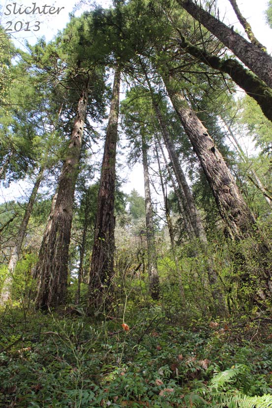
The photo at left shows old growth forest along the Eagle Creek Trail #440, Columbia River Gorge National Scenic Area.....April 11, 2013. The September 2017 wildfire probably burned this grove of trees.The photo at center shows a view down onto Eagle Creek, Columbia River Gorge National Scenic Area......November 15, 2012. The photo at right shows some of the cliffside exposure one might find along the Eagle Creek Trail #440, Columbia River Gorge National Scenic Area.....May 10, 2012.
 -
- 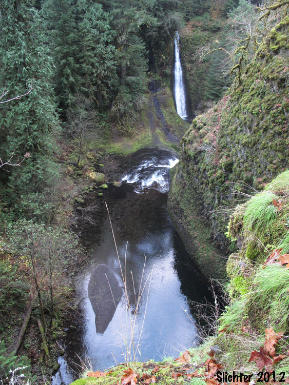
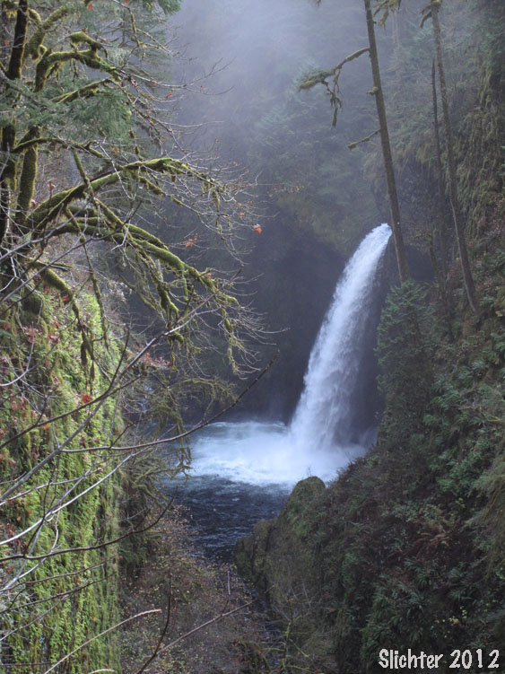
The photo at left shows Metaka Falls along Eagle Creek, Columbia River Gorge National Scenic Area......November 15, 2012. The photo at right shows a view down onto Eagle Creek from the Eagle Creek Trail #440, Columbia River Gorge National Scenic Area.....November 15, 2012.
 -
- 
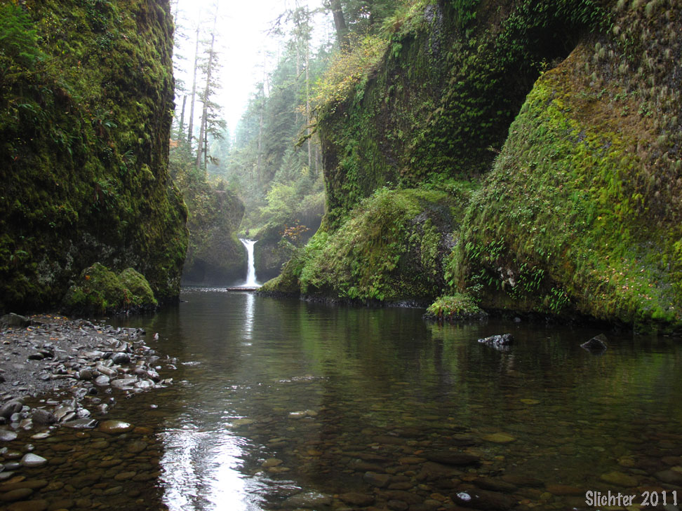
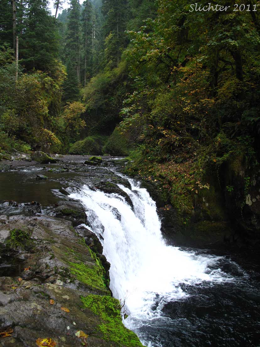
The photo at left shows Lower Punchbowl Falls along Eagle Creek, Columbia River Gorge National Scenic Area......October 18, 2011. The photo at right shows larkspurs (Delphinium sp.) blooming along the Eagle Creek Trail #440, Columbia River Gorge National Scenic Trail.....May 10, 2012.
 -
-