From Trout Lake: Proceed north on Rd #23 for 25.6 miles to the junction of Rd #2329 where you will proceed to the right onto a short paved section of road. Proceed on Rd #2329 for about 3.5 miles to the Divide Camp Trailhead, or 6 miles to the Killen Creek Trailhead.
From Seattle, Tacoma, Portland or Yakima: Drive to Randle, WA. Drive south on State Road 131 (may be signed Forest Road 25) for 0.9 miles, then turn left (east) onto Road 23 and follow it east and south uphill for 30.6 miles to the junction with Road #2329.
For the Divide Camp Trail #112, hike 2.8 miles to the PCT, then turn left, immediately (and with caution) fording Adams Creek and proceed 1.2 miles to the junction with the High Camp Trail.
For the Killen Creek Trail #113, hike 3.1 miles to the PCT, then continue upwards onto the High Camp Trail.
Low Elevation: 6100' at the PCT and Killen Cr Trail #113
High Elevation: 6880'
Elevation Gain: 780'
Trail Length: 0.7 miles (1.13 km)
From the Pacific Crest Trail #2000, the High Camp Trail climbs very steeply in places to the top of the rocky ridge where High Camp is found. Early in the season, snow will cover the lower sections of this route while High Camp, due to its southern exposure, will be snow free. The trail is very sandy in sections, and there are spots where you may almost need to crawl forward on hands and knees. Eventually you will reach a rocky point covered in krummholtz trees which is traversed in a series of several short switchbacks. You then climb more slowly above a snowfield to a notch in the ridge full of wildflowers early in the season. One can then descend several hundred meters towards the established campsites at High Camp, which is heavily used on weekends. Water may be obtained from a small stream at High Camp.
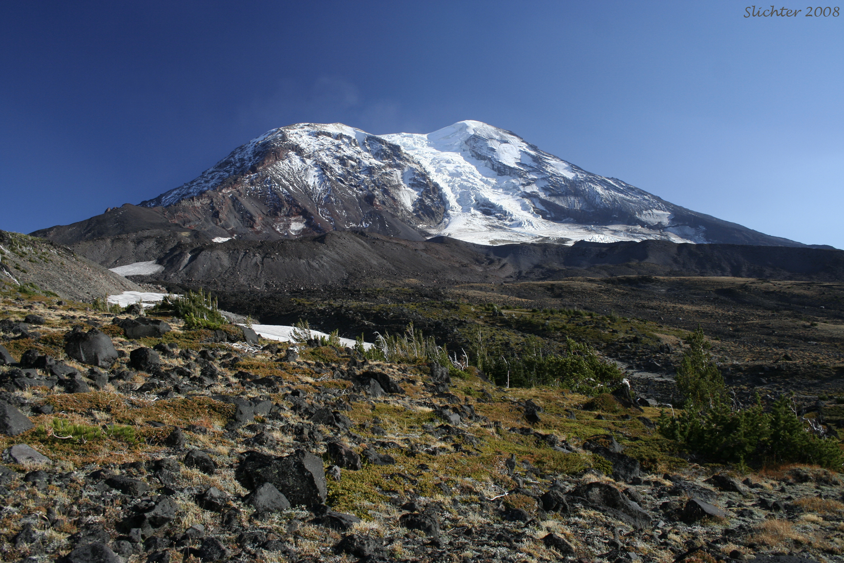
For further exploration, hike upslope from High Camp in the shallow valley bottom (Cascades Volcano Passes will be required from this point on.). I would recommend hiking on the open slopes rather than venturing into slopes covered with dense stands of krummholtz trees where it is difficult to navigate. At about 7500' (1.2 miles above High Camp), you will be confronted by several choices in route. If you bear left, you can hike to the crest of the ridge to the north which is on the western edge of Lava Glacier, with great views north and northeast towards Mt. Rainier, the Goat Rocks, Red Butte and the Devils Gardens on the far right shoulder of the mountain. Approach this ridgetop cautiously and quietly, as herds of mountain goats may be found here. In addition, this ridgetop is probably the most reliable spot for cell phone reception in case of emergency.
Proceeding right at 7500' brings you to Iceberg Lake, which has a lobe of Adams Glacier at its far shore from which icebergs occasionally calve off to give the lake its name. The lake is a light blue color from glacial silt. Under perfect weather conditions, you might get a good reflection of Mt. Adams on the lake, which could be captured with a wide-angle lens.
From the lake, you climb higher, following the route mountaineers use to climb the North Cleaver Route on Mt. Adams. One proceeds uphill east from the lake on faint climbers trails, which skirt a snowfield. About 0.2 miles east of the lake, turn southeast crossing a narrow spot in the snowfield (barren gravel and rock later in season) and one begins climbing gently up a broad rocky slope. The climb steepens but routes should be fairly easy to pick as all foot traffic is funneled to this slope. As the slope steepens, the trail begins to make several switchbacks. The crest of the North Cleaver is reached at 8840 feet. Hikers should turn back at this point, as climbing higher on the mountain requires good technical rock climbing skills, and someone with clear knowledge of the route. There are several areas above this first crest of the ridge, where untrained hikers may be tempted to proceed upwards on slopes that lead to steep drops onto the Lava Glacier, or expose them to risk of rockfall!
I have not yet climbed above 8000' here, but have scoped the area out with binoculars and have determined that there are some good clusters of plantlife to explore. One probably need not climb higher than Iceberg Lake to see most of these species. Also look carefully for mountain goats around Iceberg Lake, the ridgeline above and to the west of Lava Glacier, and then towards the base of Lava Glacier and on east to the moraines below the Devils Gardens.
The hike from the Killen Creek Trailhead to the slopes above High Camp can be done as a day hike if you are in shape. Be aware that if you hike up the north climb route, you will eventually reach slopes that require technical climbing techniques to climb several short rock cliffs. If you wish to stay at this altitude longer for wildflower viewing and photography, I would recommend camping overnight at Killen Creek Forest Camp about one-quarter mile north of the Killen Creek Trailhead.
August 12, 2016: High Camp Trail #10 and sandy-rocky slopes up to the terminal moraine of the Adams Glacier
August 11, 2016: Killen Creek Basin and overland towards Foggy Flats, above the Pacific Crest Trail
August 21, 2013: High Camp Trail #10 and aubalpin to alpin slopes uphill to the east of the PCT.
August 2 & 9, 2003: Killen Creek Trail to above High (climber's) Camp, Mt. Adams Wilderness
September 29, 2008: High Camp Trail #10 to High Camp, and then ascending to the base of the North Cleaver at 8000'.