 -
- 
-
Winter Ridge is a long fault block mountain that is found along the western margin of the Chewaucan-Summer Lake Basin which has its steep slopes facing east. The high escarpments were formed by down-shifting of the basin floor. The east-facing slopes drop approximately 3000' from the highest point at scenic Fremont Point (7135') to Summer Lake (~4150'). The ridge runs approximately north to south about 30 miles or so from where FS Road 2901 joins Oregon Highway 31 near Picture Rock Pass.
This is mostly an auto tour route following FS Road 2901 which passes through stands of conifer forest, moist and dry meadows and upland sagebrush-rabbitbrush shrublands. Several major forest firest have recently swept through the area providing a multitude of habitats to view native plants and animals. For an auto tour of any road on the forest, I'd recommend using the latest forest map. The 1995 edition of the Fremont National Forest map should suffice, but I'd also check to see if there's a current edition of the Silver Lake District map which should show road additions or deletions and current trail alignments. The Fremont National Recreation Trail #160 traverses the crest of Winter Ridge for much of its length with several access points from Forest Road #2901. Due to recent wildfires, I am unsure how much of the trail is currently accessible (due to downed trees), but if you wish to explore this route and its access to scenic views and clifftop flowers, please contact the Fremont-Winema NF offices directly in Lakeview and Paisley. I've found their recreation staffs to be helpful in deciding where to explore on the forest.
From LaPine, OR: Drive south on US 97, turning left onto Oregon Highway 31. Continue east past Silver Lake, OR and upon crossing Picture Rock Pass, descend past a lake for a mile to find FS Road 2901 on the right. Drive south uphill passing through mountain mahogany forest before entering conifer forests. Stay left on Rd 2901 to pass Grizzly Peak on the east and continue south to FS Rd 2901-034. Turn left onto this spur road to scenic Fremont Point for tremendous eastward views across Summer Lake and out towards Abert Rim and the North Warners far to the east. Return to FS Rd 2901and either return the way you came or continue south, eventually coming to a junction with FS Rd 29 at Government Harvey Pass. You can turn left here and drive downhill to return to OR 31. If you wish to take a hike, there are several spots along FS Rd 2901 to gain access to the Fremont National Recreation Trail #160. I haven't hiked these yet, so I'd recommend contacting the recreation person at the Fremont-Winema National Forest offices in Silver Lake or Paisley for more information, including whether the trails have been recently cleared of debris and locations where the trail comes to the road.
From Lakeview, OR: Drive north on US 395, staying straight onto Oregon Highway 31at Valley Falls. Continue northwest on OR 31, passing through Paisley, OR and continuing past Summer Lake Hot Springs. As OR 31 begins to turn north at the southwest corner of Summer Lake, look for FS Road 29. Turn left off the highway and drive up FS 29 to Government Harvey Pass where the Fremont National Recreation Trail crosses the trail. If you wish to do a car drive loop of Winter Rim, turn north onto FS Road 2901 at the pass and stay on that road northbound. Turn onto FS Road 2901-034 which will take you to scenic Fremont Point for tremondous eastward views across Summer Lake and out towards Abert Rim and the North Warners far to the east. Continue north on FS Rd 2901 until you return to Oregon Highway 31 about one mile east of Picture Rock Pass. Note: I haven't hiked this section of the Fremont National Recreation Trail, so I'd recommend contacting the recreation person at the Fremont-Winema National Forest offices in Silver Lake or Paisley for more information, including whether the trails have been recently cleared of debris and locations where the trail comes to the road.
April 30, 2017: Forest Service Service Road 2901 from Picture Rock Pass to MP 6.0 (Fremont-Winema National Forest)
July 12, 1998: Forest Road #2901 (Picture Rock Pass to Fremont Point) Fremont National Forest
Hiking Winter Rim, by Lee Juillerat, Klamath Herald & News staff - Offers some suggestions of hikes to undertake from FS Rd 2901 that parallels the top of Winter Rim.
Less Traveled Northwest: Day Hikes for the Adventurous - Has several trail or route suggestions for the area just south and southwest of Winter Ridge.
Fremont National Recreation Trail #160: Northern Section - From the summit of Yamasay Mountain to Government Harvey Pass
Fremont National Recreation Trail #160: Middle Section - Government Harvey Pass to Cox Pass
Fremont-Winema National Forest - Useful Forest Service website with details about some forest trails and campgrounds. Contact the Silver Lake and Paisley Ranger District offices for answers to specific questions about trail and road conditions (especially early in the season).
 -
- 
 -
- 
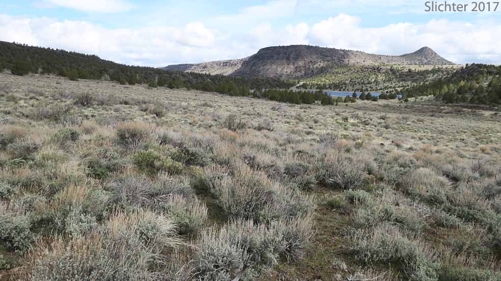
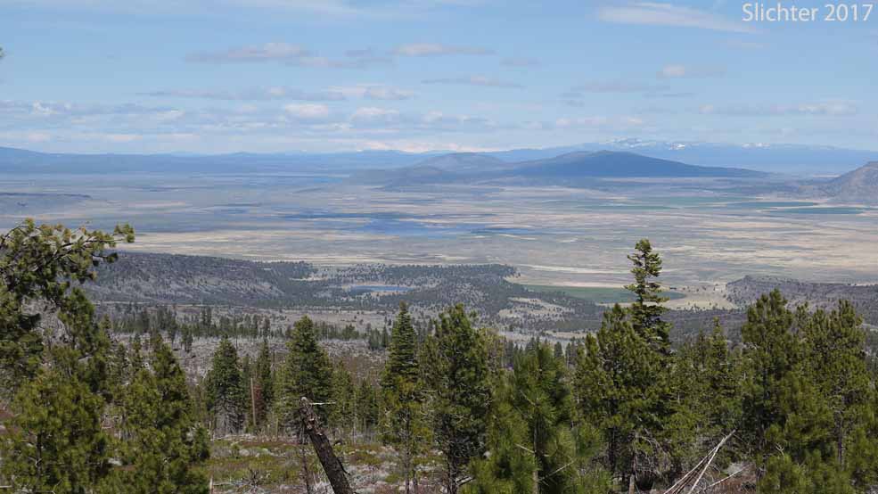
The photo at upper left shows a view northwest towards Squaw Butte and Picture Rock Pass from FS Road 2901, Fremont-Winema National Forest......April 30, 2017. I often will park about 50-100 meters south of OR Highway 31 and wander along Rd 2901 to see what I can find. The photo at upper right looks north from FS Road 2901 across Paulina Marsh at center with Fort Rock at upper left and Newberry Crater on the horizon at upper right. The town of Silver Lake, OR is off the photo to the left..Photo from April 30, 2018 from along FS Rd 2901 several miles north of Grizzly Peak which is at the north end of Winter Rim.
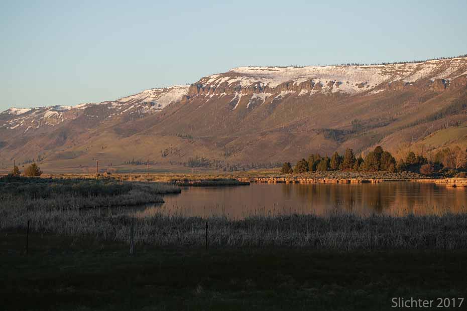
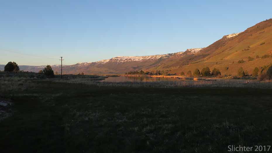
The photo at lower left shows a view southeast across the northern face of Winter Rim looking down to the Ana Reservoir at left and the alkali flats and shallow waters of Summer Lake at center and upper right. They are hard to see but Abert Rim and the North Warner Mountains can be seen on clear days on the horizon at right. Photo taken April 30, 2016 from FS Rd 2901 a mile or so north of Grizzly Peak at the north end of Winter Rim. The photo at lower right shows a view looking southwest at the still snow-covered east-facing rim of Winter Rim from alkali pools at the northwestern corner of Summer Lake, Summer Lake State Wildlife Area......April 29, 2016.