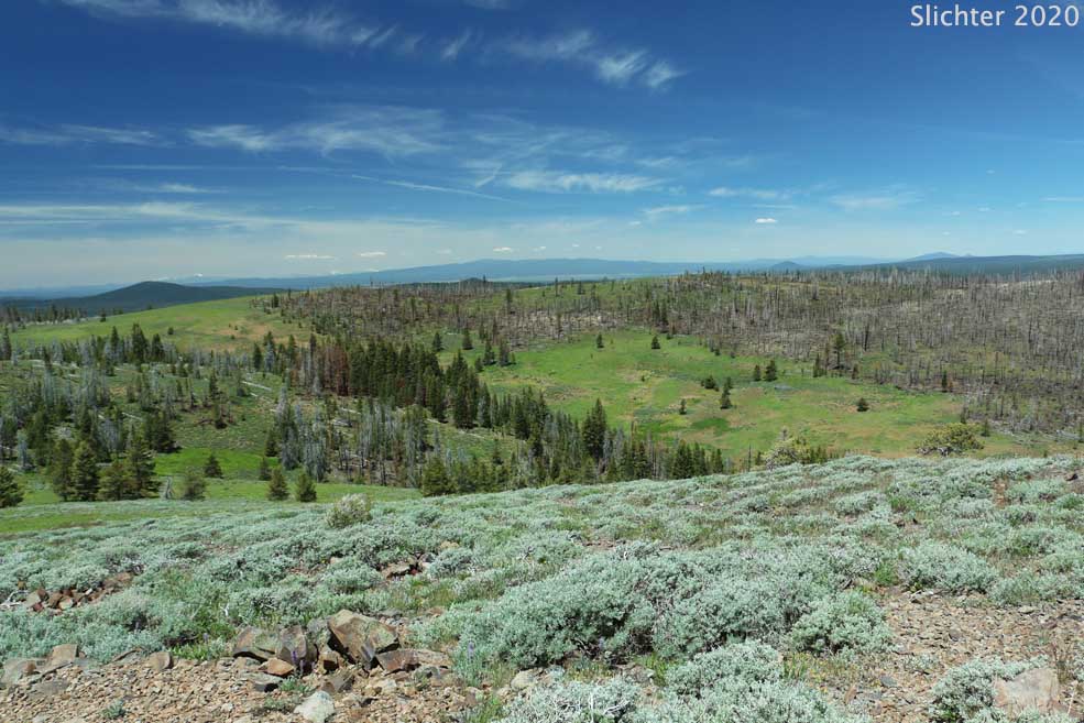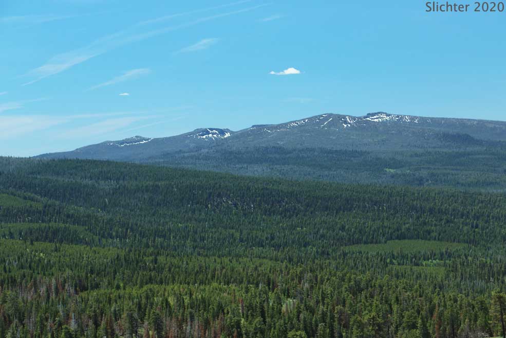
Bald Butte is a peak situated to the north side of FS Road 3411. At 7536', the non-forested summit affords 360 degree views of the surrounding countryside, ranging from the Gearhar Mountain Wilderness and Dead Horse Rim to the south, Mt. Shasta to the southwest, Winter Rim to the northeast and the high ridges on the east side of the Chewaucan River to the east.
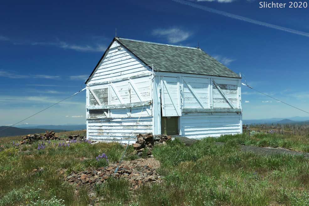
A small 14' x 14' lookout is situated at the summit. It can be rented during the summer (not open 2020 due to COVID19) and it sleeps 2. Amenities include a propane stove and heater, refrigerator, sink, lights, and a few dishes. A fire ring and picnic table are adjacent to the lookout and a vault toilet is located a short walk east. Photos of the lookout and surrounding countryside are available at the USFS link below.
Access: Note, Google Maps gives the general directions but the Forest Service road numbers may be incorrect!
From Paisley, OR: From the Paisley Ranger District USFS office, proceed west on Oregon Highway 31. In central Paisley, the highway will turn north and immediately look for Mill Street on the right and Lake County Road 2-08 on the left. Turn left onto County Road 2-08 and drive west through the outskirts of Paisley. After crossing the Chewaucan River proceed several hundred yards and turn right uphill onto FS Rd 3315. At the forest boundary and junction with FS Rd 3360, stay left on Rd 3315. Continue on Rd3315 for about 12 miles and turn left onto paved FS Rd 28. Follow Rd 28 for about half a mile through the wildflower meadows along the tributaries of Elder Creek and then turn right onto gravel FS Rd 3411. After 1.5 miles you will reach a junction with FS service road 450. If you have time, park here and either walk Road 450 1.5 miles to the summit or hike uphill through the meadows just west of the road for a wildflower treat. Note: FS Rd 450 is a primitive two-track road that is rough with several bumps that make low slung vehicles difficult to drive. An AWD or 4WD vehicle is best to drive this road. There are several sections of this road where it would be difficult to move to one side if a vehicle approaches from the opposite direction! Google Maps says this access route is 24.7 miles from Paisley with an hour of driving. I'd probably err and add twenty to thirty minutes to that drive time, and more if you stop to view or photograph roadside flowers and scenery!
From Silver Lake, OR: Although one can drive south from Silver Lake on paved FS Road 28 (signed for East Bay Campground on Thompson Reservoir, this road has long sections that are heavily pot-holed with makes for slow going. Instead, drive east on Oregon Highway 31 for 39.4 miles. Towards the south end of Summer Lake, look for FS Road 29 (signed for Government Harvey Pass) and turn right uphill onto this gravel road. At 2.8 miles, stay right on FS Rd 29 at a junction with FS Rd3360. Continue winding up FS Rd 29, cross Government Harvey Pass, staying left on Rd 29 at a junction with Rd 2901. After 2 additional miles downhill on Rd 29, turn left onto paved FS Rd 28. Continue south on Rd 28, crossing the Sycan River and wind uphill, crossing a divide and then wind down, passing a junction with FS Rd 3315 on the left. About half a mile further, turn right onto FS Rd 3411. After 1.5 miles you will reach a junction with FS service road 450. If you have time, park here and either walk Road 450 1.5 miles to the summit or hike uphill through the meadows just west of the road for a wildflower treat. Note: FS Rd 450 is a primitive two-track road that is rough with several bumps that make low slung vehicles difficult to drive. An AWD or 4WD vehicle is best to drive this road. There are several sections of this road where it would be difficult to move to one side if a vehicle approaches from the opposite direction! Google Maps says this access route is 23.4 miles from Silver Lake with an hour and one-half of driving. I'd probably err and add twenty to thirty minutes to that drive time, and more if you stop to view or photograph roadside flowers and scenery!
Plant Lists:
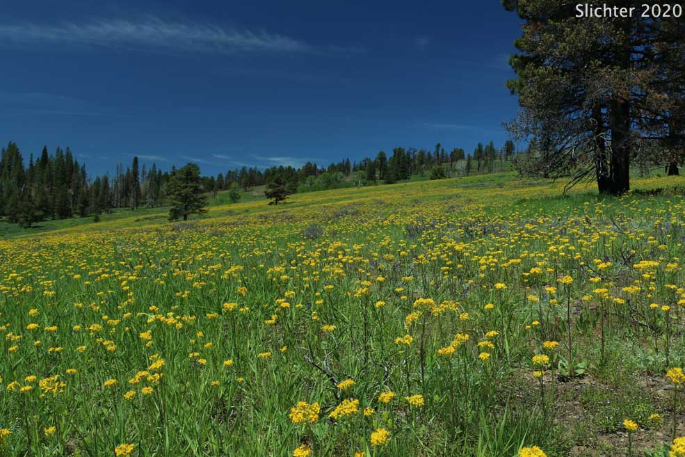
In mid-June, if you decide to hike up the valley from FS Rd 3411 between Rd 450 and the small creek, expect to eventually find entire slopes ablaze with western groundsel (Senecio integerrimus var. exaltaus). You'll also find yarrow-leaved Oregon sunshine (Eriophyllum lanatum var. achilleoides), Eaton's fleabane (Erigeron eatonii, possibly var. plantagineus ?), northwest balsamroot (Balsamorhiza deltoidea), wavyleaf paintbrush (Castilleja applegatei var. pinetorum), leafy bluebells (Mertensia foliosa, aka. M. oblongifolia) , ballhead waterleaf (Hydrophyllum capitatum var. alpinum), scarlet gilia (Ipomopsis aggregata ssp. aggregata), Rydberg's geranium (Geranium viscosissimum var. incisum), upland larkspur (Delphinium nuttallianum), american bistort (Bistorta bistortoides), Mission bells (Fritillaria atropurpurea) and sagebrush mariposa (Calochortus macrocarpus).
At and near the summit of Bald Mt., expect to find daggerpods (Phoenicaulis cheiranthoides), Nevada desert parsley (Lomatium nevadense), balloon milkvetch (Astragalus whitneyi var. confusus), silky phacelia (Phacelia sericea var. ciliosa) and others, espeically on the steep north-facing slope adjacent to the lookout where snow lies late into the season. There is quite a bit of the invasive hornseed buttercup (Ceratocephala testiculata) around the lookout, so keep that in mind if you kneel or sit down as their seed heads are quite sharp!
June 19, 2020: Bald Butte (Paisley Ranger District, Fremont-Winema National Forest)
Resources:
Bald Butte Lookout Recreation Rental (USFS)
 -
-