This is primarily a drive tour along Forest Road 3915 that allows one to see the wildflowers, birds and scenery of the high desert of extreme souther Lake County, OR. There are no developed hiking trails in the area, though one can several hike spur roads for a mile or so off of Forest Road 3915. Note that the spur roads may be grown over with sagebrush and rabbitbrush and thus difficult to walk very far. If that's what you want to do, then you'll need to drive this route and determine whether the spur road you'd like to investigate is hikable or not.
Drive north from Lakeview on US Highway 395. Turn Right (east) onto Oregon Highway 140 and drive over the Warner Summit. About 3 miles or so east of Warner Summit you will turn right (south) onto paved Forest Road 3915. It will be the first paved road on that side of the highway. After about one-half mile, turn right at a junction and stay on FS Rd 3915 which parallels the north side of Camas Creek. There usually is good birding here in the mornings or evenings. After about a mile and one-half, turn left staying on pavement and head south via a bridge across Camas Creek. After several miles, FS Rd 3915 winds up into the forest and becomes alternating sections of gravel and broken pavement. It crests the ridge near the Rogger Meadows Trailhead which can be used to access the Crane Mountain National Recreation Trail #161. Continue driving on the good gravel FS Road 3915 south as it winds along the eastern base of the North Warner Mountains, passing forests, meadows and balds, often filled with flowers from late May through July.
Continue driving south on FS Rd 3915 for about 17 miles (from OR 140) and turn right onto FS Rd 4011, signed for Deep Creek Campground. Drive about 0.7 miles along Rd 4011 to the entrance to the campground on the right. To my recollection, the route is well signed and shouldn't provide any problems getting there. Deep Creek Campground provides a good, shaded rest stop before continuing on with this drive. The campground has no drinking water but water can be filtered from Deep Creek. There is a vault toilet and several primitive campsites, so this could be suitable place to use as a base camp.
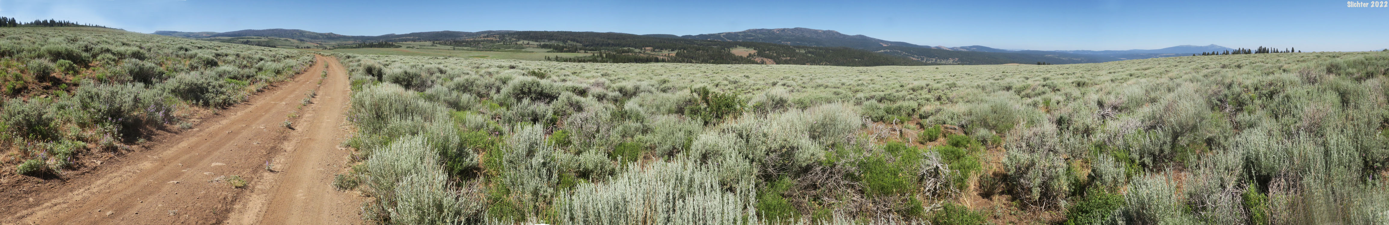
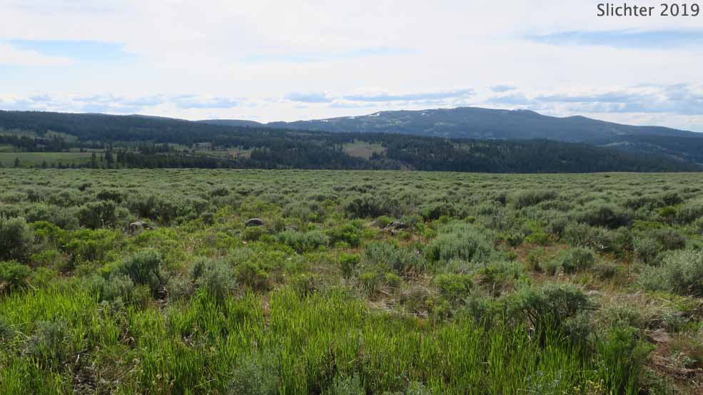
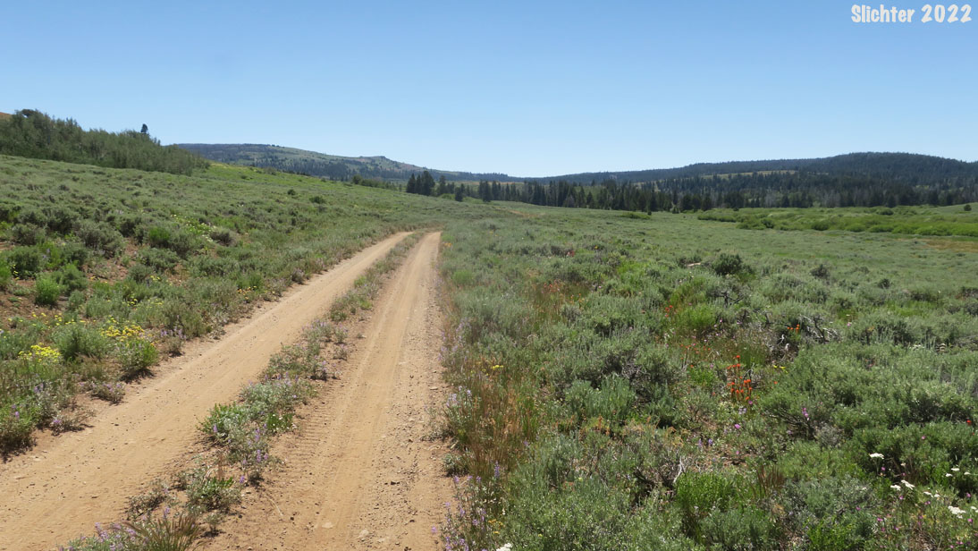
From Deep Creek Campground, retrace your route back to FS Rd 3915. Turn right and drive east on Rd 3915. After a mile or so, the road begins climbing up and winding through forest. After several more miles the road levels off and breaks out into more open terrain. A jeep road curves uphill to the right at an unsigned junction. Turn right at this junction. Unfortunately, the junction could be missed as the road that continues (marked spur road 019 on the map) is in much better shape as it allows local ranchers access to the sagebrush lands further east. The first several miles of Rd3915 are bumpy but in good shape. The road winds up through open balds filled with yampah, conifer forest and groups of mountain mahogany.
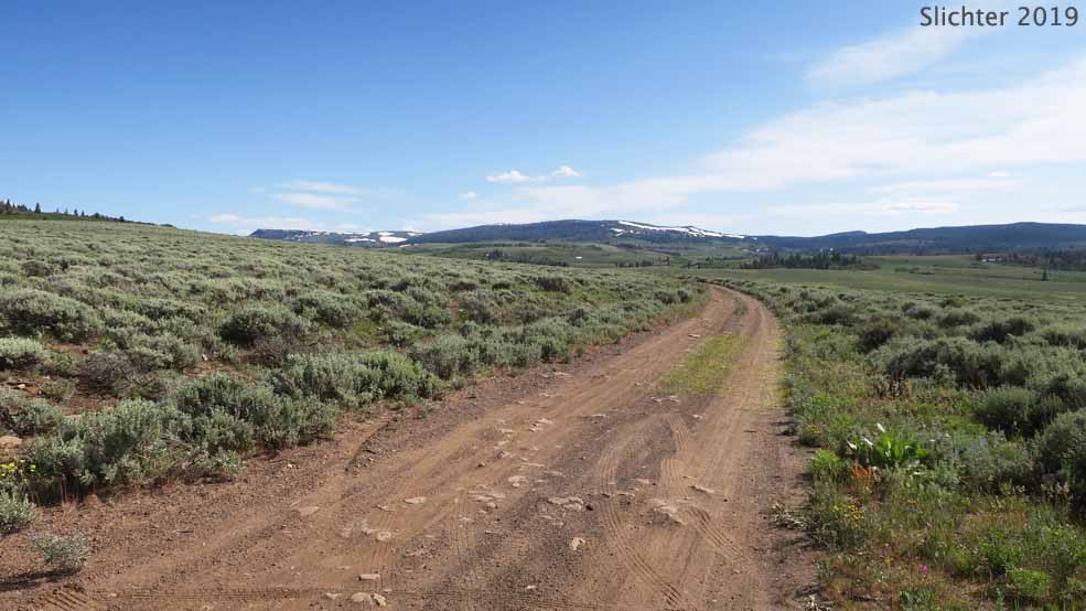
After a mile and one-half or so, the road crests the Bald Hills and the terrain becomes more open, allowing views north towards Drake and Light Peaks, northwest to Crane Mountain, and south to Mount Bidwell (in California). You'll soon pass a vernal stream with nice June and early July flowers along it. The road becomes more two track with vegetation in the middle, so low-slung vehicles may have difficulty continuing on south past the Bald Hills. In addition, sagebrush, wild roses, rabbitbrush and other low shrubs line the road so it is difficult to pull off the road (if the rare vehicle approaches or to turn around). Generally, the road surface is good in dry weather, but as one approaches the California state line, there are stretches which could be quite muddy for a few days after rain events or in late spring.
There are numerous places one can make stops (on the road) to view wildflowers up close, and of note are several open balds and swales the last mile north of the California border.
At the California/Oregon border, pass through the fence and one can continue on, or find a wide spot to turn around. Continuing south, now on FS Road 48N21 (Modoc NF), the road occasionally gets pretty bad (crossing Dismal Creek). It passes Dismal Swamp which is a research natural area, but during our visit there, it was over run with cattle. Past Dismal Swamp, the road gets better as it climbs uphill, passing several mining claims before reaching gravel FS Rd 48N20. Turn right to visit Cave and Lily Lakes, or return to US Highway 395. Turn left (east) to descend through scenic high country before eventually reaching Fort Bidwell where you can turn left and head through the high desert back to OR 140 at Adel, OR.
More Comprehensive Plant List for the Mount Bidwell Recreation Area
July 18, 2022: FS Road 3915 from the Bald Hills to the California State Line (Lakeview Ranger District, Fremont-Winema National Forest)
July 31, 2020: FS Road 3915 from the Bald Hills to Dismal Swamp (Lakeview Ranger District, Fremont-Winema National Forest and Modoc National Forest)
This is definitely an out of the way location, so there are very few online or book resources that cover the area.
Modoc Back Country Discovery Trail: Forest Service Info regarding scenic road travel on the California side of this drive, especially from the California border south to Fort Bidwell.
 -
-  -
- 
Left: A floriferous creek along FS Road 3915 at the summit of the Bald Hills, Mount Bidwell Recreation Area, Fremont-Winema National Forest....June 30, 2019. Center: A view south along FS Road 3915 towards Mount Bidwell (left skyline to left of center), Mount Bidwell Recreation Area, Fremont-Winema National Forest....June 30, 2019. Right: A view northwest towards the Dismal Creek drainage (across the center) and Crane Mountain (background) from the Bald Hills, Mount Bidwell Recreation Area, Fremont-Winema National Forest....June 30, 2019.
 -
- 
 -
- 
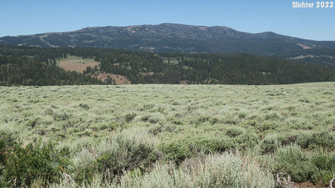
Upper left: View northwest from FS Rd 3915 in the Bald Hills towards Crane Mountain. Mount Bidwell Recreation Area, Fremont-Winema National Forest....July 18, 2022. Upper right: View north towards Light Peak (left) and Drake Peak (right) from the Bald Hills, Mount Bidwell Recreation Area, Fremont-Winema National Forest....July 18, 2022
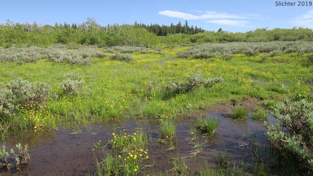
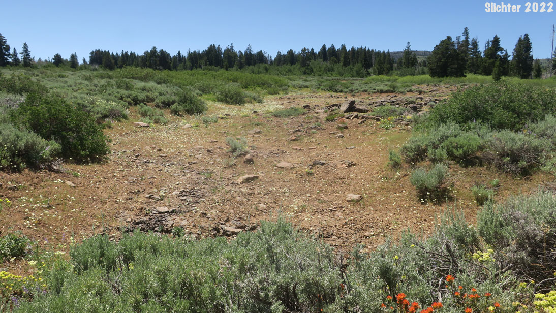
.Center: A vernally moist swale filled with yampah (Periderida sp.) along FS Rd 3915 near the California/Oregon state line, Mount Bidwell Recreation Area, Fremont-Winema National Forest....July 18, 2022
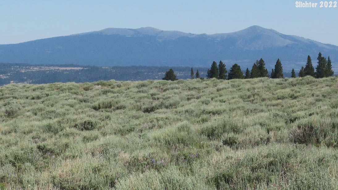
.Lower left: View north into the Mount Bidwell Recreation Area from the California/Oregon state line, Fremont-Winema National Forest....July 18, 2022. Lower Right: View south along FS Road 3915 towards Mount Bidwell, left of center. Mount Bidwell Recreation Area, Fremont-Winema National Forest....July 18, 2022.