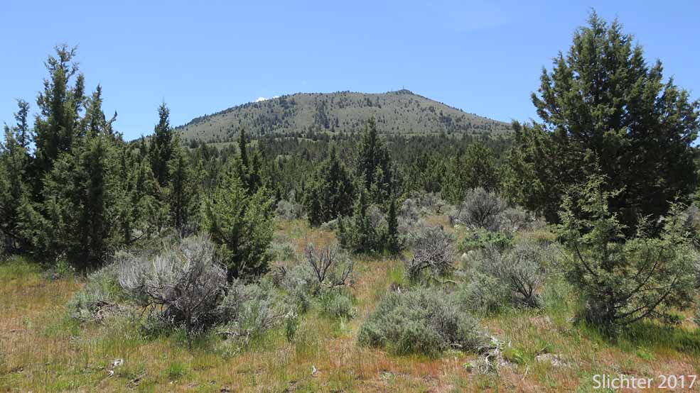
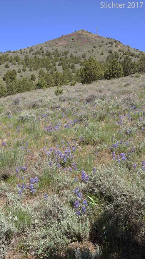
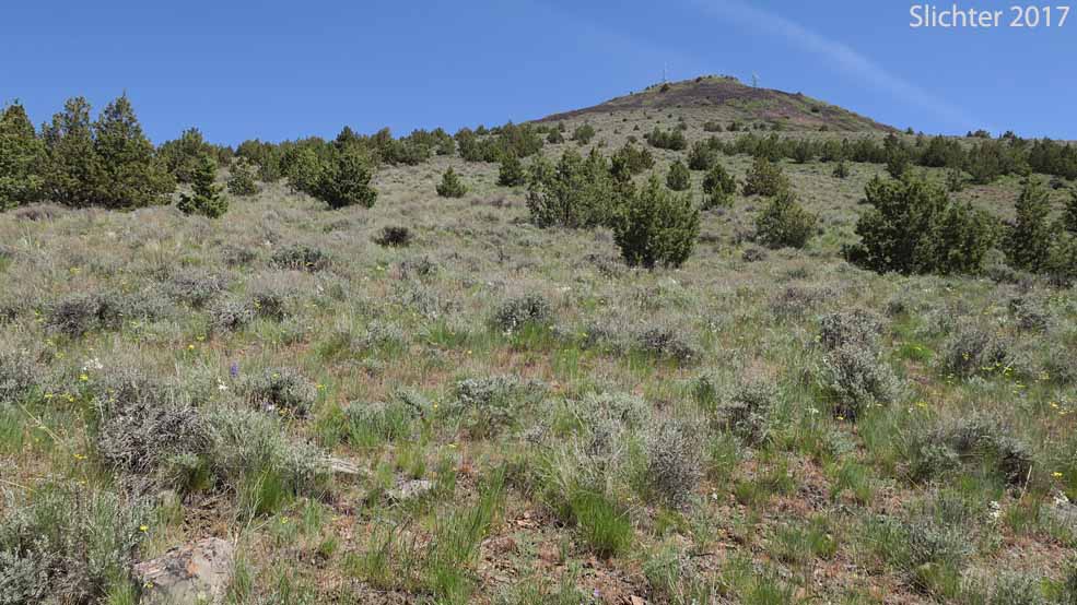
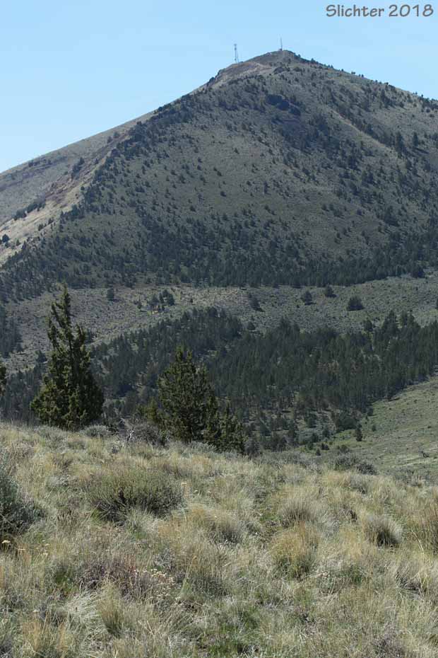
 Gray Butte rises from the relatively flat high desert to form a broad, conical peak which is visible from much of central Oregon (we can see it easily when hiking far away Lookout Mountain or Mount Hood, both in the Mt. Hood National Forest). Early to late spring wildflowers can be quite scenic here, and shrub/scrub, scabland and grassland habitats are all evident along the trails. Sadly, by mid-June the area around the north trailhead sees some cattle grazing but it is evidently light enough that the flower display is good before that. And fortunately, most of the trail along the west side is spared this grazing. Another draw of this hike is the fine views west across the high desert, and the deep canyons of both the Crooked and Deschutes Rivers to the snow-capped high Cascades.
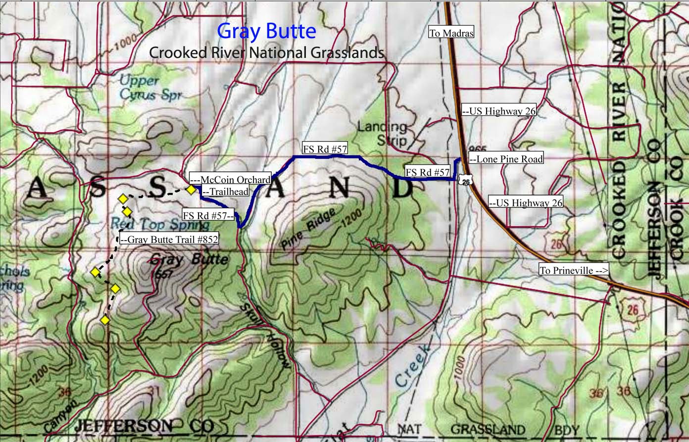
A number of hiking, biking and equestrian trails circumnavigate Gray Butte and its lower neighbor to the east, Pine Ridge. Here, we'll describe the Gray Butte Trail #852 as hiked from the McCoin Orchard Trailhead (north). There's also trail access from the south at Smith Rocks (a long trail with lots of elevation gain) and a shorter access from the south from Gray Butte Saddle (See descriptions in William Sullivan's "100 Hikes/Travel Guide: Eastern Oregon").
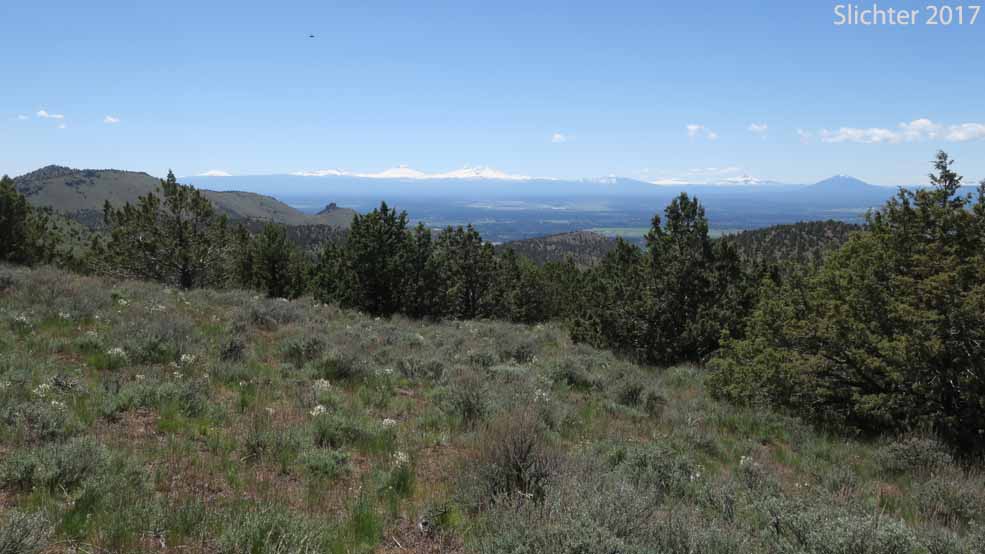
From the McCoin Orchard Trailhead, Trail #852 climbs gently but steadily to the southwest, passing slopes with a mix of large western junipers, antelope bitterbrush, both low and big sagebrush and a nice mix of native bunchgrasses and high desert forbs like several desert parsleys, Idaho milkvetch and silvery lupine. Within several hundred meters the narrow trail crosses a primitive road which heads uphill towards the summit (See description of that route below). Continue southwest on the trail continuing to climb gradually passing some vernally moist swales with different flora. As the trail climbs more steeply you enter an area of shallower soils and different flora and at 0.9 miles, pass through a gate. If the gate was open, leave it open, but if it was closed, be sure to close it. If cattle are about, close the gate behind you! The trail keeps climbing through mostly open slopes with Gairdner's penstemon, lowly penstemon, Peck's paintbrush, bighead clover, Cusick's elkweed and other low ground plants eventually reaching a high point on the west slope. The trail then descends gradually to a rock outcrop just west of the trail at about 1.9 miles. This is Creson Viewpoint, a good turn around spot. Besides the great view west, carefully look on the rocks for rock spiraea, King's sandwort, John Day cinquefoil, mountain mahogany and others. Stonyground lupine blooms along the trail there in mid-late May. Return as you came or continue downhill to the south about another 2 miles to the other trailhead at Gray Butte Saddle for a longer hike.
Hike Option: Hikers can follow the primitive road noted above which leads uphill near the trailhead towards the summit. It eventually curves east so at that point, hikers can then head steeply cross country uphill for about 1.5 miles and 1350' elevation gain to view the different flora there. Obviously, this is not an easy route due to the steepness and rough terrain!
Trailhead Description from the Crooked River National Grasslands
Map of the trails near Gray Butte (equestrian, bike and hiker)
Trailhead Amenities: There are no trailhead amenities at this trailhead.
Access:
From Madras: Drive southeast on US Highway 26 for about 15 miles. Turn right (south) onto signed Lone Pine Road (paved). After about 0.25 miles, turn right (west) onto FS Road #57 (unimproved soil). This road should be avoided early in season or for several days after substantial rainfall (there's a couple deep puddles to drive through, plus the roadbed turns to goop).
Follow FS Road #57 for 3.3 miles, avoiding small spur roads. The trailhead is on the left (south) side of the road opposite of the old apple orchard surrounded by high poplars. To help stay on FS Road #57, spot conical Gray Butte and keep in mind that the trailhead is on its north side.
Note: About 2 miles south of the Rimrock Springs Trailhead on US 26 you will spot a brown road sign with an arrow pointing right (west) with Gray Butte on it. This dirt road leads to the trailhead access from the Smith Butte SP area, so don't take that route. If conditions are wet, we will provide alternative directions to the Gray Butte Trailhead.
From Prineville: Drive northwest on US Highway 26 for about 12 miles. Turn left (south) onto signed Lone Pine Road (paved). After about 0.25 miles, turn right (west) onto FS Road #57 (unimproved soil).
Follow FS Road #57 for 3.3 miles, avoiding small spur roads. The trailhead is on the left (south) side of the road opposite of the old apple orchard surrounded by high poplars. To help stay on FS Road #57, spot conical Gray Butte and keep in mind that the trailhead is on its north side.
Do not leave valuables in the car, although this trailhead may be safer due to the distance from any towns or cities. The area should see a lot of weekend traffic, so it is best to be safe! Besides hikers, this trail sees quite a bit of equestrian and mountain bike use, so keep an eye (and ear) on the trail both in front and behind you. Keep dogs safe and near you to prevent collisions with bikes and keep dog/horse interactions safe!
Plant Lists for the Rimrock Springs Trail #850:
Comprehensive Plant List for Pine Ridge and Gray Butte
June 24, 2017: Gray Butte Trail #852, from the old McCoin homestead trailhead (Crooked River National Grasslands)
May 20, 2017: Gray Butte Trail #852, from the old McCoin homestead trailhead (Crooked River National Grasslands)
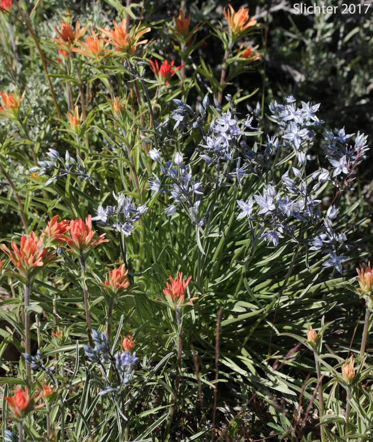
Peck's paintbrush (Castilleja peckiana) and Cusick's elkweed (Frasera albicaulis var. cusickii) along the Gray Butte Trail #852, Crooked River National Grasslands.......May 20, 2017.
 -
-  -
- 
 -
- 