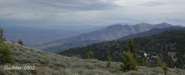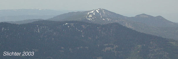
Aldrich Mt. (6991') is found at the west end of the Aldrich Mts in central Oregon. Views from the manned lookout (during fire season) include the Greenhorn Mts to the northeast, Fields Peak several miles to the east, the Steens Mt far off on the horizon to the south, Snow Mt with its prominent snow patch to the south (at the head of the South Fork John Day River), the Ochoco Mts several miles to the west with an occasional view of the highest Cascade peaks. The upper John Day valley from the Picture Gorge east to near Mount Vernon can be seen along with the deep chasm of the South Fork John Day River about three miles to the west.
The summit of Aldrich Mt. is a rocky outcrop with some open meadows, flower filled outcrops and a fair amount of deciduous shrub slopes and conifer forest, especially on the north.
Bighorn sheep can occasionally be observed on the steep slopes around the mountain. Elk and mule deer are more common. Expect blue grouse and the occasional spruce grouse. A diversity of forest birds should be expected.
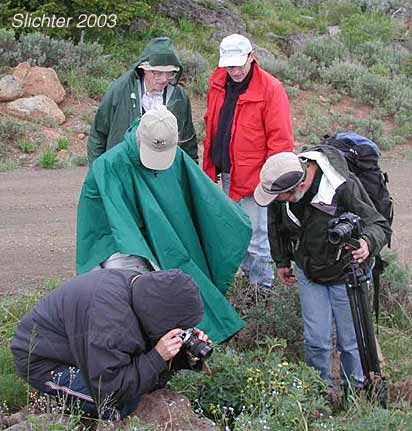
At the Cabbage Patch see Phacelia minutissima (sensitive status) with a short 1 mile but steep hike downhill and thus uphill exit. Nice, if short hike!
At Aldrich Mt., expect to see Brown's peony (Paeonia brownii), long-flowered bluebells (Mertensia longiflora), nettle-leaved horsemint (Agastache urticifolia), Rocky Mt. Sunflower (Helianthella uniflora), round-leaf alumroot (Heuchera cylindrica v. alpina) and many other wildflowers.
From John Day, OR, drive west on US Highway 26 for about 18 miles, passing through Mt. Vernon, OR and continuing west. Turn south on paved Forest Service Road 21 (signed for Murderers Creek). Buck Cabin Campground provides a convenient spot for a bathroom break. Continue uphill until reaching the pass in the Alrich Range about 9 miles south of US 26. At the pass, turn right (west) onto gravelled (but good quality) Forest Service Road 2150. Numerous wildflowers dot the roadside and banks above the road in June and early July (although there is one section of signed, private land to stay out of enroute). After passing FS Rd 070 which joins FS Rd 2150 from the left (south), continue driving about another mile before coming to the signed Cedar Grove Trailhead on the right. Continue on westward on FS Rd 2150 for an additional 9 miles to reach the parking area for the Aldrich Mt. lookout (about 40 miles distant from John Day). All the main gravel roads that access this area should be in good shape but some of the side roads may not be as good (I once passed a pickup at the Cabbage Patch that had been abandoned due to 3 flats!).
This trip can be combined with a visit to the Cedar Grove (reached as listed above). One can also return to John Day by visiting Murderers Creek via FS Rd 070 and FS Rd 2170. There is an abundance of wildflowers along Murderers Creek near the Oregon Mine Campground. Continue your return to John Day by turning left (north) and driving uphill on FS Rd 21, or continue east on FS Rd 21, eventually arriving at Grant County Road 63. Follow Road 63 east to US Highway 395, then follow it north to John Day.
At the Cabbage Patch see Phacelia minutissima (sensitive status) with a short 1 mile but steep hike downhill and thus uphill exit. Nice, if short hike!
July 15, 2003: Aldrich Mt., Malheur N.F.
June 19, 20 & 21, 2003: Aldrich Mt., Malheur N.F.
May 24, 2003 The Cedar Grove Trail
May 26, 2002 Aldrich Mt.
May 26, 2002 FS Rd # 2150 between FS Rd #21 & Aldrich Mt.