
 -
- 
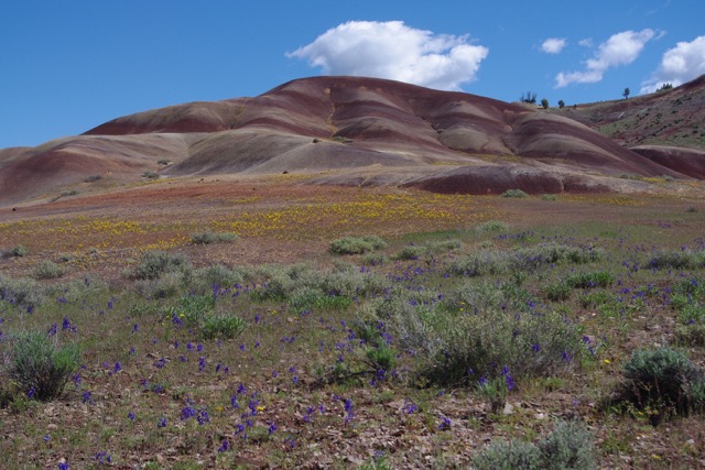
The Juniper Hills Preserve is one of those special places that nature lovers should have on their bucket list. At 13, 920 acres, the preserve (formerly the Alaska Pacific Ranch) is situated between the Ochoco Mountains to the north and the Maury Mountains to the south. The preserve serves as a vital migratory corridor for elk, antelope and other wildlife. The area supports about 70 bird species and provides critical habitat for the endangered redband trout. Numerous native grasses and wildflowers are found in the 65 distinct plant communities found within the preserve. The preserve also features a scenic and colorful landscape due to the prescence of the John Day and Clarno "painted hill" formations.
Note: The Juniper Hills Preserve is closed to public access throughout the fall and winter. Please email or call the Nature Conservancy of Oregon before visiting the Juniper Hills Preserve. Current contact information regulations and and other information regarding the Juniper Hills can be found at the following link: Juniper Hills Preserve - Nature Conservancy of Oregon. The Nature Conservancy offers spring time hikes on the preserve and there are opportunities to attend volunteer work parties there. Contact the Nature Conservancy of Oregon for more information.
From US Highway 26 in Prineville, Oregon, turn south onto the Paulina Highway/SR380. Zero your odometer or pay attention to the mile markers. At 1.2 miles, stay left. Do not take the right fork which heads to the Prineville Reservoir. At 29.3 miles, sections of the preserve will begin to appear on your left. There are two designated public access points to the preserve. Access point #1 is on your left at 34.6 miles. This gravel road leads up to the barn and the Lost Creek reservoir, the most common rendevous points on the preserve. Access point #2 is on your left at milepost 36. This area contains excellent examples of the "painted hills" formations.
Comprehensive Plant List for the Juniper Hills Preserve
Trip List provided by Stu Garrett