Wildflower Hikes at the Mouth of the Deschutes River: East Bank
 -
- 
-
Note: Several wildfires swept through the area over the past dozen or so years, destroying much of the native rabbitbrush and big sagebrush community. Watch along the trails for new growth of both species. Unfortunately, the wildfires have also allowed the rampant spread of non-native grasses which will fuel wildfires in the future. A wildfire that burned the east bank from just south of Rattlesnake Rapids downstream to the state park campground and up to the canyon rim burned a number of the historic almond trees. Spring 2024 will be a time to assess how many of these beautiful spring-blooming trees survived!
The trails here can be hikeable all months of the year, although side trails from the river up to the old railbed as well as the loop up to Ferry Springs and return can be hazardous if there is any ice and snow on the ground.
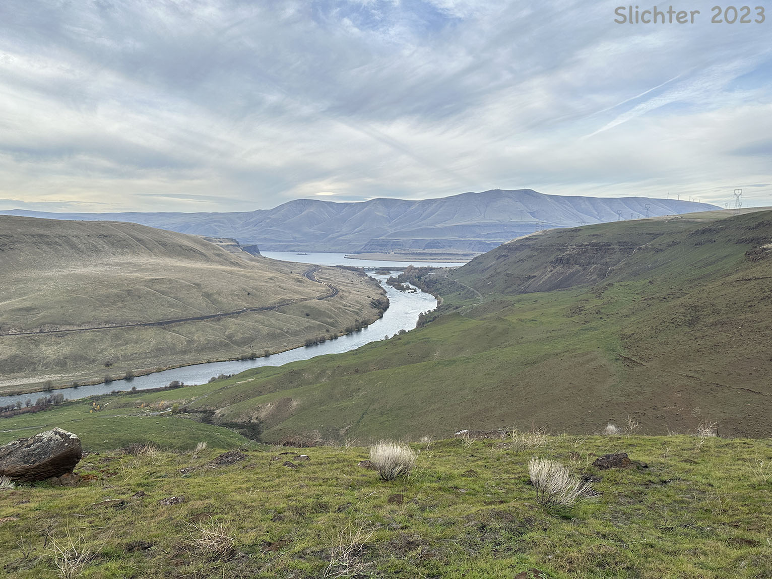
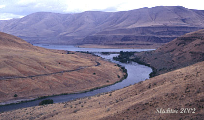
The mouth of the Deschutes River is a popular place for fishermen, both those in drift boats or those who stalk the shores, and it is the hauling out point for the many rafters who float the Deschutes during warmer weather. For those who like plants, it provides about nine months of botanizing during most years (especially the wetter ones) with early bloom starting in late February with grass widows and salt and pepper and continuing until late october as the sagebrush and rabbitbrush commence their show. I've seen as many as 30-40 species in bloom in mid to late October in the vicinity, and interestingly enough, some of them are plants that bloomed earlier in the spring. Occasionally during mild early winters, a few snow buckwheats, gray rabbitbrush and hairy goldenasters may still be found in bloom into early January.
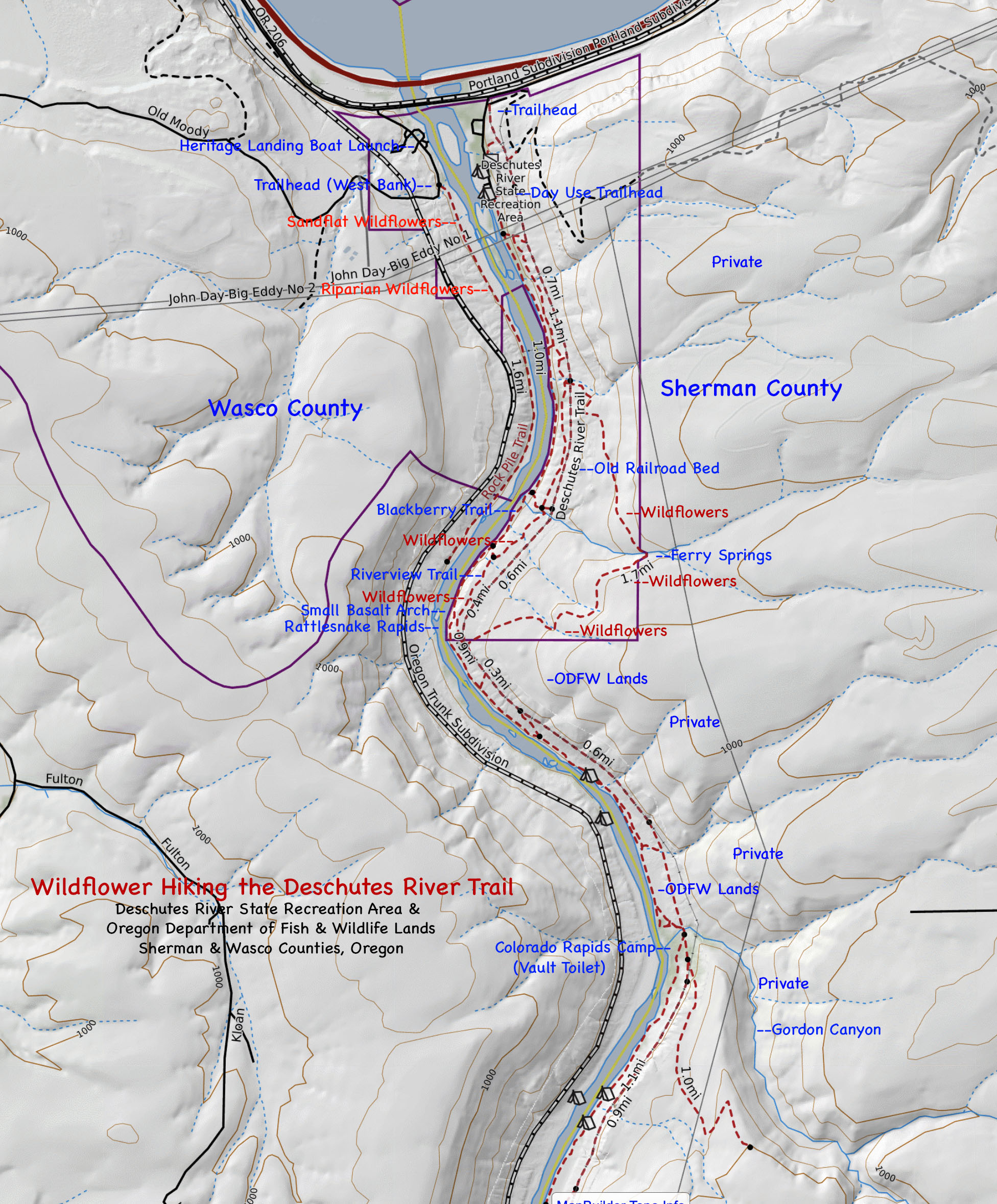
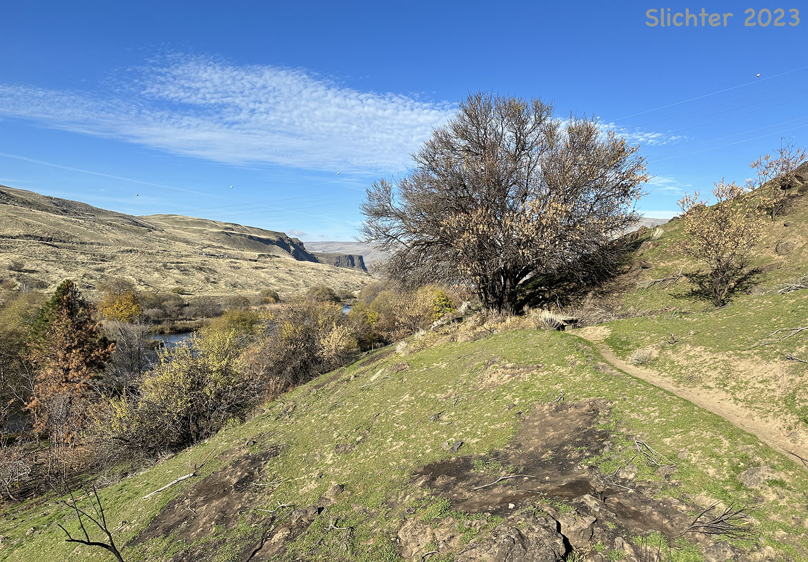
You can either proceed into Deschutes State Park following the paved road straight past the camping area to several large day use parking areas from which you can either hike the trail along the river (Blackberry Trail) for several miles before looping up to the old railroad bed, or you can take several paths that immediately ascend the slope to the east to the railroad bed. About 50 meters upslope above the Blackberry Trail find the Riverview Trail which begins in a pioneer almond grove and proceeds south at mid-slope. As its name implies, it gives a good view of the Deschutes River. There are occasional spots with wildflowers along the trail. One can also climb up to the old rail bed and hike along it upstream. Conversely as you turn into the State Park from OR 206, take the gravel fork to the left and park. The gated trailhead is at the southwest corner of the parking lot. Make sure not to park in the slots assigned as horse trailer only!
The railroad bed is fairly flat and smooth and proceeds south for about 11.3 miles. I've hiked it out to about the 7 mile point. The farther south you get (especially after about 3 miles, the more natural the vegetation. Near the 1 milepost, a gated trail leads uphill another mile to the east to Ferry Springs. There's some good natural vegetation (desert parsleys, shooting stars, milkvetch and yellow bells) along the upper portion of the loop which crosses a shallow, slippery rock stream before descending back to the main railroad bed just south of the 3 mile post. Be aware that mountain bikers have discovered this loop and may try to scream past you on their downward trek. The songs of rock wrens can constantly be heard on talus slopes and atop cliffs throughout the area. Nice hanging gardens abound on cliffs that are intermittently encountered south of the 4 mile post. Outhouses can be seen downslope towards the Deschutes River every couple of miles at areas which would provide good picnic spots. There are a number of rocky shored rapids along the river with sandy areas nearby. These should be searched for native blooms from June through early September.
I should point out that the railroad bed is appropriate for nature watching via mountain bike. The bed is sandy with some gravel in sections and the occasional larger rock that should be watched for. Probably the biggest concern for bicyclists is the thorny puncturevine seeds which can deflate one's tires. It might be recommended to have flat-resistant inserts placed between the tire and tube for any of the bike routes in the east Gorge and Klickitat drainage.
 Directions:
Eastbound: Take Interstate 84 east of The Dalles and take the Celilo Exit (Exit #97). Turn right and immediately left onto Highway 206. There are several places along this stretch of highway to view wildflowers. Have a passenger watch the slopes to the south of the roadway for bloom, stopping safely as needed. Examples of wildflowers to see along this stretch include white sand-verbena (Abronia mellifera), veiny dock (Rumex venosus), hoary aster (Machaeranthera canescens), and rigid sagebrush (Artemisia rigida). Continue along Highway 206 until reaching the mouth of the Deschutes River. Cross the river and turn right into the State Park.
Westbound: Drive west on I-84 from Arlington, OR and points east, exiting at Biggs Junction (Exit 104). US Highway 97 crosses the Columbia River at this point, so those coming from the north or south may approach Biggs Junction via those highways. Turn west onto the old highway and proceed west, past the junction of Highway 206 (which can lead to another interesting as well as scenic gorge vista at Gordon Ridge). The mouth of the Deschutes River is several miles west of this juntion. Before crossing the river turn left towards the grassy and shaded area of the State Park. One can either stop at the small parking area on the left of the entrance which gives access to the old railroad grade (now a trail- suitable for mountain bikes) or proceed into the park proper where there is water and rest rooms.
Note: A few salt and peppers (Lomatium gormanii) and white alders (Alnus incana) can be spotted in bloom here by late January, most years (earlier if the winter is warmer than average).
A fairly comprehensive Plant List for the East Bank of the Deschutes River.
March 31, 2017: Trails Along the East Bank of the Deschutes River, Including Ferry Springs, Deschutes River State Recreation Area.
February 20, 2016: East Bank of the John Day River at Cottonwood Canyon State Park
September 15, 2001: Reports for the west bank, but vegetation will be similar on the east bank.
August 26, 2001: Reports for the west bank, but vegetation will be similar on the east bank.
July 27, 2001: Reports for the west bank, but vegetation will be similar on the east bank.
April 2, 2000 North-facing slopes about 1/2-3/4 miles east of the east bank of the Deschutes River.
September 14, 1997 Old railroad grade along the east side of the river.
Lower Deschutes River: Northwest Wildflowers
Lower Deschutes Trailhead: OregonHikers.org
Deschutes River Hike: OregonHikers.org
Deschutes River State Park - Ferry Springs Loop: Friends of the Columbia Gorge
Deschutes River State Park - River Trail: Friends of the Columbia Gorge
Deschutes River: Washington Trails Association
 -
-