Hiking to Monte Carlo was one of my July 4 destinations for a number of years in the early 1990s. Back then, I started at the Buck Creek #2 Trailhead near the end of Road B1800 and then spent an hour or so slowly hiking upwards through a beautiful mature coniferous forest with numerous singing swainson's thrushes singing in the trees before making the switchback climb up the south face of Monte Carlo. That route is still hikeable, but that trail now winds through a recent clear cut.
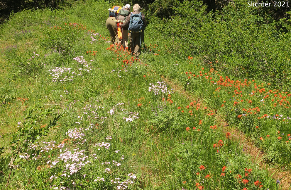
Being focused on hiking slow and enjoying the wildflowers, we now park on Penny Ridge at the end of Spur Road B10 (needs high clearance vehicle to access) and hike the fire road northwest up the ridge to gain access to Monte Carlo. Along that route, there are several opportunities to access views down the south-facing slopes of Penny Ridge towards upper Buck Creek Meadows. In May, those open slopes sport many pretty wildflowers. The fire road that the Buck Creek Trail follows however contains a mix of sunny slope flowers and forest flowers (See plant list below for the Penny Ridge hike.). After a mile and one-half or so, the trail climbs more steeply through darker forest before coming out to a mix of open forest and meadows just past the DNR/USFS boundary where the Buck Creek Trail also climbs up from the Buck Creek #2 Trailhead at left.
Veering right at the ridgetop places one on the Monte Carlo Trail #52 which meanders up and down through a series of wildflower meadows following the narrow ridgetop. If you time it right, you'll be treated to a spectacular show of balsamroots, reminiscent of the show you might see when hiking the more popular Grassy Knoll or Dog Mountain balsamroot displays. Continue hiking the ridgetop meadows for about one and one-quarter miles before the trail begins descending down into the forest. Continuing would take you to the Monte Carlo Upper Trailhead. I'd stop before descending very far and return the same route you came.
The area was both extensively logged and then burned by early 1900s wildfires. When hiking the long Monte Carlo ridgetop in the 1990s I can remember sweeping views west to the peaks of Little Huckleberry, Big Huckleberry and Grassy Knoll. To the west one could clearly see BZ Corner, WA along SR141 and a glimpse of the grasslands at Conboy Lake National Wildlife Refuge. Most of that view is now gone as the forest is maturing as the trees get taller and younger trees have begun encroaching upon the ridgetop.
 Directions:
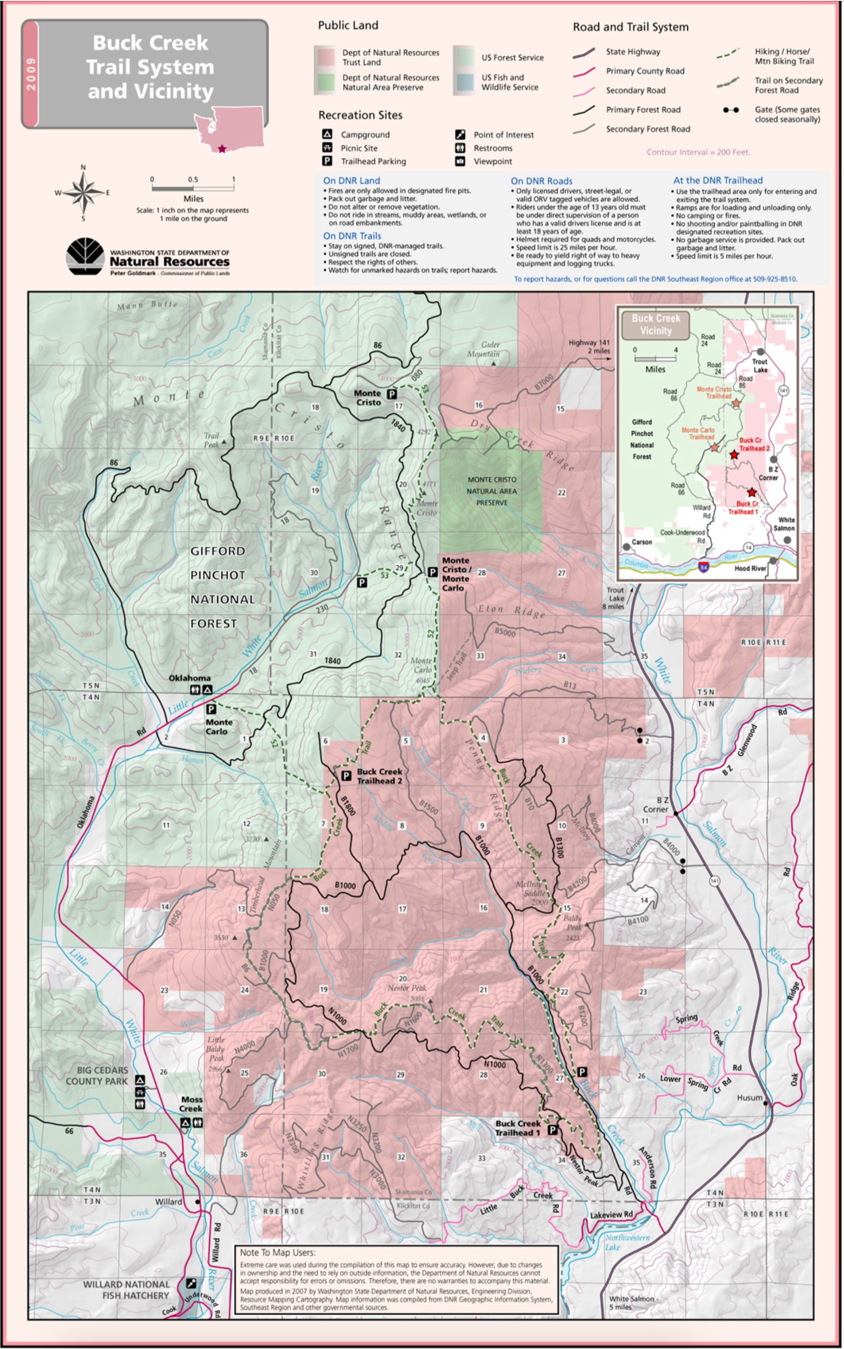
Since there are at more than 5 trailheads for Monte Carlo, I will only describe here the directions to McIlroy Saddle and the unofficial trailhead at the end of Spur Road B10 on Penny Ridge. Click on the respective trailhead links in the Online Resources section below to view how to get to those trailheads should you wish to hike longer sections of trail.
From Washington Highway 14 at the east end of the White Salmon River, turn north onto SR 141 Alt signed for Trout Lake and Mount Adams Recreation Area. In about 2.2 miles, turn left onto SR141. Drive about 2 miles north and turn left onto Northwestern Park Road (signed for Northwest Park). The road sign may not be visible until you are on it! Drive downhill and cross the White Salmon River where the road soon becomes the gravelled Nestor Peak Road or DNR Road B1000. Drive about 0.4 miles uphill and stay right on B1000 at a junction with N1000. Continue driving up the Buck Creek Valley for about 3.8 miles and turn right onto B1300. Follow B1300 uphill for about 0.9 miles to signed McIlroy Saddle where one can park at a spot on the left side of the road for the Buck Creek Trail which can be hiked (mostly through forest for a mile and one-half or so.
Or, continue driving up B1300 several miles to the unsigned (in 2021) Spur Road B10 on the left. When viewing maps, this would be the second B10 junction to take. Spur Road B10 is rough due to about half a dozen deep water bars, so a higher clearance AWD or 4WD is recommended. Park in a wide spot in the road where B10 crests the ridge and reaches the Buck Creek Trail coming out of the woods from the left. There's room for several vehicles here. No passes are required. Hike up the old jeep/ fire road to the right which constitutes the Buck Creek Trail for this part of the hike up Penny Ridge.
Comprehensive Plant List for Penny Ridge and Monte Carlo
June 10, 2021: Buck Creek Trail along Penny Ridge to the Monte Carlo Ridgeline (Washington Department of Natural Resources lands and Gifford Pinchot National Forest)
Monte Carlo: Washington Trails Association Trip Report - Provides directions and description of access to Monte Carlo from either the McIlroy Saddle Trailhead or an unofficial trailhead at the end of spur road B10 on Penny Ridge.
Buck Creek Trail System and Vicinity Map: Washington DNR - This is a good map to print off when planning to hike the trails of the Buck Creek Trail system as well as hiking Monte Carlo and Monte Cristo.
Monte Carlo: OregonHikers.org - Contains detailed info about the various routes to Monte Carlo, including hiking from the Buck Creek Falls, McIlroy Saddle trailheads.
Buck Creek Falls Trailhead: OregonHikers.org
McIlroy Saddle: OregonHikers.org - Directions to this trailhead.
Monte Carlo via Middle Fork Grove Hike: OregonHikers.org - Contains info about the route to Monte Carlo from the Buck Creek #2 Trailhead
Buck Creek #2 Trailhead: OregonHikers.org - Directions to this trailhead.
Monte Carlo-Monte Cristo Hike: OregonHikers.org - Contains infor about hiking to Monte Carlo & Monte Cristo from the Monte Carlo Upper Trailhead.
Monte Carlo Upper Trailhead: OregonHikers.org - Directions to this trailhead.
The photo at left shows a fire road that the Buck Creek Trail follows along Penny Ridge from the trailhead at the end of spur road B10 upwards to the Monte Carlo ridgeline, WA DNR lands.....June 10, 2021. The photo at right shows the south-facing slopes near the top of Penny Ridge. The grassy slopes are only easily accessible from a few locations along the Buck Creek Trail. WA DNR lands in the upper Buck Creek drainage.....June 10, 2021.