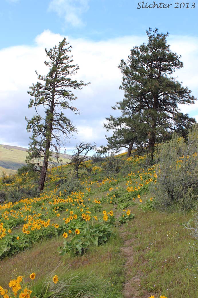
The Chenoweth Table area is probably an under-appreciated place for wildflower hikers. Other nearby spots see much higher visitation by wildflower seekers. However, the north and northwestern slopes offer fine views out to Sevenmile Hill, the Four Sisters Preserve, and the Columbia Hills. All become yellow in late April and early May due to the dense bloom of balsamroots on those sites.
Chenoweth Table contains pretty nice natural habitats which in turn host a wide number of native wildflowers. The upper north and northwest facing slopes sport a mix of open oak forest with some conifers as well as natural grassland slopes with patches of nice balsamroots and lupines. The flatter tableland was overtopped by Missoula Flood wave action and scoured out, creating numerous swales which are vernally wet, and more importantly, contain a wetland flora not often seen in the eastern Columbia River Gorge.
 Directions:
From the east or west on Interstate 84, exit the freeway at Exit 83 for West The Dalles.Turn left onto 6th stree and drive 0.2 miles.Turn right onto Webber Street and continue 0.3 miles.Turn left onto 10th Street and drive 0.3 miles.Turn right onto Cherry Heights Road and drive uphill for 3.4 miles. Turn right onto Sandlin Road and drive about 0.8 miles. Park off to the side of the road before the pavement ends. Please do not block the road or residential or farm driveways. Walk 0.7 miles further down Sandlin Road to the USFS gate.
Note: I've omitted the directions to the old Chenoweth Middle School trailhead as it may have been closed to hiking access. I will try to check that out during the spring of 2024.
Comprehensive plant list for Chenoweth Table (pdf)
April 21, 2013: Chenoweth Table (USFS)
March 28, 2013: Chenoweth Table (USFS)
March 9, 2013: Chenoweth Table (USFS)
Chenoweth Tableland: Northwest Wildflowers - Access via Sandlin Road.
Chenoweth Tableland Loop Hike: OregonHikers.org - Access via Chenoweth Middle School or from Sandlin Road
Chenoweth Middle School Trailhead: OregonHikers.org (Note: This access may now be closed. Check signs on the fences, or check current conditions at OregonHikers.org)
Sandlin Road Trailhead for Chenoweth Table: OregonHikers.org (Park before the end of pavement about 0.7 from the USFS gate to Chenoweth Table in order to placate local "angry" landowners.)