Forest Road #500 can be quite rough at times, so drive carefully. This used to be one of the worst access roads on the mountain but has been improved during the past decade.
Permits: Northwest Forest Passes should be displayed on your dashboard or on the mirror at all Forest Service Trailheads for access to Mt. Adams. All who hike above 7000' should obtain and display the Cascade Volcanoes Pass and register for and carry the wilderness permit. Climbers above 7000' should also register at the Forest Service Ranger Station at Trout Lake.
Water: There used to be a spring at the southeast corner of Cold Springs CG which usually ran into late summer, but I have not recently checked to see whether it still remains. The only other water sources (filter or boil) are at Morrison Creek CG or along the trail as it crosses Morrison Creek at MP 2.0. These creeks are typically dry by mid-August in most years.
Lowest Elevation: 5600'
Highest Elevation: 6250' at the junction with the Round the Mt. Trail #9, trail maintained to 8000', Lunch Counter at 9100', and informal trail to the summit at 12,276'.
Elevation Gain: 650' to the Round the Mt. Trail, 3500' to the Lunch Counter, and 6676' to the summit.
Trail Length: about 1.2 miles to the Round the Mt. Trail #9, 2.0 miles to Morrison Creek, 3.7 miles to the Lunch Counter, and about 5.7 miles to the summit (all distances are one-way).
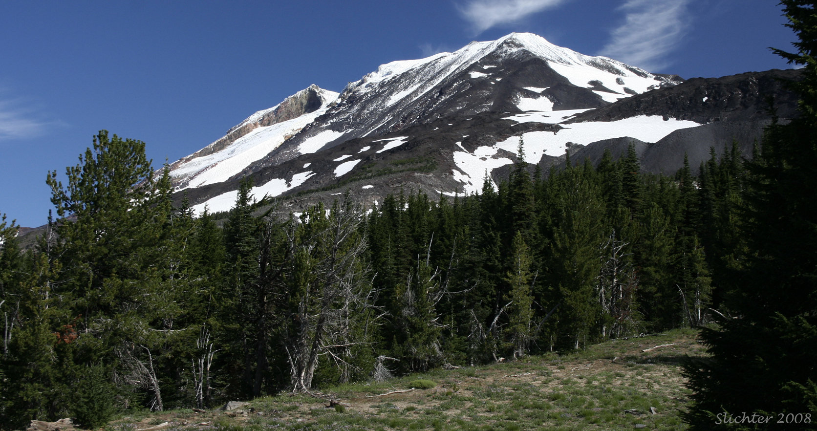
Special Considerations: Although fairly easy in terms of mountaineering technique under most weather conditions, this hike is very strenuous above the crossing of Morrison Creek. Especially early in the season when there is more snow, one should be prepared for the possibility of encountering ice during the day, and thus carry crampons and ice axe, and know how to use them, and especially how to self-arrest. For safety sake, travel together as a group and turn back if encountering high wind, fog, or build-up of clouds at the summit. Be aware that thunderstorms may build up on the other side of the mountain during the late afternoon and early evening during late spring through the summer. Also be aware that many climbers do experience mountain sickness above the Lunch Counter. Cell phones should work over much of the route. If unfamiliar with the route and clouds are building on the upper part of the mountain, it is best to camp at the Lunch Counter or return to Cold Springs. Route finding in a white out can be difficult and there are very steep slopes with potential drops about one-quarter mile west or east of the climb route from the Lunch Counter upward.
Climbers and skiers should carry sealable plastic bags for the climb. A human waste refuse station is available at the trailhead.
A few species of plants probably may be found up to the false summit, but that portion of the trail is very exposed, often on steep snowfields, and probably beyond interest of those interested in viewing the nature found along this path. Generally on this trail, it is asked that hikers stay on the trail to minimalize damage to fragile plants and prevent a broad path of meandering trails which will last visibly for decades, and that all human wastes be packed out (this is probably the most heavily used portion of the mountain!) to preserve the water quality of the groundwater that provides water for camping areas far below.
July 19, 2009: South Climb Trail #183 to the Round the Mountain Trail #9, then east to Bird Creek Meadows and Hellroaring Overlook
August 23, 2008: South Climb Trail #183 (from Cold Springs to the base of the Crescent Glacier and eastward one-half mile to South Butte)
