Lowest Elevation: 4700'
Highest Elevation: 6100'
Elevation Gain: 1400'
Trail Length: 2.8 miles (4.5 km)
Permits: Northwest Forest Passes should be displayed on your dashboard or on the mirror at all Forest Service Trailheads for access to Mt. Adams. All who hike above 7000' should obtain and display the Cascade Volcanoes Pass and register for and carry the wilderness permit. Climbers above 7000' should also register at the Forest Service Ranger Station at Trout Lake.
Water: Water for this hike may be obtained at the trailhead (until late summer during dry years), a branch of Morrison Creek and a seep within the last 0.75 miles of the trail (available most of the year), and then Crofton Creek at the end of the trail (also available most of the year).
Morrison Creek Campground generally offers quiet camping along Morrison Creek (may dry up towards the end of the season) and several pit toilets, including one at the trailhead. In low snow years, I've camped there in solitude as early as the Memorial Day weekend.
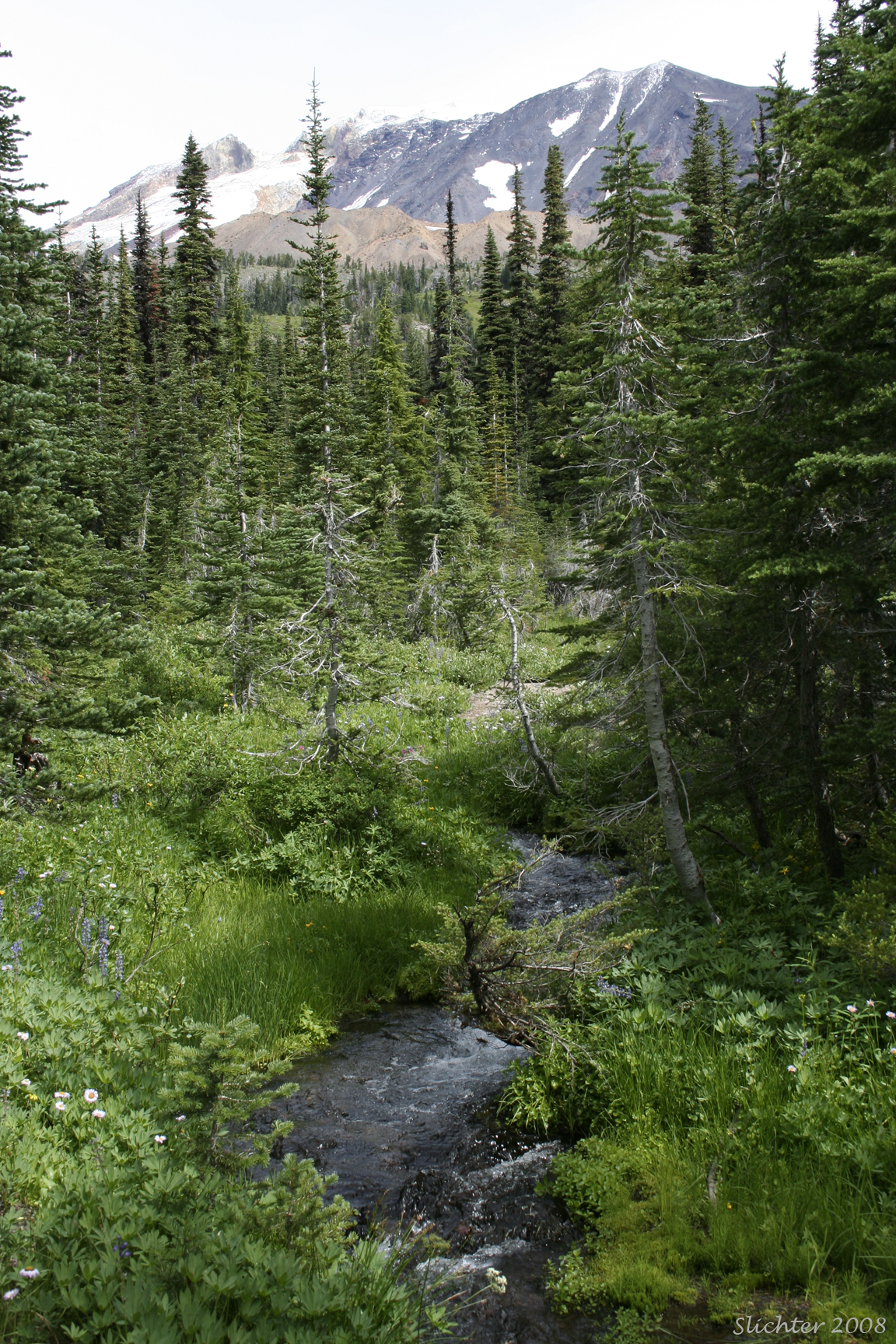
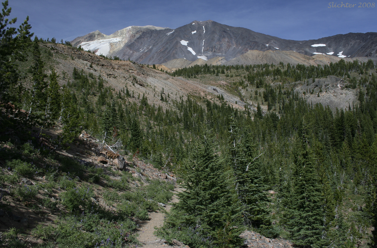
The trail climbs through fairly dense coniferous forest from the trailhead, ascending fairly steeply at times. At about 2 miles, the trail levels out and begins to enter open spots in the forest before crossing a creek (usually a fairly reliable source of water into late season) and a moist meadow with a smaller stream. Both riparian areas are good places to rest a few minutes and explore the plant life. The trail continues another quarter mile before dipping and crossing the more difficult Crofton Creek (you may have to wade here, especially in the spring) before ascending steeply via several switchbacks the eastern face of Crofton Ridge to arrive at the Round the Mt. Trail #9. Take care descending this section of the trail on your return as there are numerous loose rocks to lose your footing on!
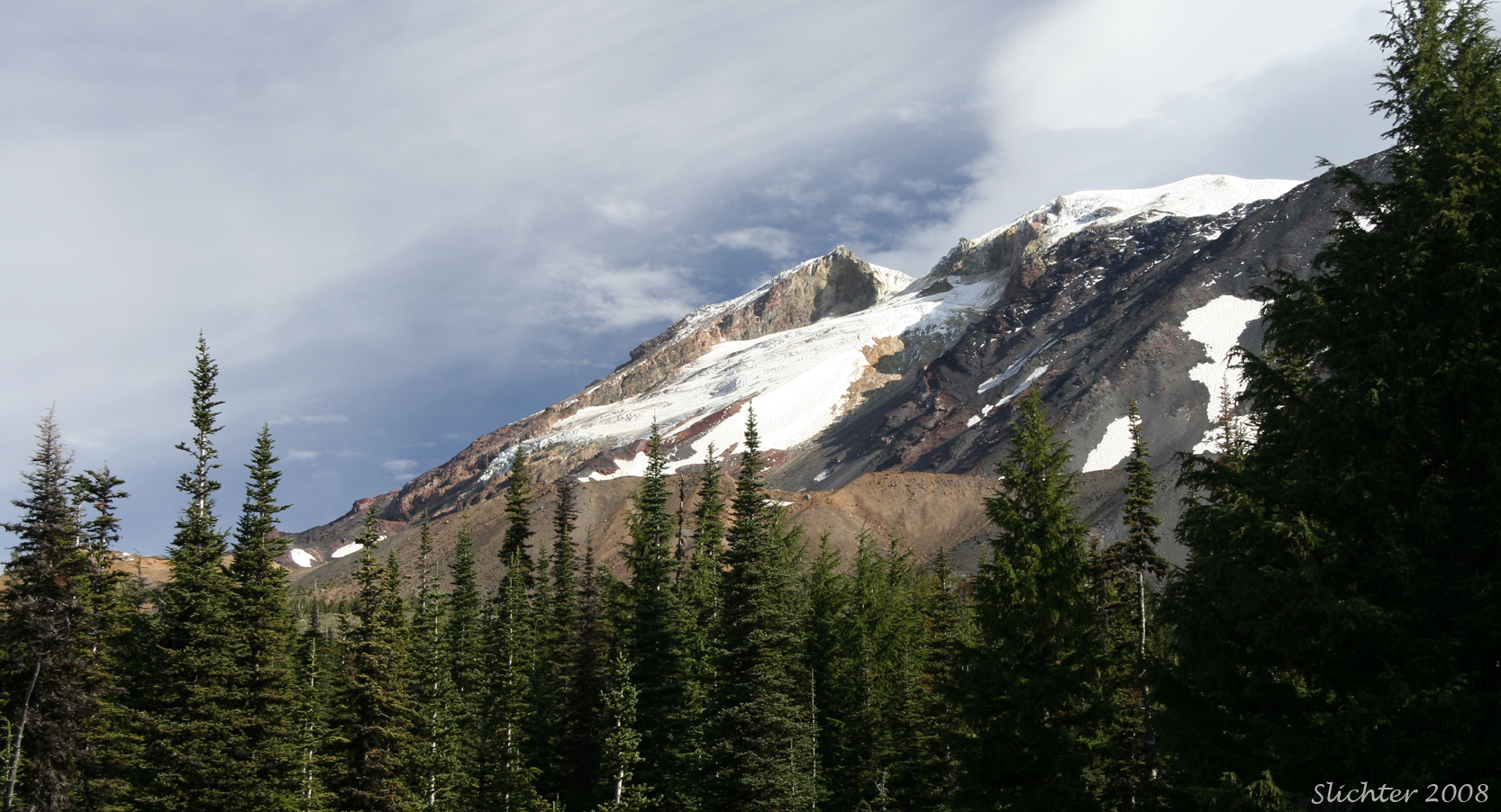
The junction with the Round the Mt. Trail affords a good view of Mt. Adams with the Avalanche and White Salmon Glaciers viewed slightly to the left.
At this point, one may continue east on the Round the Mt. Trail to make a loop with the South Climb Trail #183 (you'd have to descend the dusty access road #8040 unless you are good at cross country travel through timber), or you may continue west along the Round the Mt. Trail to Madcat Meadows (about 45 minutes of hiking) or even further to Lookingglass Lake or Horseshoe Meadows where the trail joins the Pacific Crest Trail #2000. Westward, one must ford several tributaries of Salt Creek, which may present difficulty in passage early in the year, or after significant rain storms. Generally the fording will consist of rock hopping.
During high snowfall years when snow lingers late into the season, the Shorthorn Trail may be the best option for accessing the Round the Mt. Trail.
The heavy rains of November 2006 caused water to pool in the glaciers and when they reached high amounts, they caused a large glacial outburst of water which flowed down into the Crofton & Morrison Creek drainages as well as into the Cascade Lake drainage. These flash floods scoured the upper creek beds so savagely that hikers were presented with near impossible creek crossings. Due to the erosion, the trails end at the edges of each of these creeks with a shear drop of 10-20 feet. The earliest 2007 hikers had to rope up to get through these obstacles. I'm not sure yet whether the Forest Service has repaired this problem adequately so that ordinary day hikers can hike the trail.
July 7, 2021: Shorthorn Trail #16 between Morrison Creek Camp and the Round the Mountain Trail #9)
August 24, 2008: Shorthorn Trail (from Morrison Creek Camp to the Round the Mountain Trail #9)
August 22, 2008: Morrison Creek Campground
July 29, 2005: Shorthorn Trail & Round the Mountain Trail #9 (from Morrison Creek Camp to Madcat Meadows)
July 27 & August 3, 2002: Shorthorn Trail & Round the Mt. Trail #9, Mt. Adams Wilderness
August 20, 1998: Shorthorn Trail & Round the Mt. Trail #9, Mt. Adams Wilderness