From Trout Lake:
Drive north from Trout Lake on Road #23 (sometimes known as the Mt. Adams Recreational Access Rd) for 25.6 miles to the junction with paved road #2329. Proceed right onto Road #2329 and follow it 6 miles to the Killen Creek Trailhead on the right side of the road.
From Seattle, Tacoma, Yakima and Portland:
From Randle (on US Highway 12) proceed south for 0.9 miles on State Road 131 (sometimes signed as Forest Road 25). Turn left onto Road #23 and follow it uphill to the junction with Road #2329 where you will turn left and drive for 6 miles to the trailhead. Note: It's wise to check the Gifford Pinchot NF website or call the Cowlitz Valley Ranger District Office in Randle, WA for the latest road conditions. There have been occasions where FS Road #23 has been closed in recent years due to flood damage.
High Elevation: 6100'
Elevation Gain: 1500'
Trail Length: 3.1 miles (5 km) one-way to the PCT with an additional 1.2 miles to Killen Creek Meadows.
Permits: Always place the Northwest Forest Pass on your dashboard or mirror at the trailhead as this is commonly patrolled. Register for and carry the wilderness permit as several forest guards daily patrol the trails of this region. If you plan to climb above 7000' or climb the mountain, visit the Mt. Adams Ranger Station in Trout Lake in order to register details of your route and to purchase a Cascade Volcanoes Pass.
Trail Use: This is perhaps the most heavily used trail on the north side of Mt. Adams and sees moderate to heavy use on weekends both by hikers and backpackers as well as many horses. Use at midweek is much lighter. In addition the trailhead at the parking lots typically fills early on weekends.
Water: Filter or treat all water along this route! Water may be obtained at Killen Creek at the Killen Creek Forest Camp about one-quarter mile north of the trailhead on Road #2329. A small stream (dries up by late summer) is crossed on the trail at 5700' about 2.2 miles from the trailhead. Once the PCT is reached, proceed north about a mile to several streams with water throughout the season.
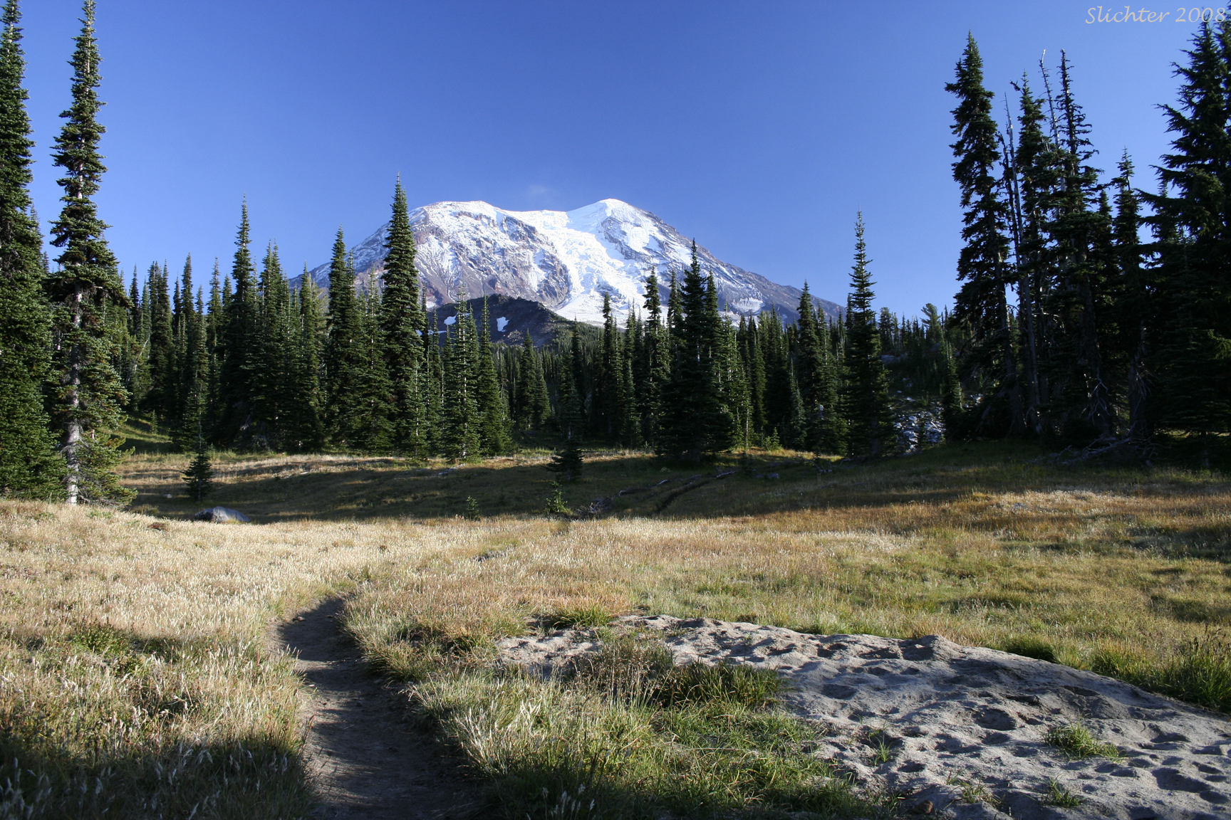
At 2.2 miles from the trailhead, the trail enters a large meadow crossed by a small stream. Early in the season, the wildflower bloom is spectacular here with numerous lupines, pink heather, paintbrush and other riparian species. For some this is will be a great detour along the route for identifying and photographing the many species found here.
For the remaining 0.9 miles, the trail continues at a gentler slope through mostly open meadows before climbing a steeper slope in a series of 3 switchbacks. The trail then flattens out again and crosses a broad sandy area with some of the first subalpine plants before reaching the Pacific Crest Trail.
The Killen Creek Trail is commonly used to either access High Camp, a mountaineering camp high on the mountain via the High Camp Trail #10. Campers and day hikers commonly use this trail to access the photogenic Killen Creek Meadows.
If you have 2 vehicles, you can make this a part of longer day hike loop involving either the Divide Camp Trail #112 or the Highline Trail #114 or Muddy Meadows Trail #13. Consult a wilderness map to plan this out more thoroughly.
August 4, 2022: Killen Creek Trail #113 to the Pacific Crest Trail and north to Killen Creek Meadows, Mt. Adams Wilderness
August 12, 2016: High Camp Trail #10 and sandy-rocky slopes up to the terminal moraine of the Adams Glacier
August 11, 2016: Killen Creek Basin and overland towards Foggy Flats, above the Pacific Crest Trail
August 21, 2013: Area above the Pacific Crest Trail south of Adams Creek uphill to Adams Glacier terminal moraine
August 21, 2013: Killen Creek Trail #113 to the Pacific Crest Trail
September 29, 2008: Killen Creek Trail #113 to the Pacific Crest Trail.
August 2 & 9, 2003: Killen Creek Trail #113 to above High (climber's) Camp, Mt. Adams Wilderness