From Trout Lake:
Drive north from Trout Lake on Road #23 (sometimes known as the Mt. Adams Recreational Access Rd) for 25.6 miles to the junction with paved road #2329. Proceed right onto Road #2329 and follow it 3.6 miles to the Divide Camp Trailhead on the right side of the road.
From Seattle, Tacoma, Yakima and Portland:
From Randle (on US Highway 12) proceed south for 0.9 miles on State Road 131 (sometimes signed as Forest Road 25). Turn left onto Road #23 and follow it uphill to the junction with Road #2329 where you will turn left and drive for 3.6 miles to the trailhead. Note: It's wise to check the Gifford Pinchot NF website or call the Cowlitz Valley Ranger District Office in Randle, WA for the latest road conditions. There have been occasions where FS Road #23 has been closed in recent years due to flood damage.
High Elevation: 6020'
Elevation Gain: About 1300'.
Trail Length: 2.8 miles (5.6 miles round trip)
Trail Traffic: Moderate. This trail is a major access point for climbers on the north and western slopes of the the mountain. Weekends bring many day hikers, campers, and climbers. On some weekends, horse traffic can be heavy (and thus very dusty) as it is part of a loop riders use in combination with the Muddy Meadows Trail #114 or Killen Creek Trail #113 to the north. Midweek on the trails here tend to be much more quiet, and sometimes, no one else is seen en route.
Permits: Display the Northwest Forest Pass on your dashboard or on a mirror at the trail head, which is regularly visited by Forest Service personnel and sheriffs deputies. Also register and carry a wilderness permit while on the trail (also regularly patrolled by forest guards). If you plan to hike above 7000' or climb on the mountain itself, visit the Mt. Adams Ranger Station in Trout Lake to register with details for your climb and purchase a Cascade Volcanoes Pass.
Water: Boil or Filter all water in this area! Except early in the season, water is not present along this trail, although Adams Creek may be heard nearby on the north side of the trail. Be aware that Adams Creek usually is a cloudy or milky white due to its high content of fine, glacial silt which might clog filters. Clearer water may be found along the Pacific Crest Trail by hiking south to the Lewis River, or cautiously crossing Adams Creek and hiking into the Killen Creek area.
I have done this hike as a half-day hike (out and back) numerous times with a picnic at the junction with the Pacific Crest Trail although it is possible to include further destinations. I did use this trail as part of a longer day hike, which extended north to Killen Creek and then onto the Highline Trail to Foggy Flats on the northeast side of the mountain and return via the same route. It would also be possible to hike south to Horseshoe Meadows and return within one days time for those ambitious enough to do so.
One could also include this hike with either the Killen Creek Trail #113 or Muddy Meadows Trail #13 as alonger day loop hike if cars are parked at both trailheads.
I have also heard that there is an unofficial trail which ascends from the PCT near Adams Creek to proceed towards High Camp. The word I've heard is that this trail has a good floral display near the creek, but I have yet to take the time to investigate the specifics of this claim.
August 22, 2022: Divide Camp Trail #112 to the Pacific Crest Trail and above
July 18-19, 2018: Divide Camp to the terminal moraine of the Adams Glacier.
September 18, 2008: Divide Camp Trail #112 to the Pacific Crest Trail
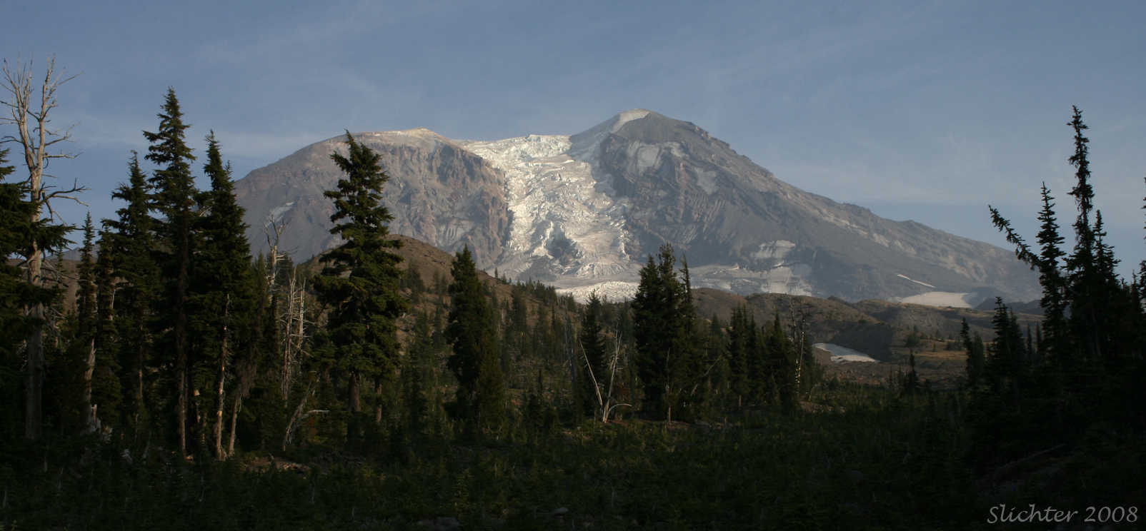
September 18, 2008: Slopes above the junction of the Divide Camp Trail and Pacific Crest Trail to the base of the Adams Glacier