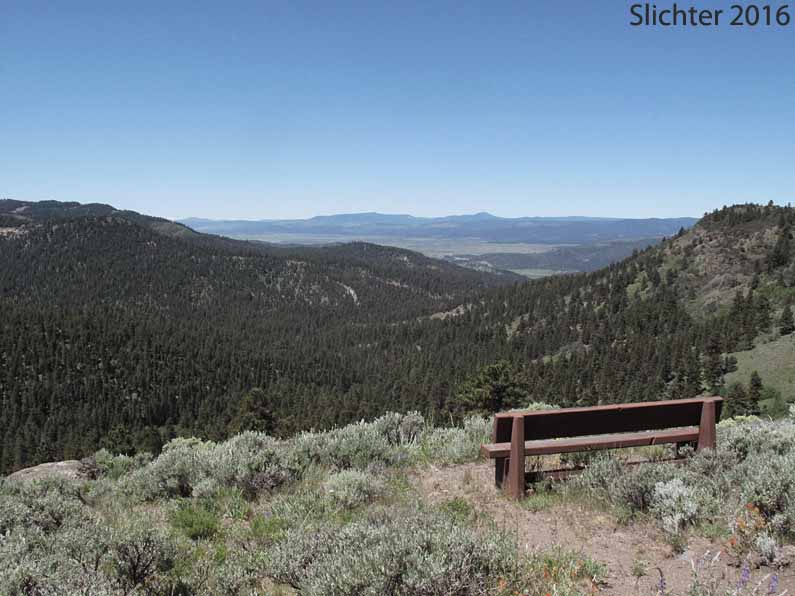
Located at 6300', the North Warner Viewpoint consists of a short access road with turn around spot and parking with a short path out to two benches and a picnic table at the northern crest of Crooked Creek Valley. The site provides a view west to the mountains north of Cottonwood Reservoir, including Big and Little Baldy. The Cascades loom beyond, with Mount Shasta at the south end. There are no hiking trails but one can wander along the crest of the valley looking for what wildflower lurk there. The upper slopes are pretty steep.
The Fremont National Recreation Trail #160 climbs up along the bottom of Crooked Creek Valley from the Mill Trailhead to the South Fork Crooked Creek Trailhead, so the view gives an idea of what that hike will be like, scenery-wise.
I'd guess this would be a pretty good spot to watch the fall hawk migration, and perhaps an even better spot to watch the night sky, including meteor showers since it has a wide view of the night sky.
To complete your visit here, you might consider a drive north to Vee Lake Campground, or drive back east on FS Rd 3615 to the South Fork Crooked Creek Trailhead and hike the Fremont National Recreation Trail #160 either up towards the saddle between Light and Twelvemile Peaks or downstream along Crooked Creek, which passes through some nice aspen stands. One can also hike west then south along the Crane Mountain National Recreation Trail #161 towards Bull Prairie. We have yet to hike all three of these trails, so we don't know their condition. Call the Lakeview Ranger District office in Lakeview, OR to verify their status.
Another option for a day trip from Lakeview is to drive up to enjoy the view from Drake Peak Lookout (8222').
There is no water or restroom facilities at this recreation site.
Drive north of Lakeview on US 395. Turn right onto Oregon Highway 140 and cross the Warner Mountain Summit. About 3.5 miles east of the Warner Mountain Summit, turn left onto Forest Road 3615. This is the first major junction east of the summit with FS Rd 3915 heading south towards Willow Creek CG on the opposite side of the road. Drive north on paved FS Rd 3615 about 12.7 miles and turn left onto spur road 074. This is about 100 yards east of the junction with FS Road 3720.
North Warner Viewpoint is approximately a 50 minute drive northeast of Lakeview, OR. The drive will take longer if you are stopping to view wildflowers and wildlife along forest roads or in Bull Prairie.
June 12, 2016: North Warner Viewpoint, Fremont-Winema National Forest
North Warner Viewpoint: Info from the USFS website.