Malheur N.F
 The North
Fork Malheur River is accessed via much the same route as the Monument Rock
Wilderness. From US Highway 26, turn south in downtown Prairie City at a sign
for Depot Park. After 0.4 miles, turn left at a stop sign and continue on what
becomes County Road 62. After about 8 miles, turn left onto FS Rd #13. Continue
on this paved road until you reach FS Rd #16. The meadows at this intersection
may be explored or continue south on FS Rd #16, passing Elk Creek CG before
arriving at the intersection with FS Rd #1675 (gravel). Turn left (east) onto
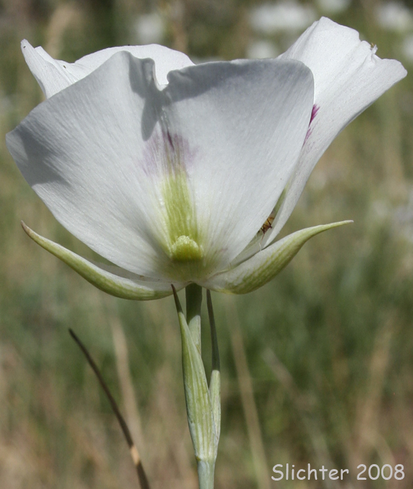
this road. Begin looking for wildflowers (several species of fleabanes, Allium,
and Calochortus eurycarpus may be found in the woods and dry openings
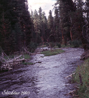
here. Continue down FS Rd #1675 until reaching the riparian meadows along the
North Fork Malheur River. These could be explored for spring wildflowers. The
North Fork Malheur CG affords another place to botanize as does the meadows
at the trailhead for the North Fork Malheur Trail (#381). The trail closely
follows the west bank of the river. Few person hike it, and it is a good spot
for a leisurely stroll in search of flowers or birds. The area near North Fork
Malheur CG also features some large diameter Western Larches.
The North
Fork Malheur River is accessed via much the same route as the Monument Rock
Wilderness. From US Highway 26, turn south in downtown Prairie City at a sign
for Depot Park. After 0.4 miles, turn left at a stop sign and continue on what
becomes County Road 62. After about 8 miles, turn left onto FS Rd #13. Continue
on this paved road until you reach FS Rd #16. The meadows at this intersection
may be explored or continue south on FS Rd #16, passing Elk Creek CG before
arriving at the intersection with FS Rd #1675 (gravel). Turn left (east) onto
this road. Begin looking for wildflowers (several species of fleabanes, Allium,
and Calochortus eurycarpus may be found in the woods and dry openings
here. Continue down FS Rd #1675 until reaching the riparian meadows along the
North Fork Malheur River. These could be explored for spring wildflowers. The
North Fork Malheur CG affords another place to botanize as does the meadows
at the trailhead for the North Fork Malheur Trail (#381). The trail closely
follows the west bank of the river. Few person hike it, and it is a good spot
for a leisurely stroll in search of flowers or birds. The area near North Fork
Malheur CG also features some large diameter Western Larches.
The North Fork Malheur River is also prized by fishermen. Follow all posted rules when fishing here.
Partial Plant Lists for the North Fork of the Malheur River: