Malheur National Forest

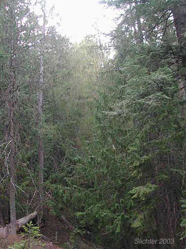
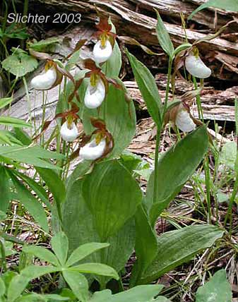
The Cedar Grove is a peaceful one mile walk along the Cedar Grove National Scenic Trail #203A to a relict stand of Alaska yellow cedar (Chamaecyparis nootkatensis) as well as mountain lady slipper (Cypripedium montanum), bigleaf lupine (Lupinus polyphyllus) and other forest wildflowers. The area is unique because the nearest populations of Alaska yellow cedar are about 130 miles further west. The cedars are a relic from the Pleistocene age when the climate was cooler and wetter, and the cedars were more sidespread through the mountains to the immediate west. Currently, about 26 acres of Alaska yellow cedars survive in the Cedar Grove.
Wildfires burned through the area in 2006. A backfire was set to help save the Cedar Grove from the larger fire sweeping through the forest. Many of the cedars survived the back fire but their bark is thin which makes them less tolerant to fire so that it appears the mortality of Alaska yellow cedars is currently about 90% while a much higher percentage of the other, thicker-barked conifers survived. Fortunately, there seems to be a high number of seedlings growing up in the burnt area. Only time will tell whether they will continue to survive in this arid climate as the coniferous forest canopy closes in on them and threatens to shade them out.
Elevation: 5200-5600'
Rating: Moderately easy
Season: June to November
Allowed Activities: Hiking only. ATVs, horse use and mountain bikes prohibited.
Use: Light
From John Day, OR, drive west on US Highway 26 for about 18 miles, passing through Mt. Vernon, OR and continuing west. Turn south on paved Forest Service Road 21 (signed for Murderers Creek). Buck Cabin Campground provides a convenient spot for a bathroom break. Continue uphill until reaching the pass in the Alrich Range about 9 miles south of US 26. At the pass, turn right (west) onto gravelled (but good quality) Forest Service Road 2150. Numerous wildflowers dot the roadside and banks above the road in June and early July (although there is one section of signed, private land to stay out of enroute). After passing FS Rd 070 which joins FS Rd 2150 from the left (south), continue driving about another mile before coming to the signed Cedar Grove Trailhead. The trailhead is about 5 miles west of FS Rd 21. The trailhead is about a one and one-half hour drive from John Day, OR. Parking is fairly limited at the trailhead.
This trip can be combined with a visit to Aldrich Mt. by continuing westward another one-half hour on FS Rd 2150. One can then return to John Day by visiting Murderers Creek via FS Rd 070 and FS Rd 2170. There is an abundance of wildflowers along Murderers Creek near the Oregon Mine Campground. Continue your return to John Day by turning left (north) and driving uphill on FS Rd 21, or continue east on FS Rd 21, eventually arriving at Grant County Road 63. Follow Road 63 east to US Highway 395, then follow it north to John Day.
Partial Flora of the Cedar Grove
July 15, 2003: The Cedar Grove Trail, Malheur N.F.
June 21, 2003: Cedar Grove, Malheur N.F.
May 24, 2003 The Cedar Grove Trail
