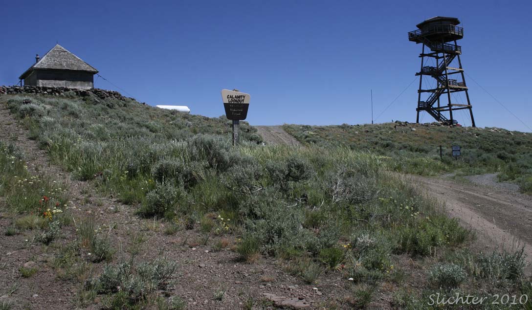
Malheur National Forest
Calamity Butte is the highpoint (6695') on a north-south ridgeline in the Burns Ranger District of the southern Malheur National Forest. The site features a 4-sided wooden ground cabin built in 1927 (the orignal lookout) and a newer 50' wooden tower which is currently staffed during the fire season. Views from the ground are nearly 360 degrees, with the view east hampered by forest which approaches the ridgetop from that direction. The Steens Mt. is readily visible (except on very hazy days) to the south, while the Alrich and Strawberry Mts are visible to the northwest and northeast respectively. The Monument Rock Wilderness is visible far off on the horizon further to the northeast.
The summit flora includes dense patches of lupine, paintbrush, hawksbeards, several buckwheats and other plants commonly found on dry, rocky summits.
Drive south from John Day, OR (or drive north from Burns, OR) on US Highway 395 to the southern end of the Silvies Valley. Turn east onto gravel Forest Service Road 2840. At the junction with FS Rd 28, turn left (north) for a hundred yards before turning right (uphill) onto FS Rd 2860. The narrow dirt road climbs through open forest with wildflowers and bunchgrasses making up much of the groundcover. Several small streams cross under the road which is lined with interesting riparian plants in the ditch, but care must be taken at those locations due to lack of parking (although the road is very lightly used) and also because they are on private inholdings. The moist meadow and streamside below Tin Can Springs (also partially on private land) also provide an additional site for floral exploration.
The road continues climbing, trending to the northeast before curving eastward to a junction with FS Access Rd 2860.155. Driving further north on FS Rd 2860 from this point looks difficult for low slung passenger cars, although it might be worth exploring on foot for a ways as it descends. Rd 155 climbs steeply in places to the summit of Calamity Butte. Higher clearance vehicles with AWD or 4WD are recommended for this section of the drive (although I barely made it with my Honda Civic much to the surprise of the FS person staffing the lookout) due to the steep sections of road with loose gravel, large cobbles and rock outcrops in the middle of the road. There is limited parking atop Calamity Butte. If your car is low clearance, consider parking at wide points in the road back near the junction of Rd 2860 and Rd 2860.155. If you are into hiking, consider parking at widespots in the road near Tin can Springs and hiking uphill across the open slopes to the summit (quite floriferous in late June/ early July).
Partial Flora for Calamity Butte
July 18, 2010: FS Road 2860 and Calamity Lookout, Malheur National Forest
