Views of the Cold Springs Fire on Mt. Adams
July 16 and August 23, 2008

This photo shows a mid-morning view of the Cold Springs Fire as seen across private lands and Conboy Lake NWR from the BZ Corners - Glenwood Road...........July 16, 2008
This photo shows a view of the Cold Springs Fire as seen across Camas Prairie in Cold Springs NWR.........July 16, 2008. The photo was taken from Fisher Hill Road.
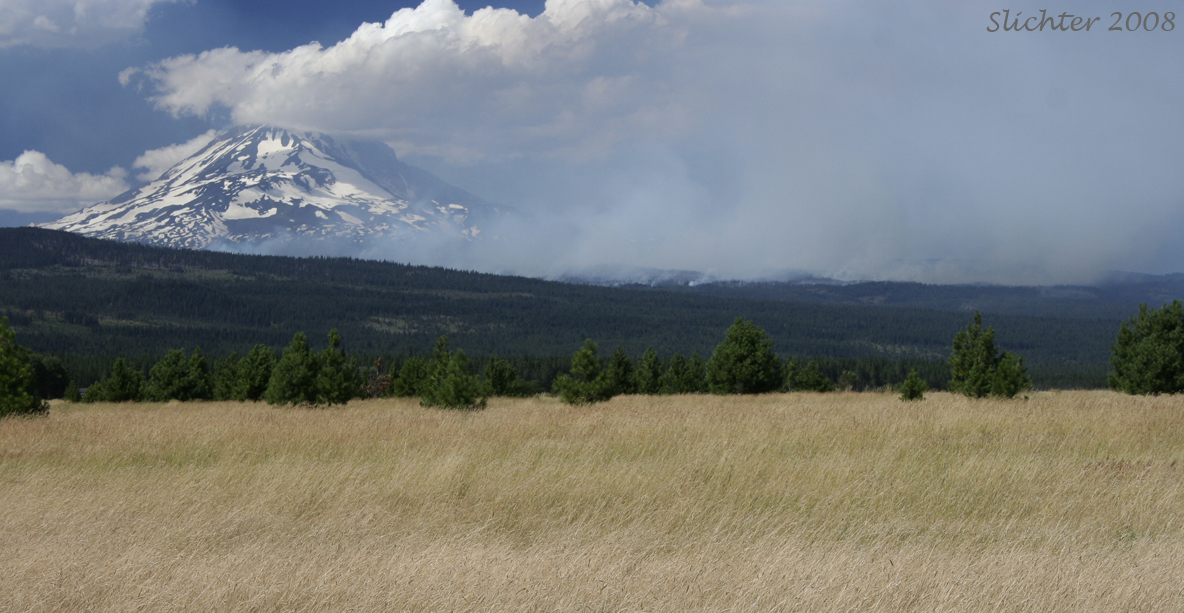
This photo shows a mid-afternoon view of the Cold Springs Fire as it spreads eastward between King Mt. (at left) and Mt. Adams...........July 16, 2008. Photographed in Conboy Lake NWR from Kreps Lane.
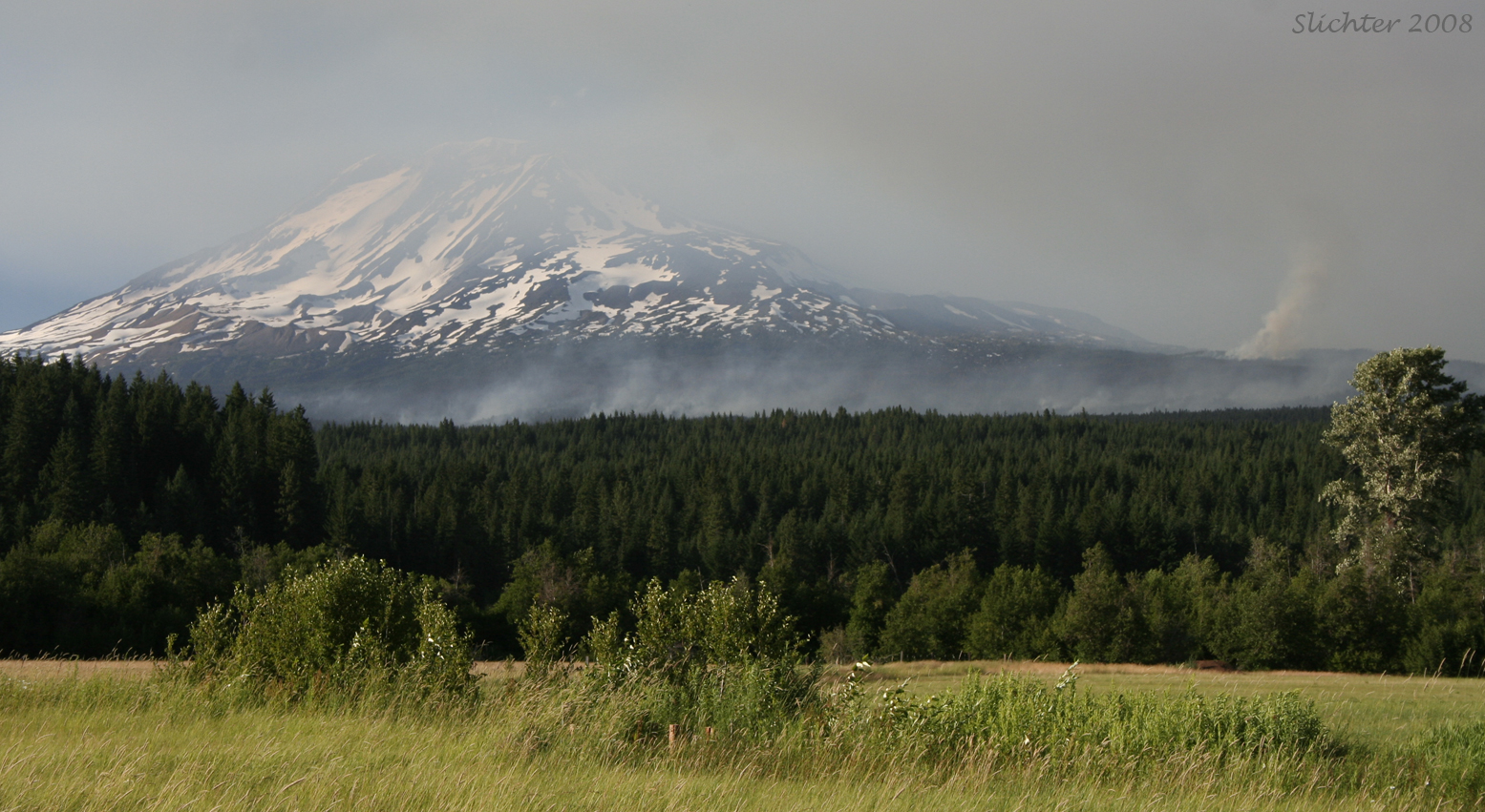
This photo shows an early evening view of the Cold Springs Fire as seen from about one mile northeast of Trout Lake, WA along the Trout Lake - Glenwood Road..........July 16, 2008. The tall plume of smoke at right is located somewhere between Snipes Mt., Snowplow Mt. and Bird Lake.
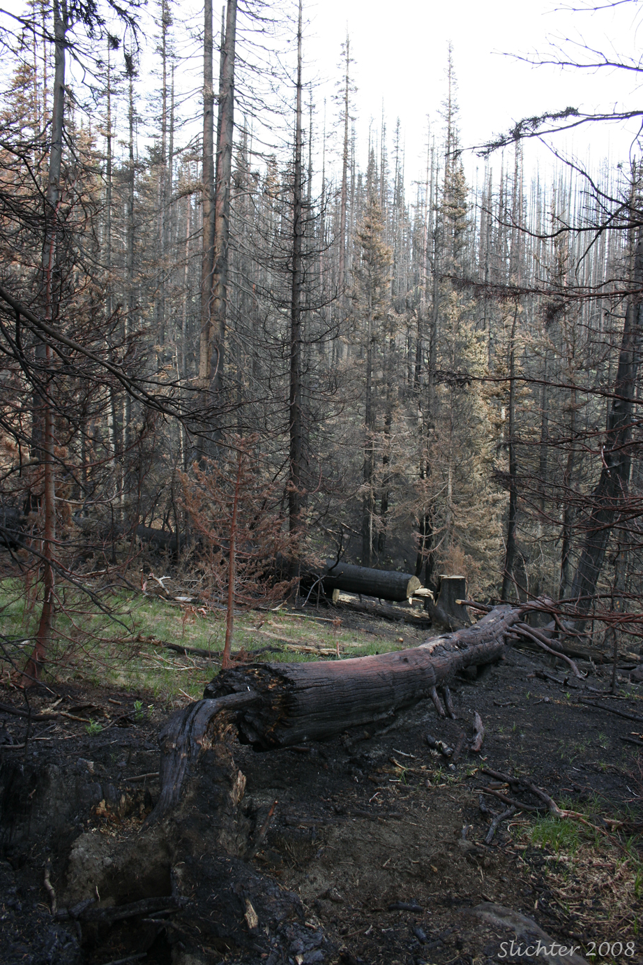
This photo shows a view of the actual burned area of the Cold Springs Fire. Photographed above 5000' along Forest Road 500, the access road to the South Climb Trailhead..........August 23, 2008. There was a period of snow and rain the week previous to this, so note the re-emerging grasses, sedges and woodrushes in the photo. The pinkish tinge on some of the trees is remnants of fire retardent.

This photo shows a view south and east towards the aftermath of the Cold Springs Fire. The black swathes across the landscape are the blackened trees that resulted from the fire. The Aiken Lava Flow can be seen at right. The green meadows of Bird Creek Meadows are visible at center (protected during the fire by several feet of snow). The fire burned eastward to about the 4500' level (my estimate) of the Bird Creek and Dry Creek basins. Photographed from South Butte (about 7700') on Suksdorf Ridge of Mt. Adams........August 23, 2008.
